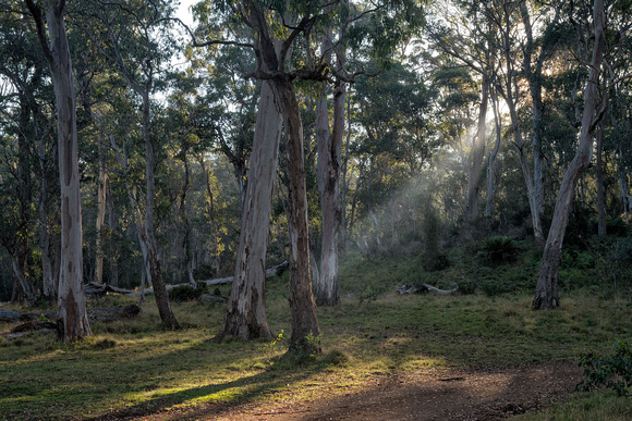
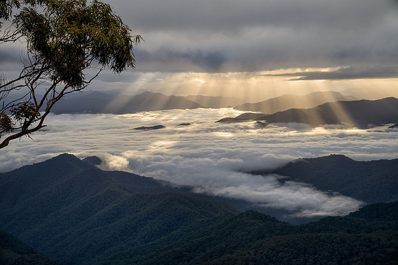
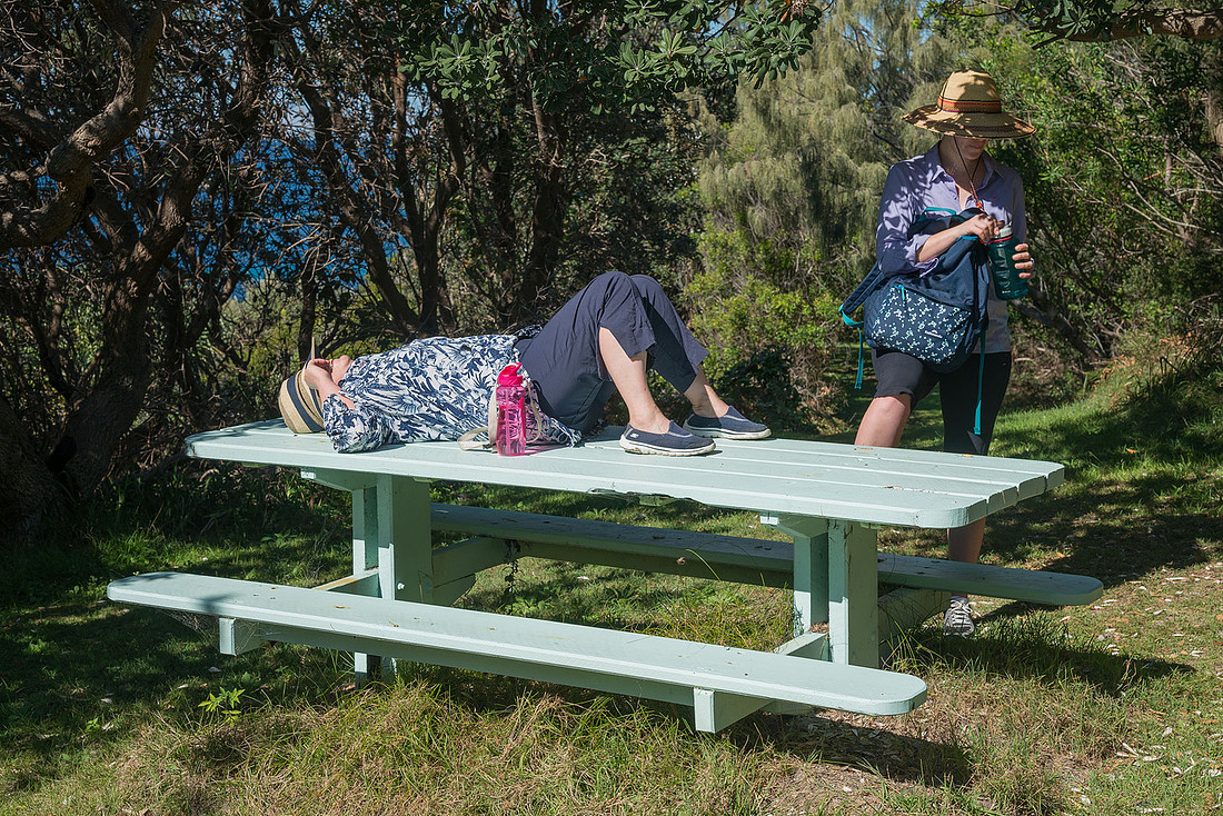
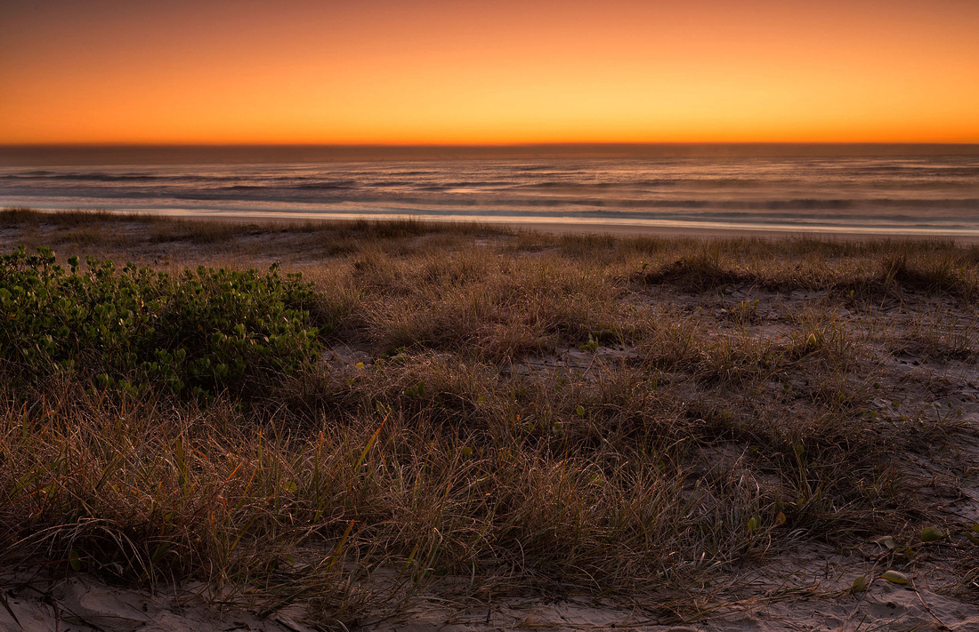
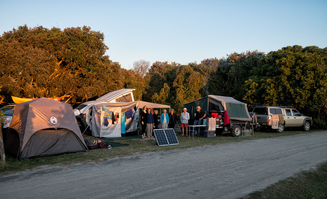
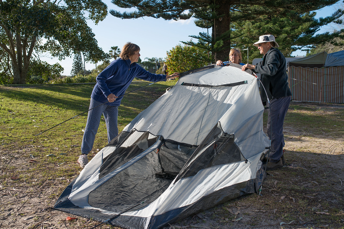
Many showers during the night and the tent was quite wet. At least there was no check-out time like a caravan park and we could wait for the sun to dry the tent. I hadn't planned taking any photos this morning, but when I saw the light and clouds I couldn't resist.
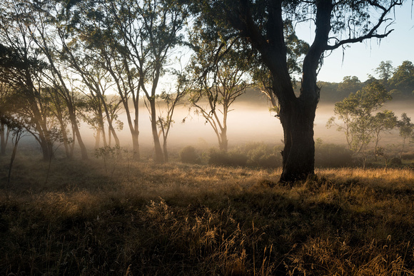
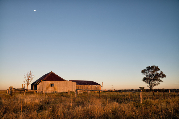
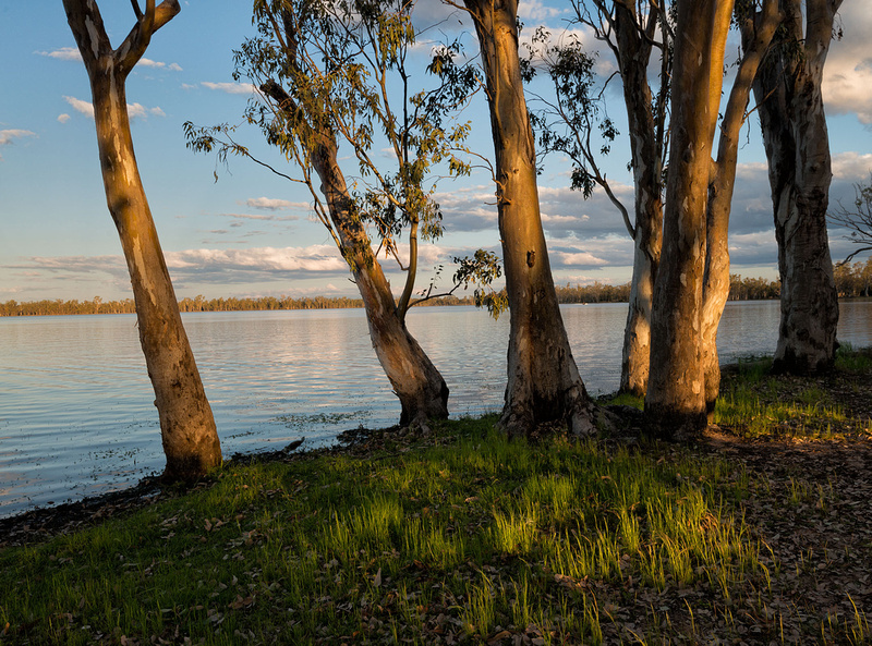
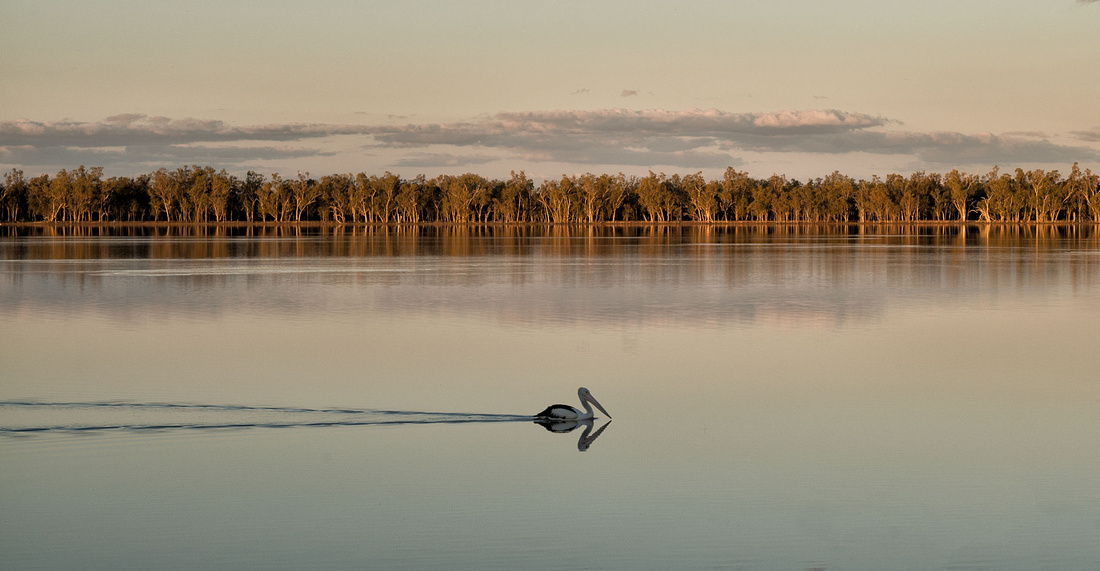
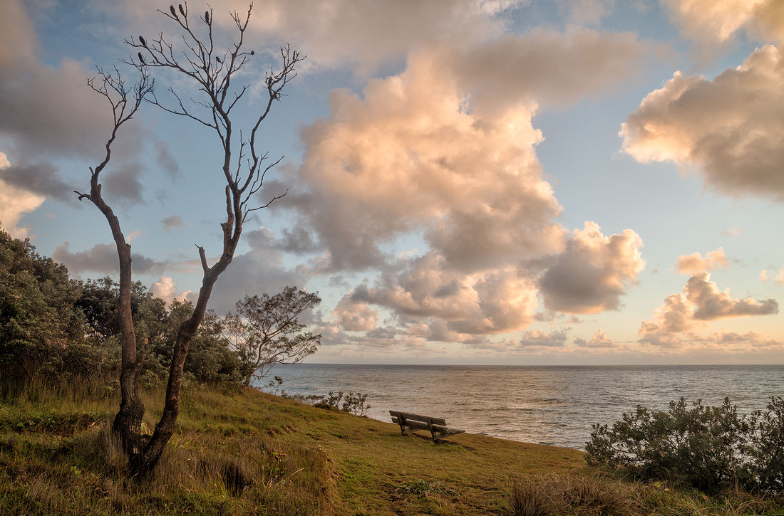 Morning near Boorkoom Campground, Yuraygir National Park
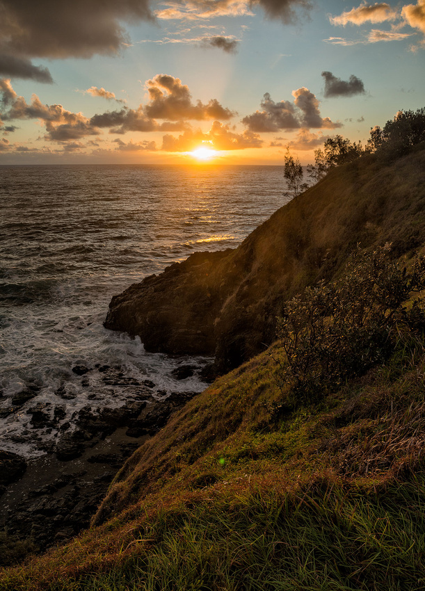 Morning near Boorkoom Campground, Yuraygir National Park
Packing up was a hot and sweaty job as the showers had cleared and there was no breeze. At least the sun dried the tent.
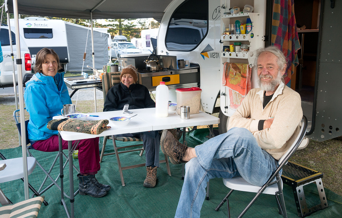
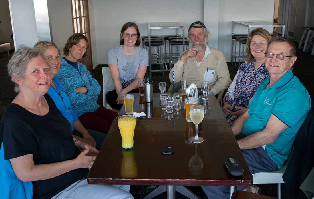
We had arranged to visit Bev's cousin Estelle at Bogangar on the way home. It was good to catch up with her, although her husband Ian was playing bowls, and we were provided with a very nice lunch.
And finally home at last with unpacking and a lot of washing to be done.
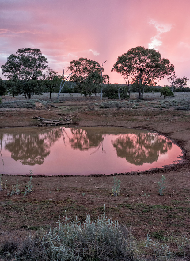
]]>We had a few showers during the night but the morning was fine, although the tent was quite wet. We packed up fairly quickly and were on the road by 9:15 (NSW time).
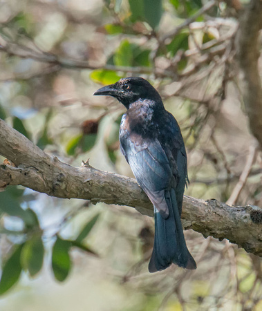
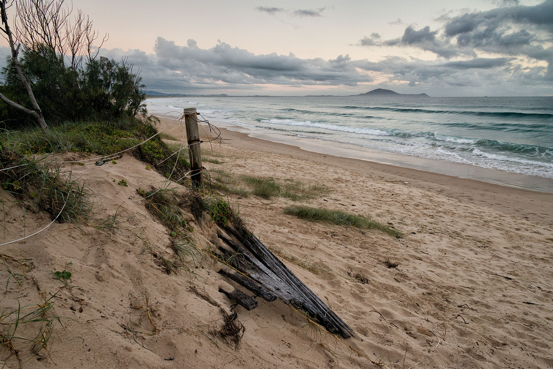
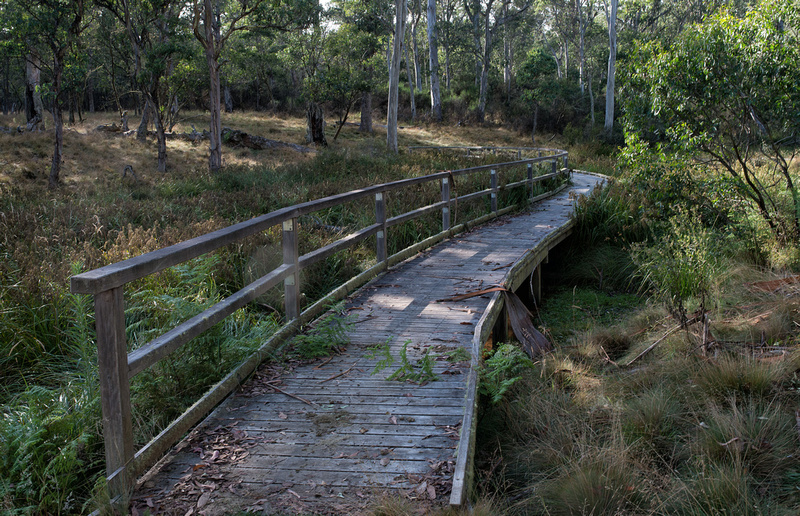
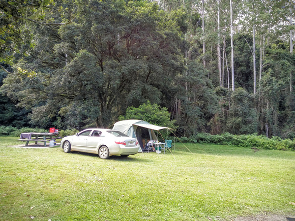
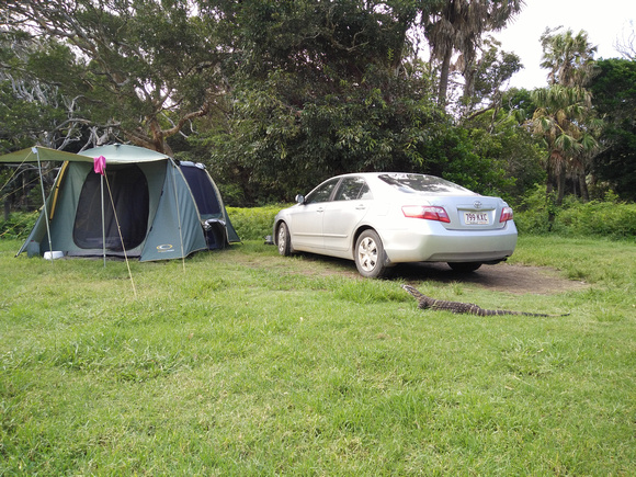
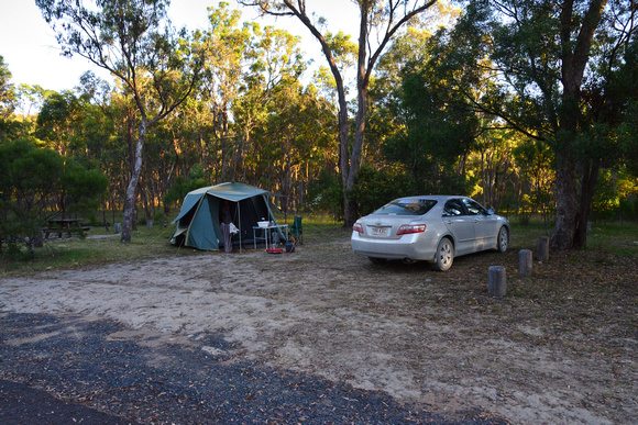
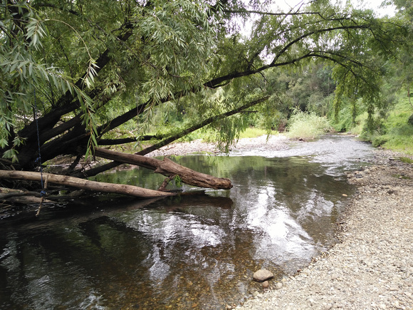
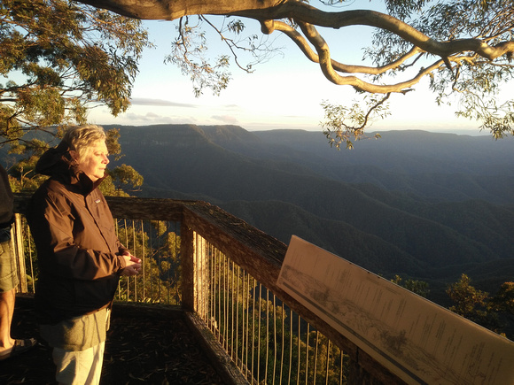
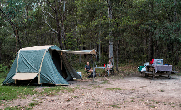
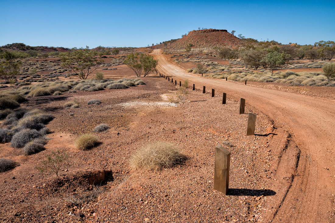
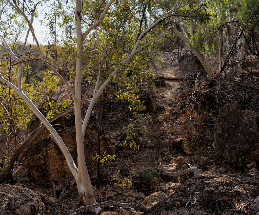
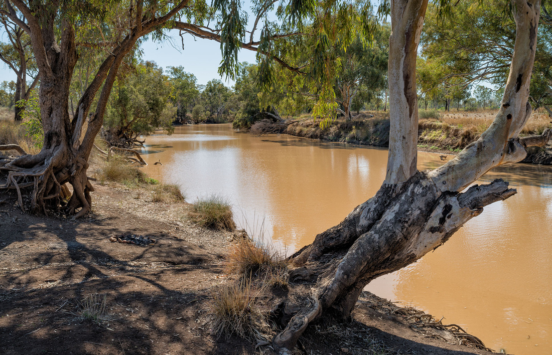
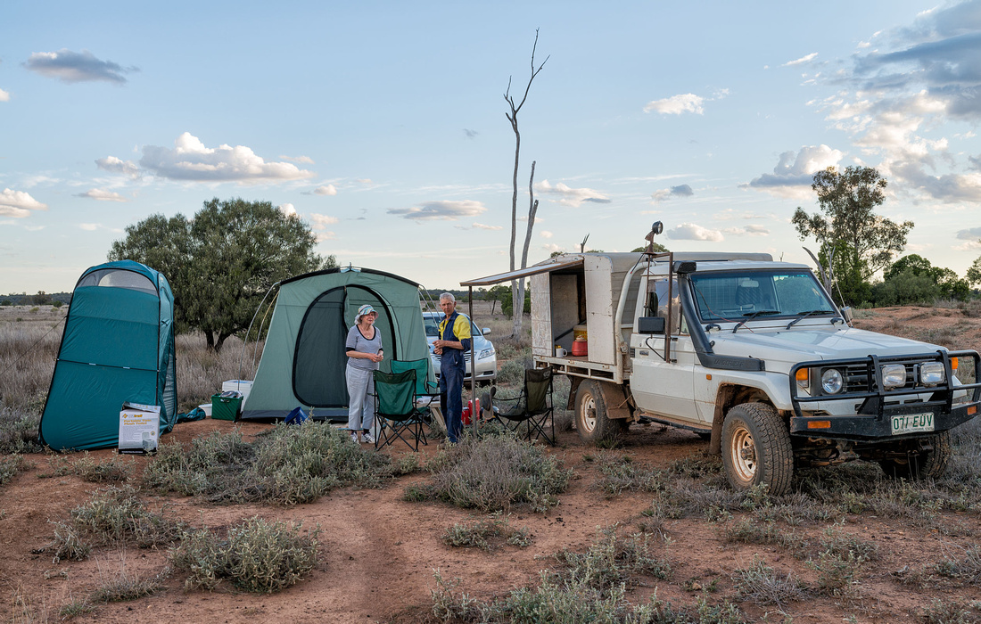
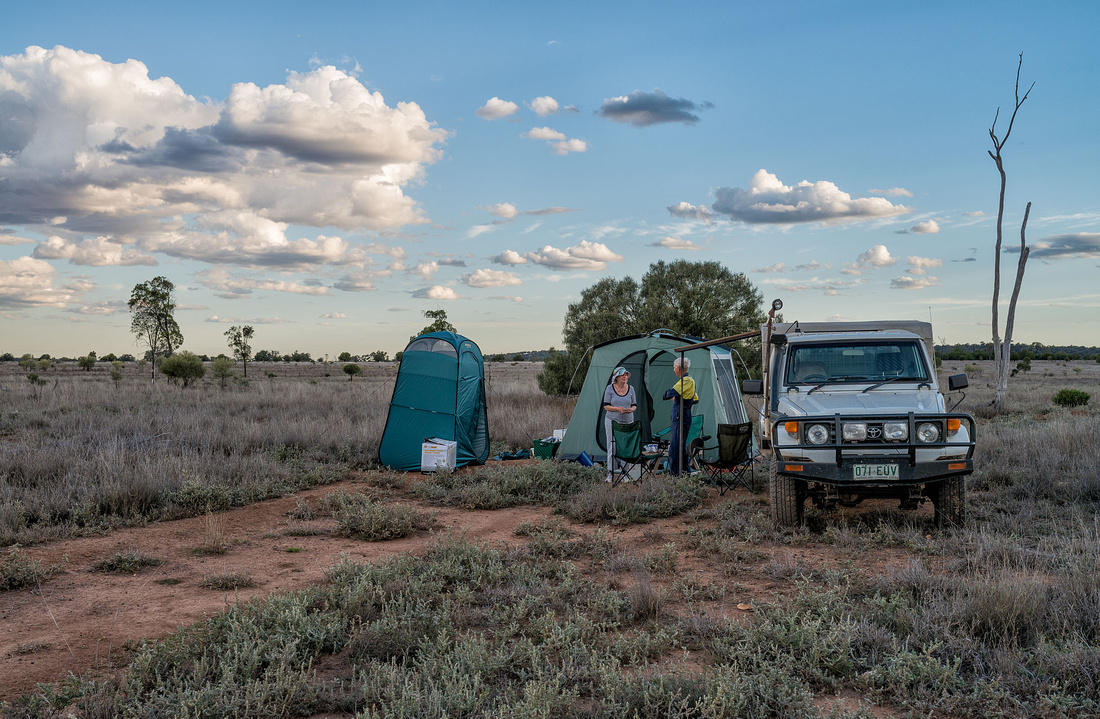
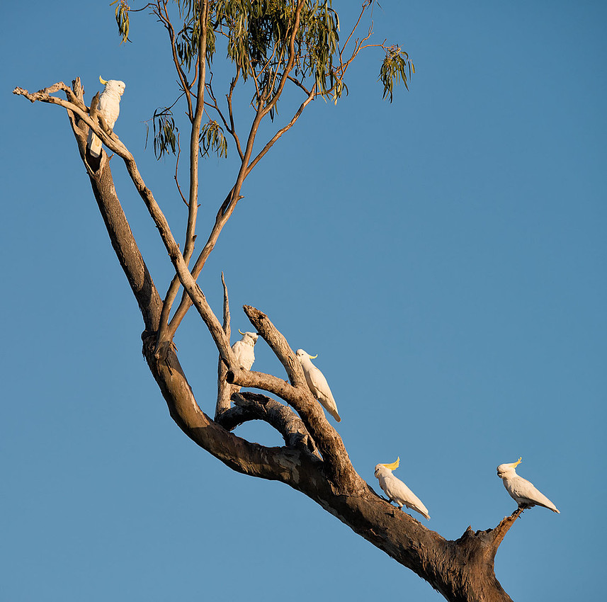
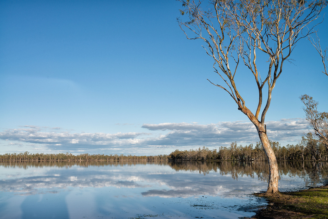
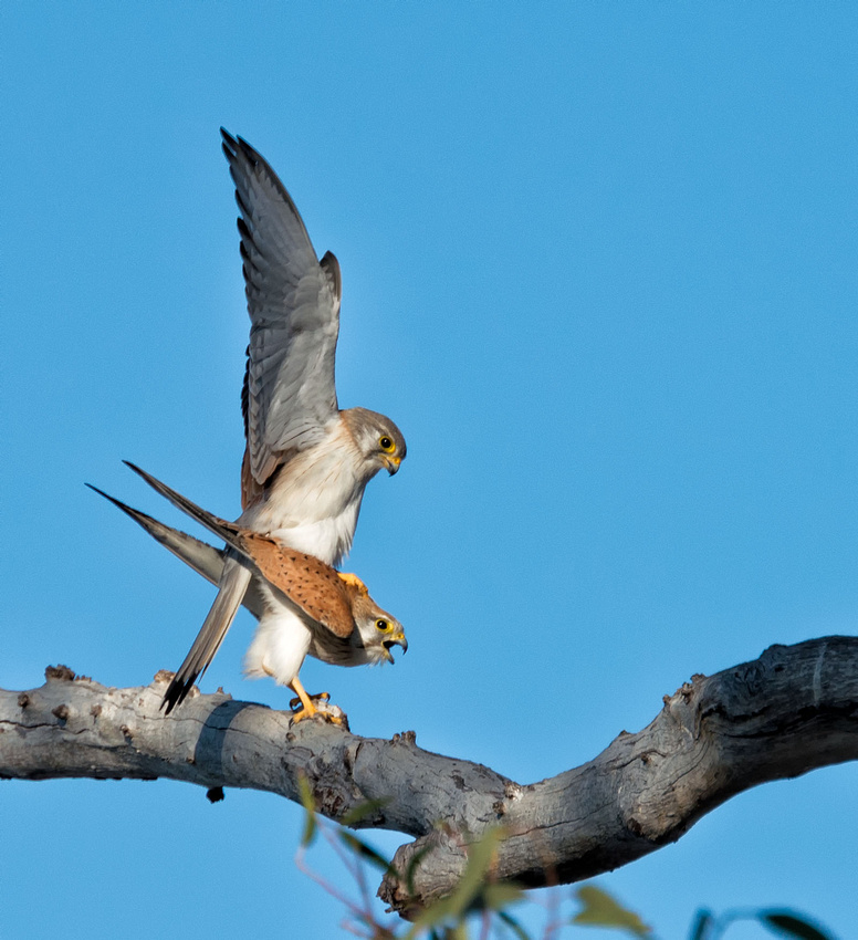
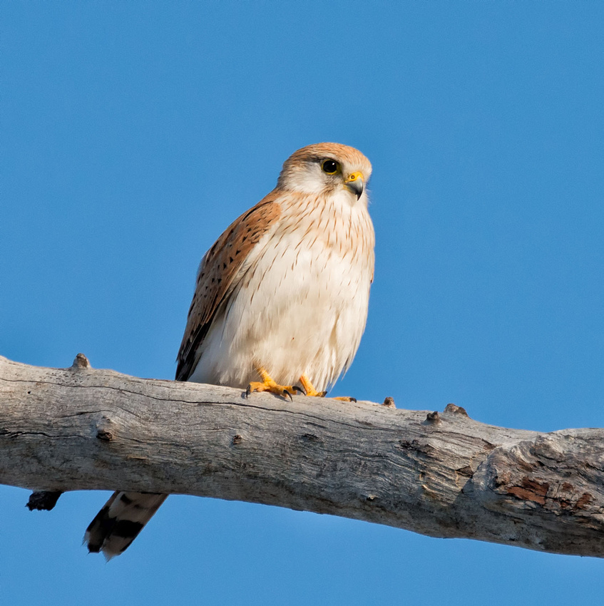
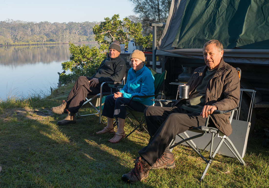
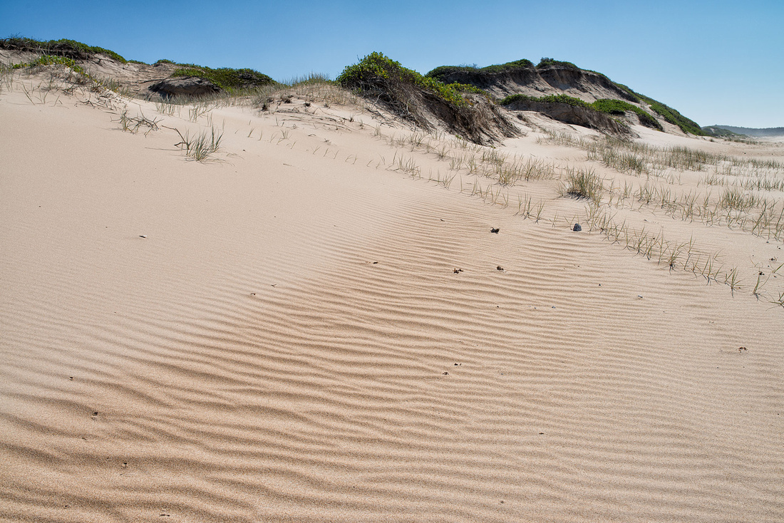
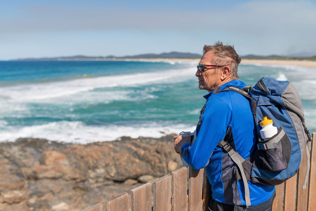
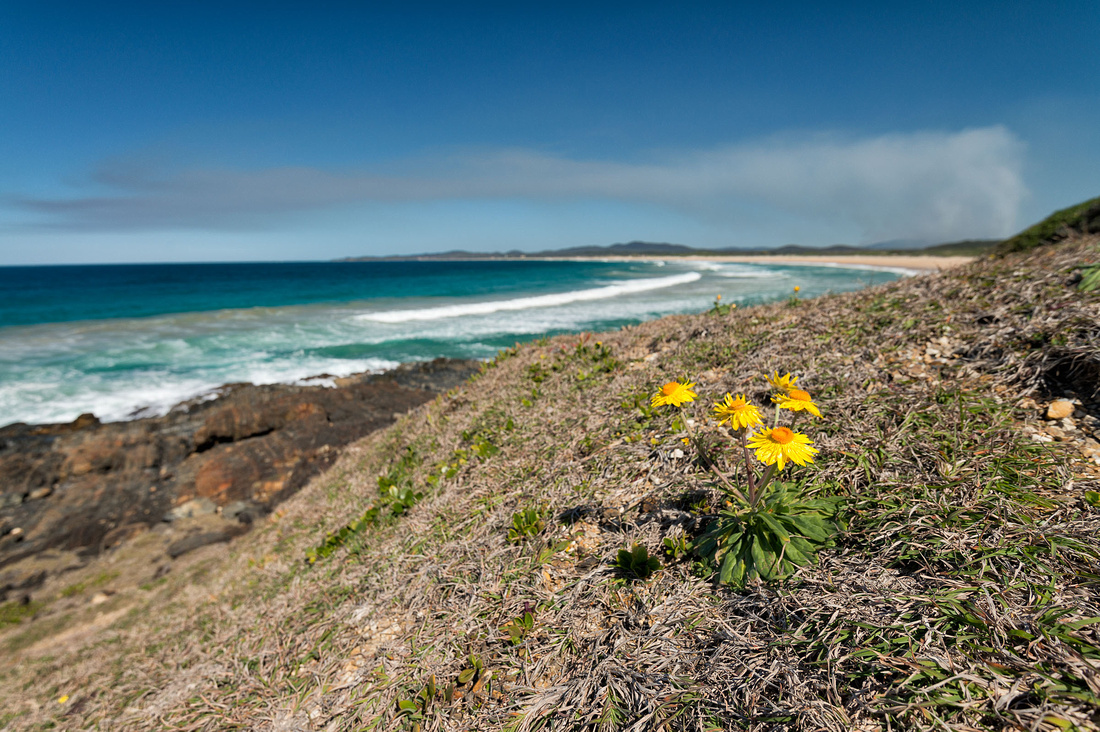
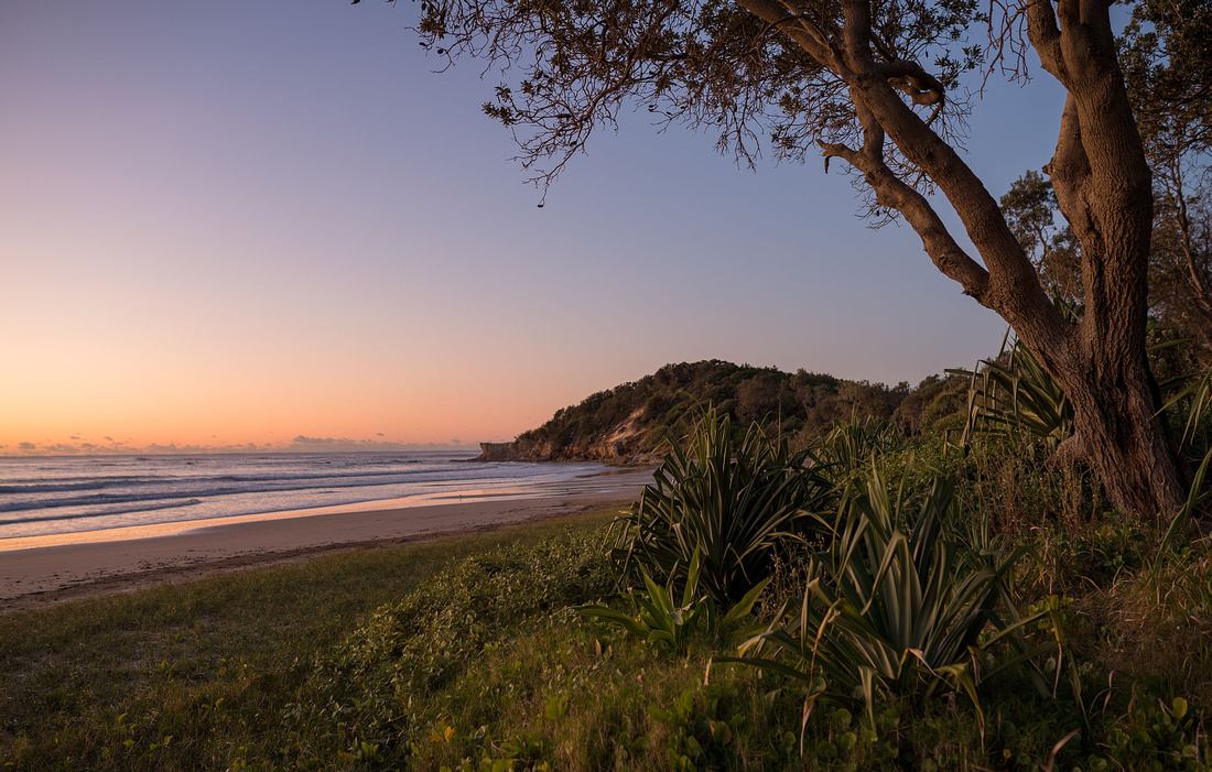
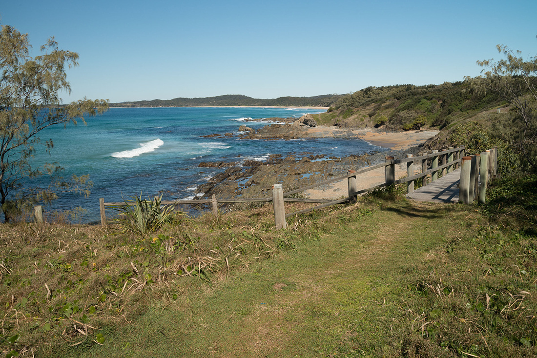
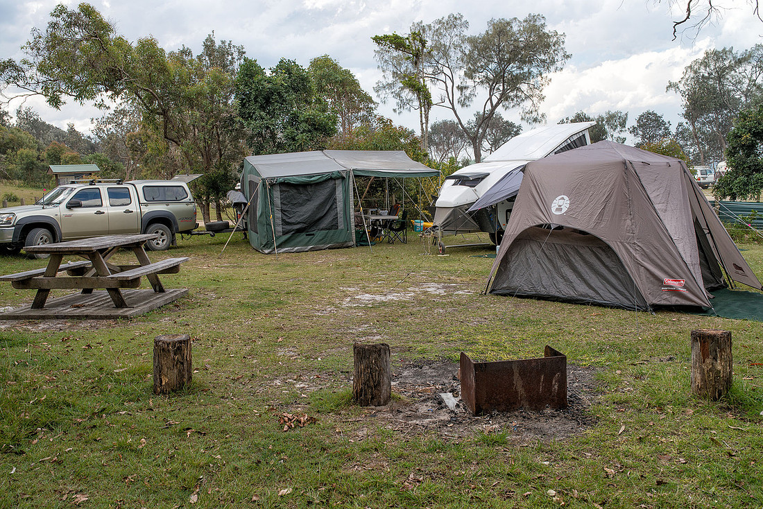
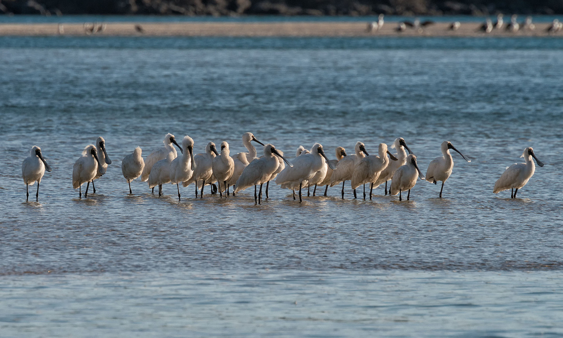
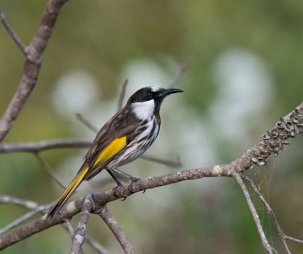
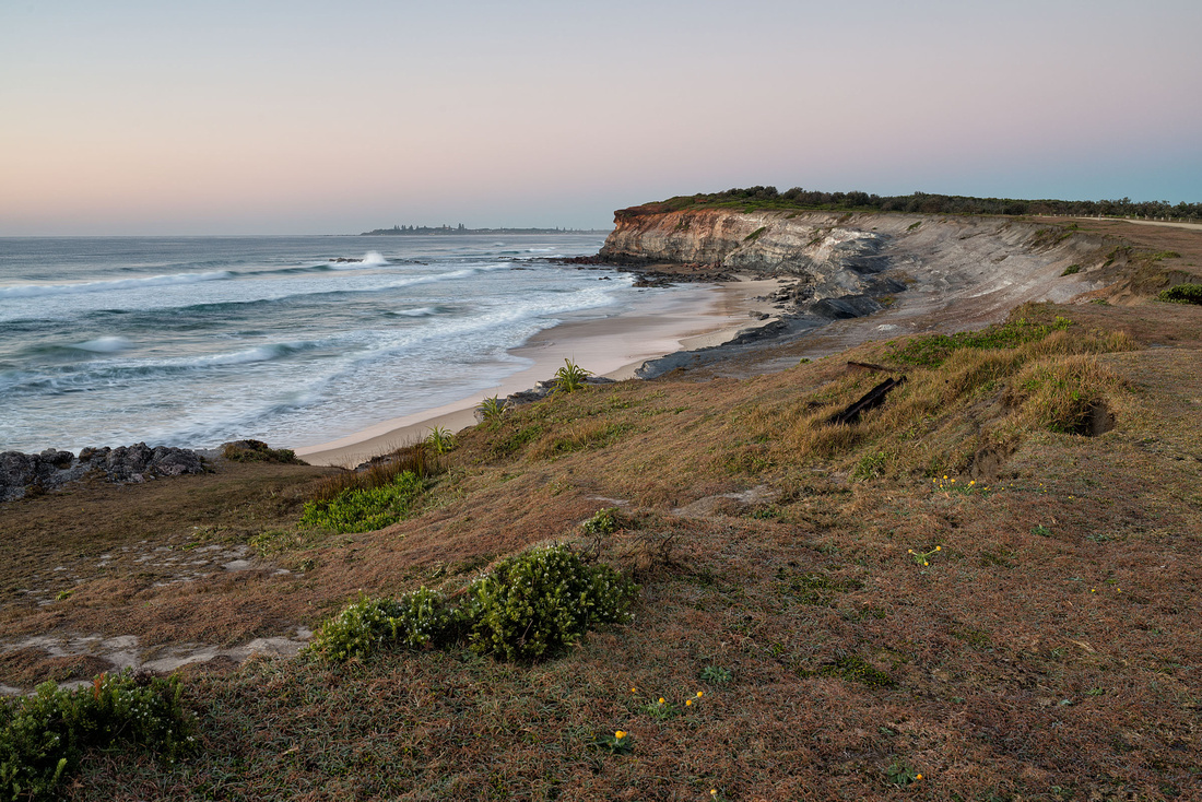
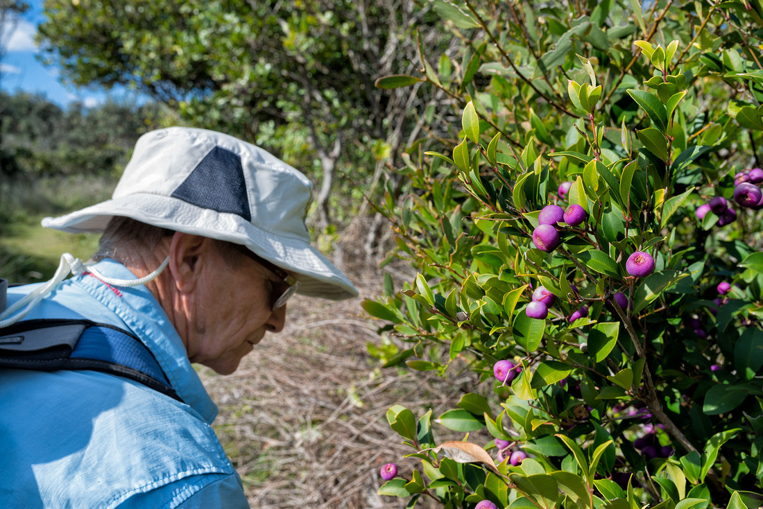
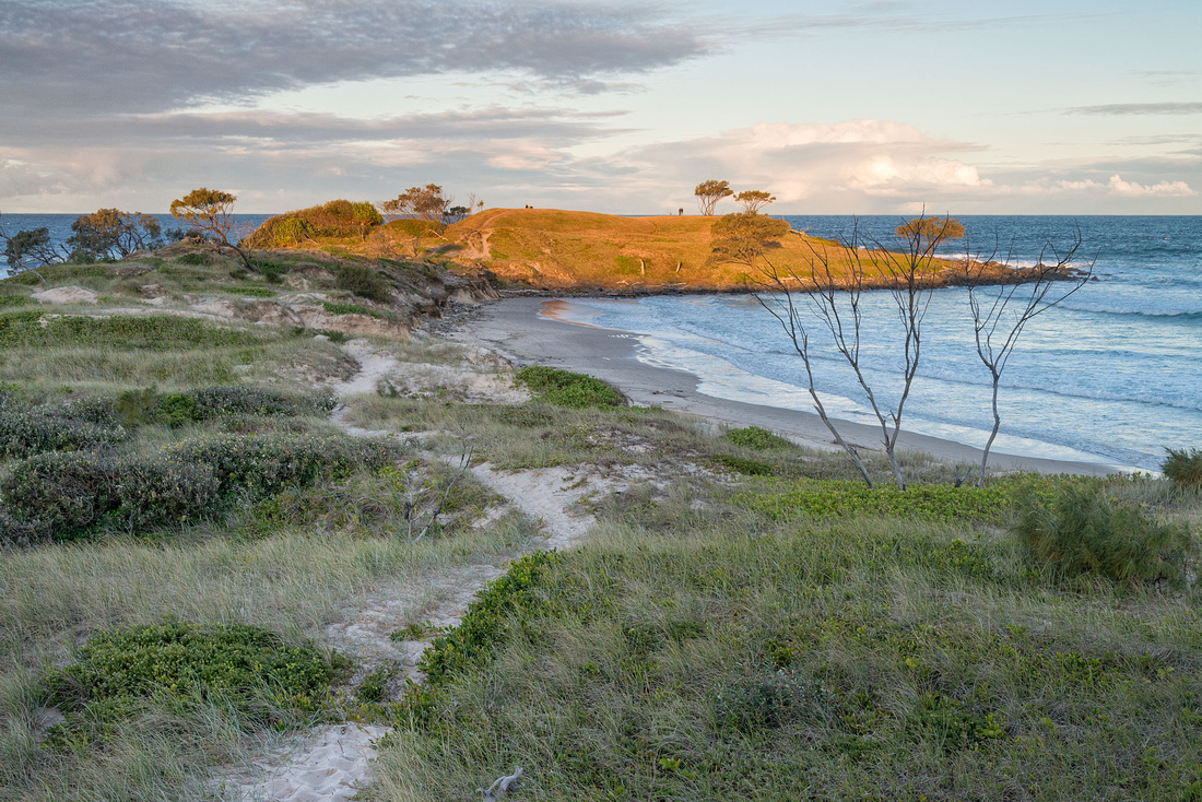
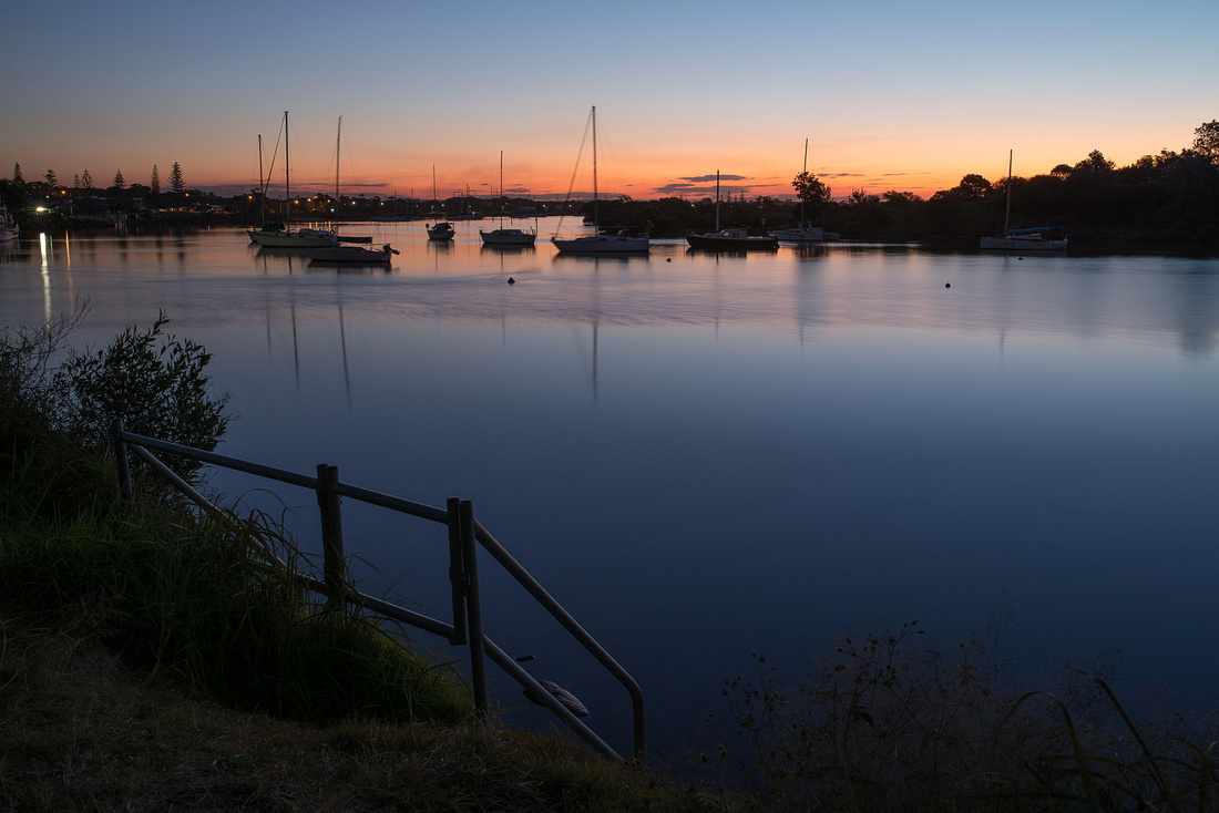
Our destination is Boorkoom campground in Yuraygir National Park, near Diggers Camp just north of Wooli. We had missed this during our walk last year so I wanted to check it out and get some photos of white-breasted sea eagles, which we had seen frequently during the walk.
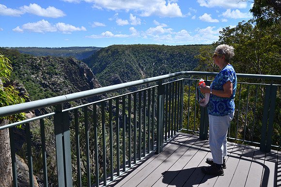
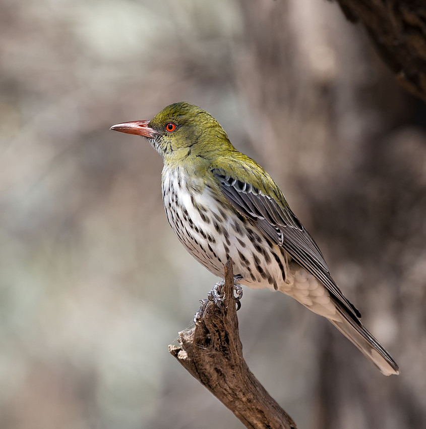
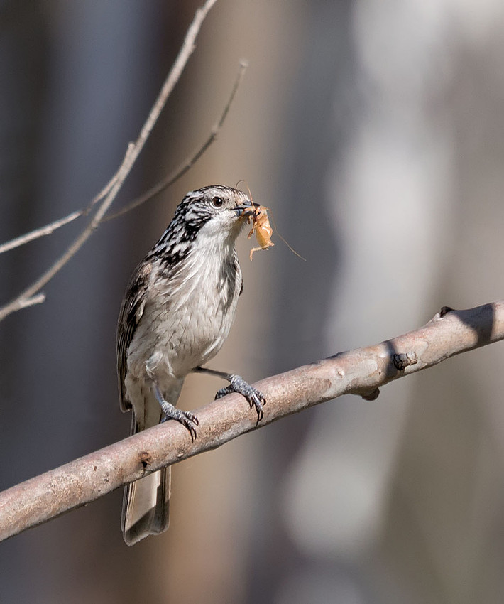
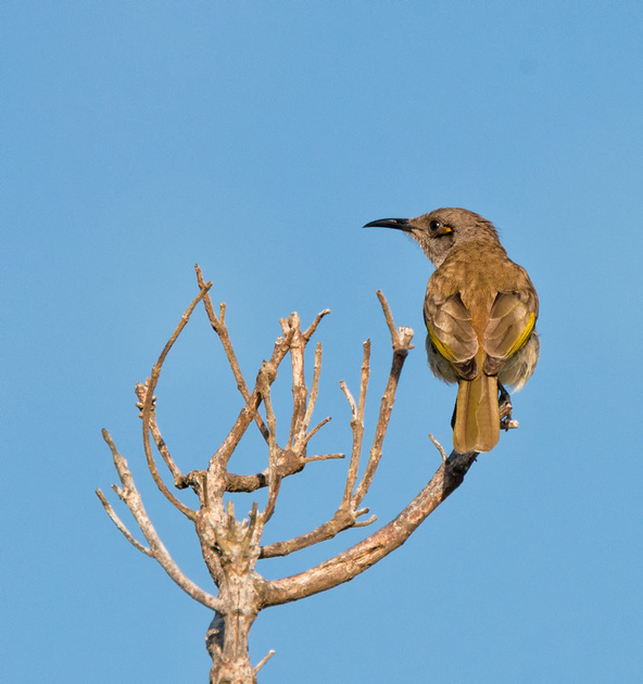
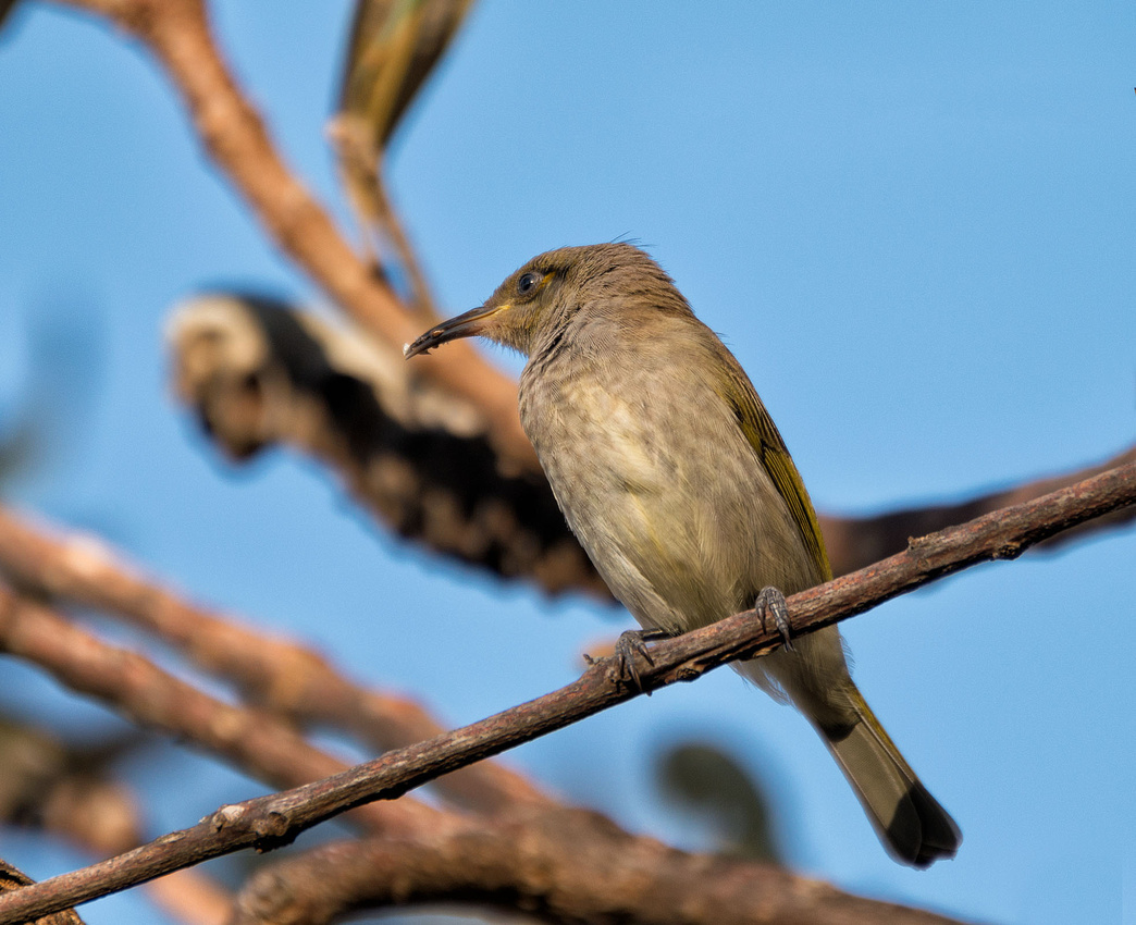
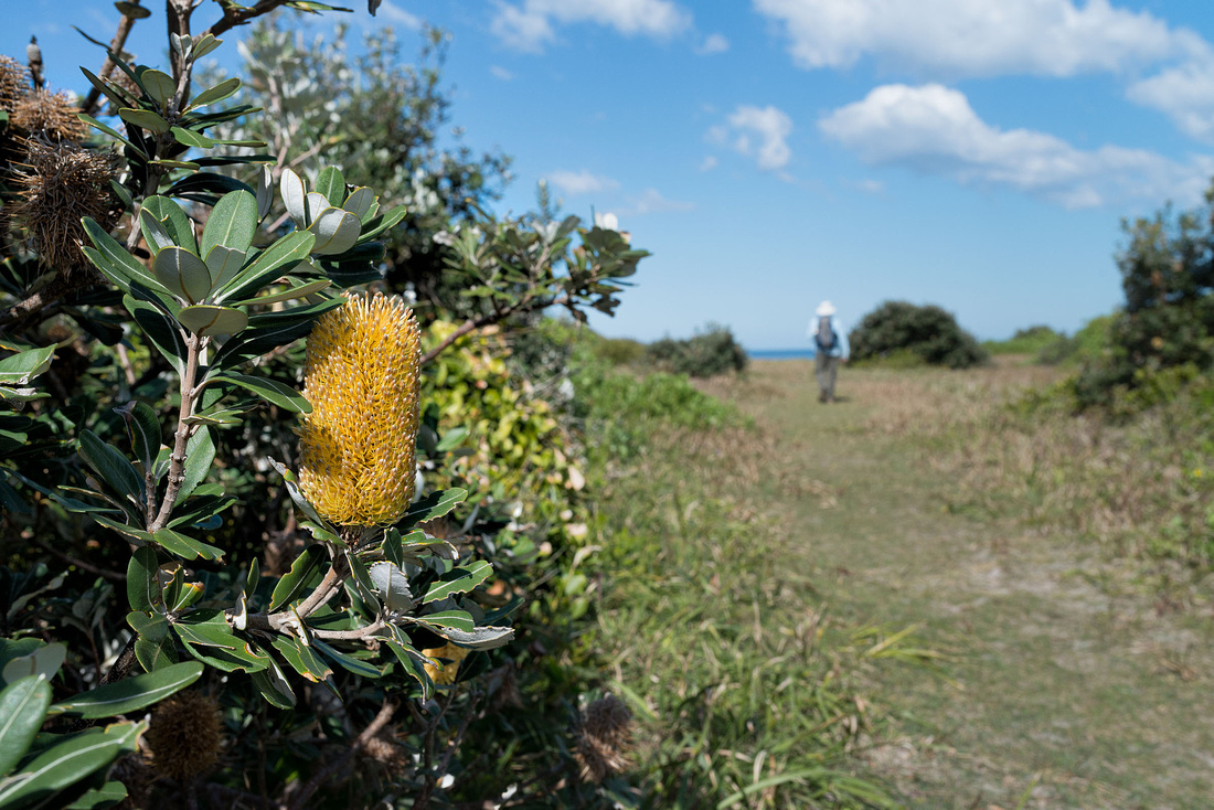
It's a small campground with not much shade and not much flat ground, but we found a spot with a bit of shade. Hoping to see a sea eagle we drove the sort distance to the Wilsons Headland picnic area and walked out to the lookout. Although we sat there for ages, we saw no eagles. We did see a Spangled Drongo and a Little Wattlebird on the walk out.
 Spangled Drongo, possibly juvenile
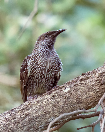 Little WattlebirdWilsons Headland
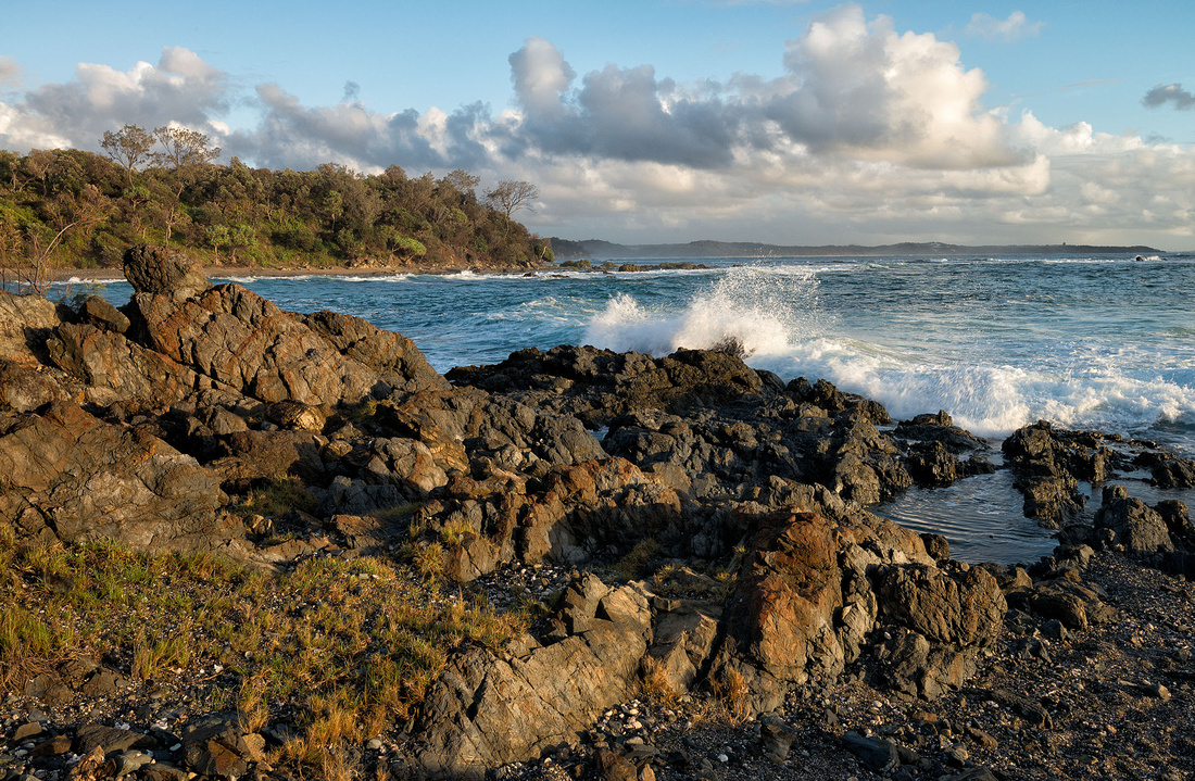
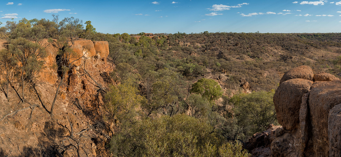
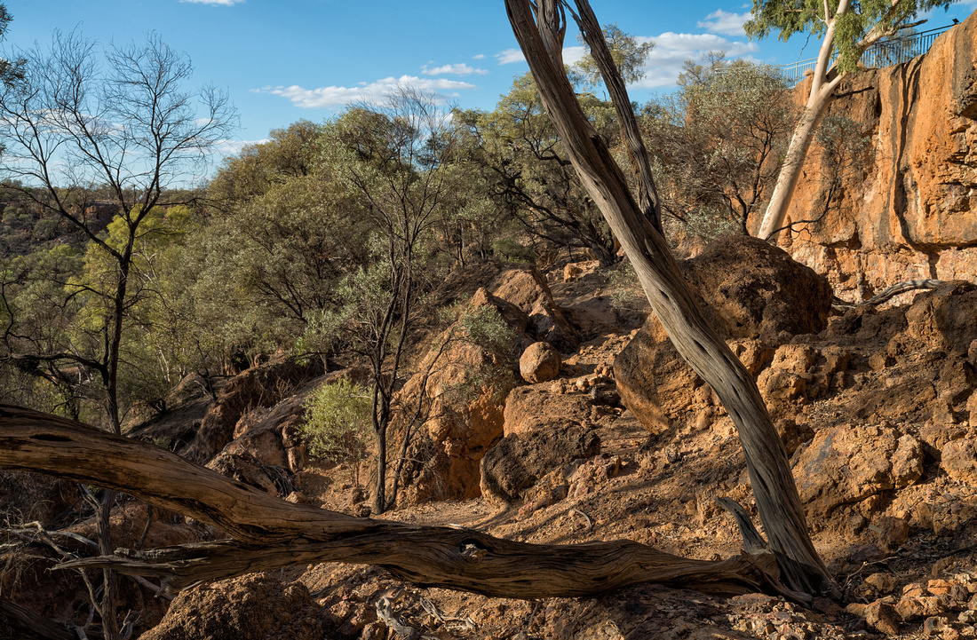
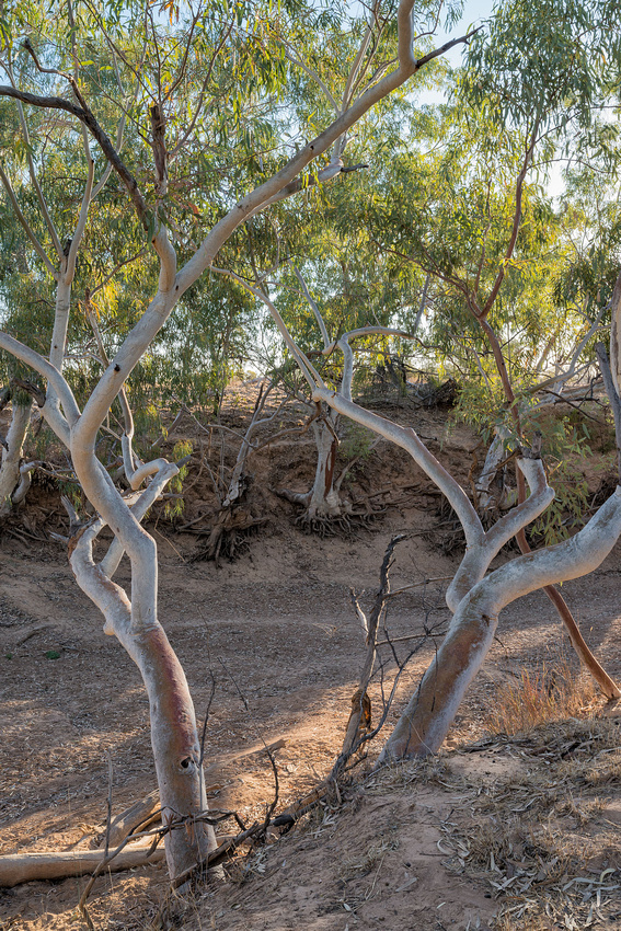
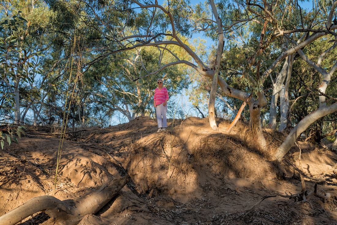
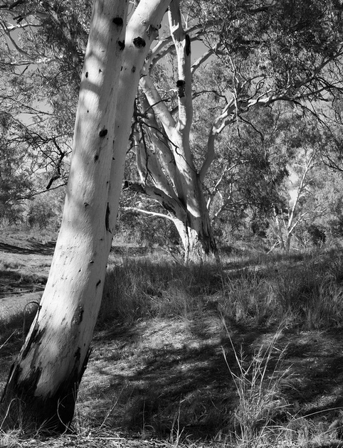
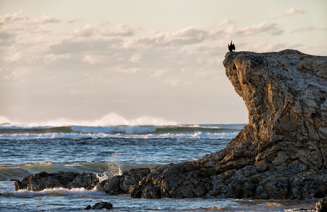
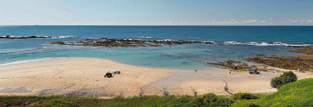
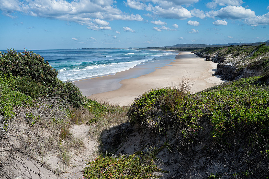
The choice of campground wasn't the best for Bev as it's at the top of a cliff and, although there are stairs down to the sea there isn't really any beach. It has some sand but is mostly rock and large pebbles.
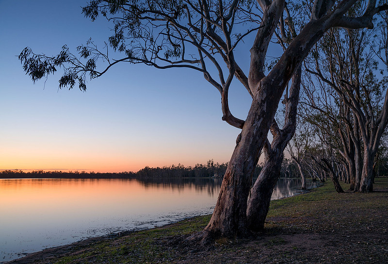
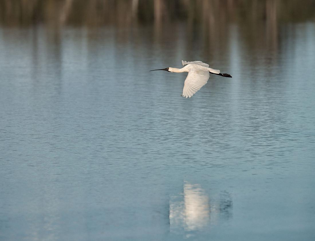
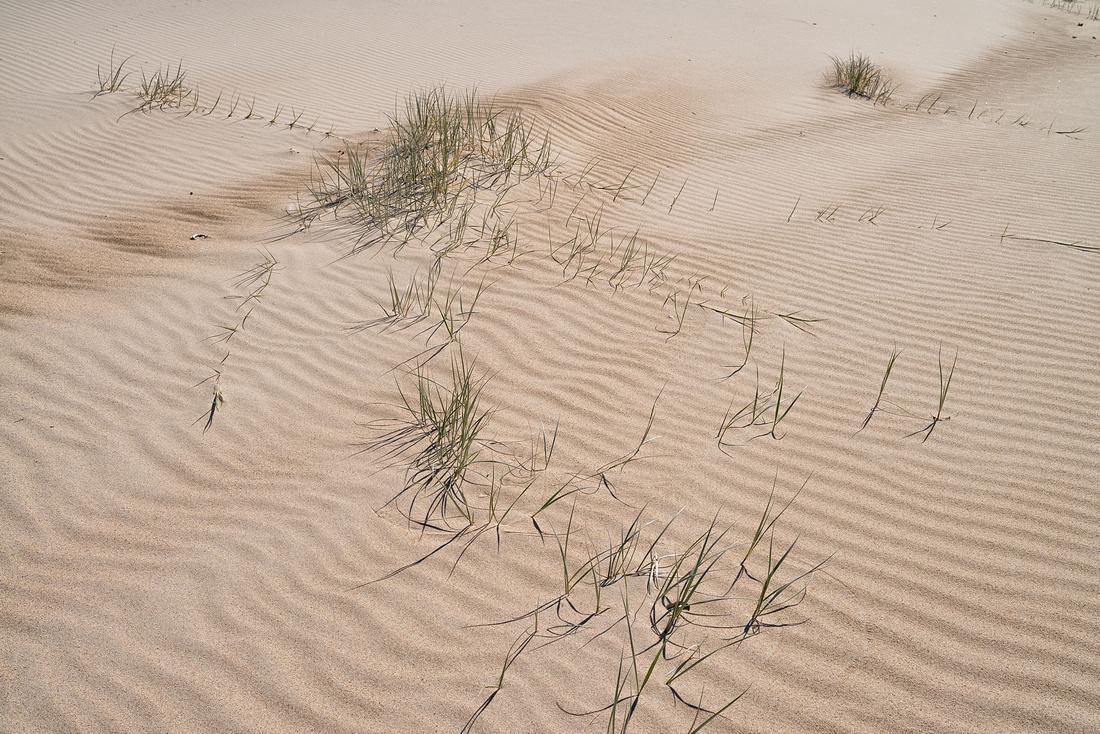
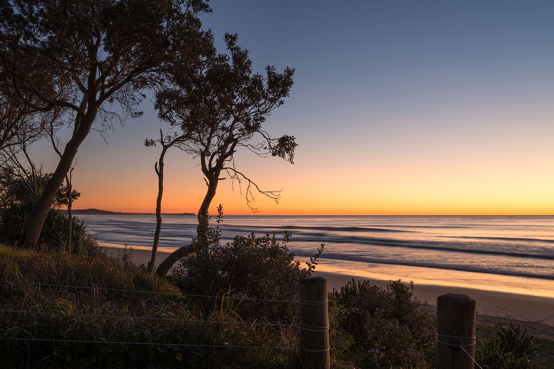
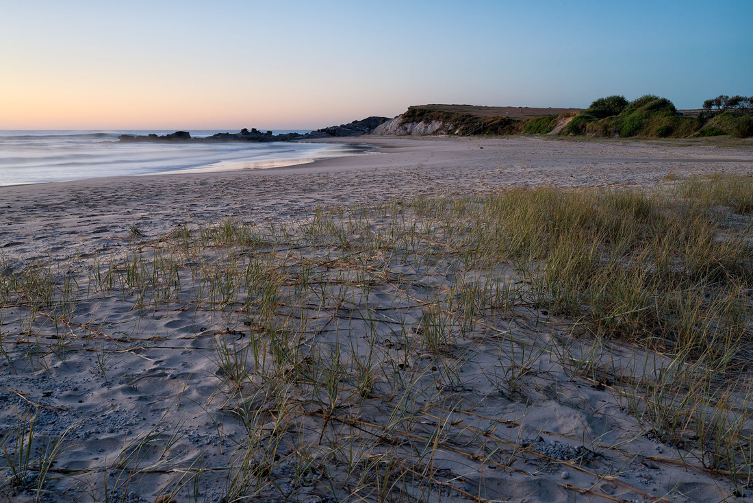
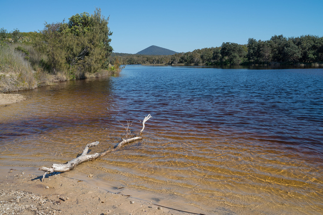
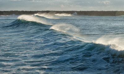
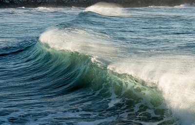
8 March 2016
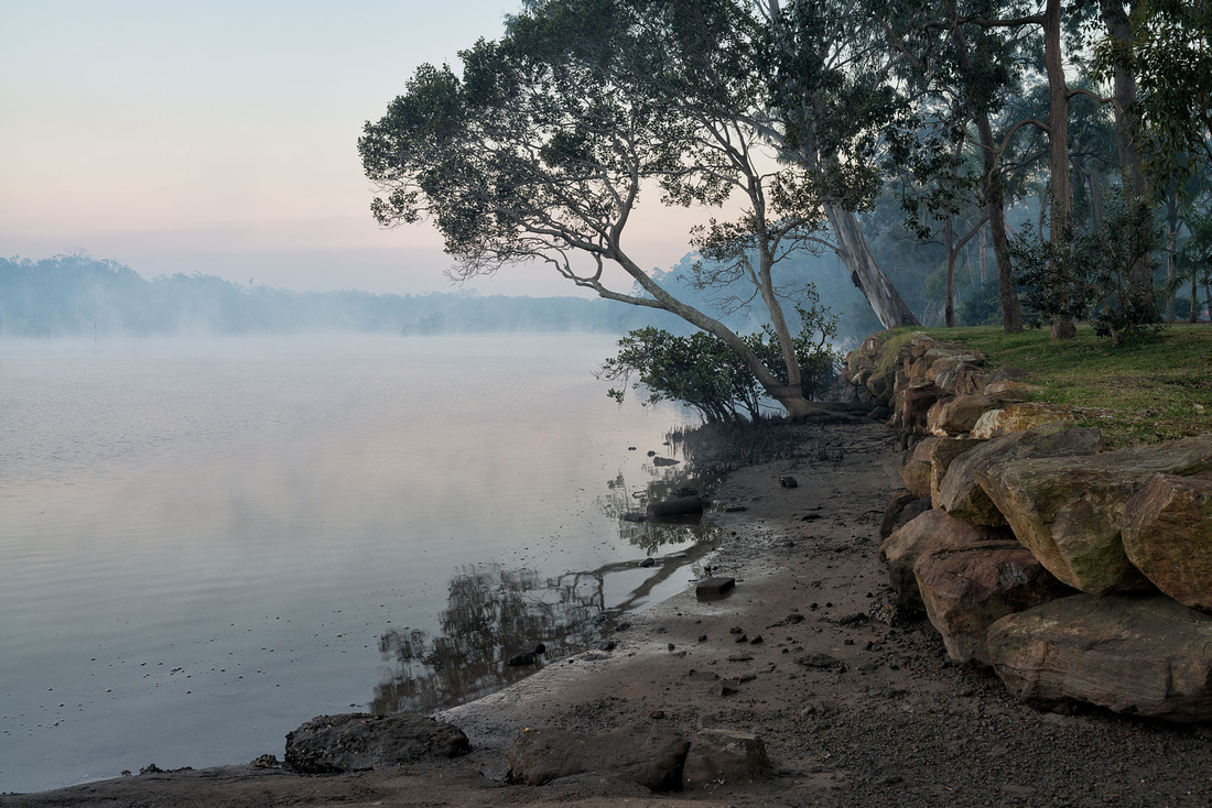
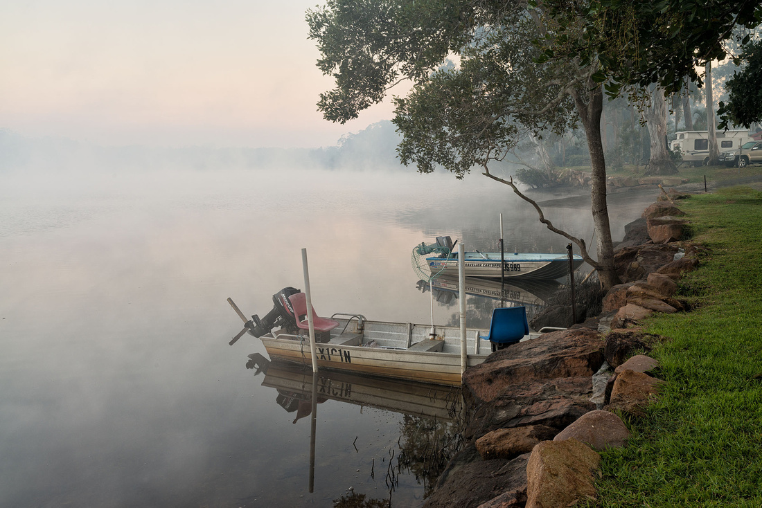
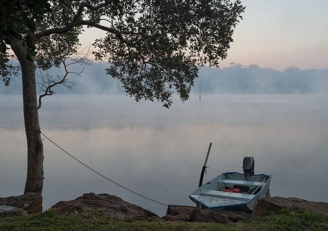
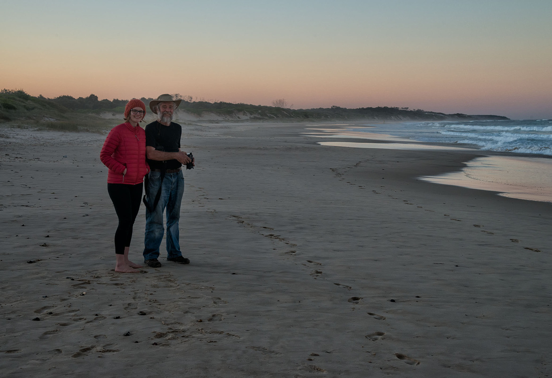
Up before sunrise and down to the 'beach' for some photos.
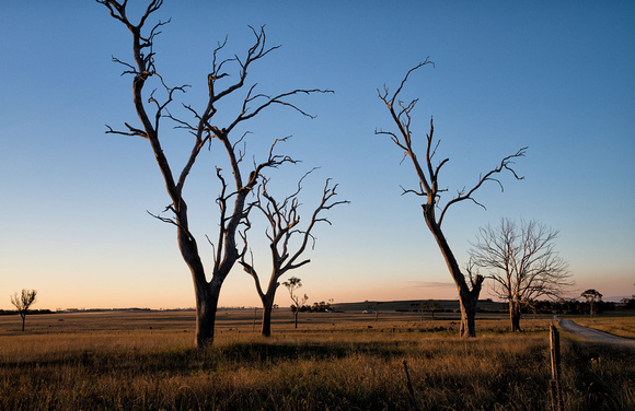
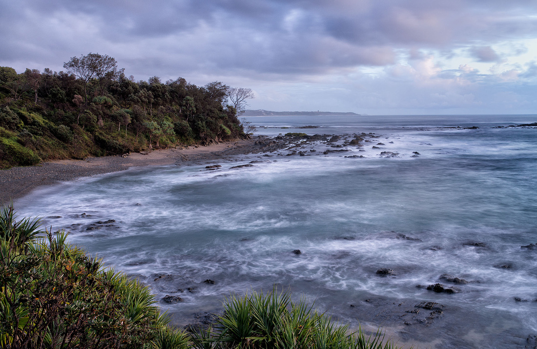 Morning near Boorkoom Campground, Yuraygir National ParkJust before sunrise
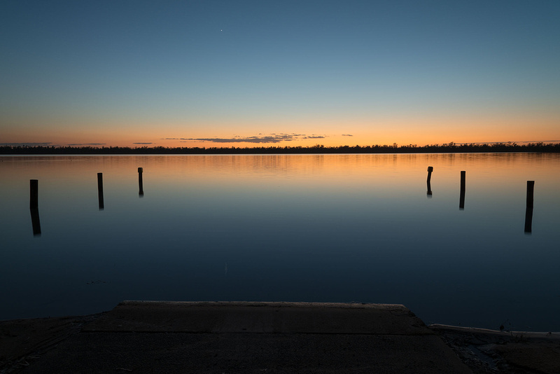
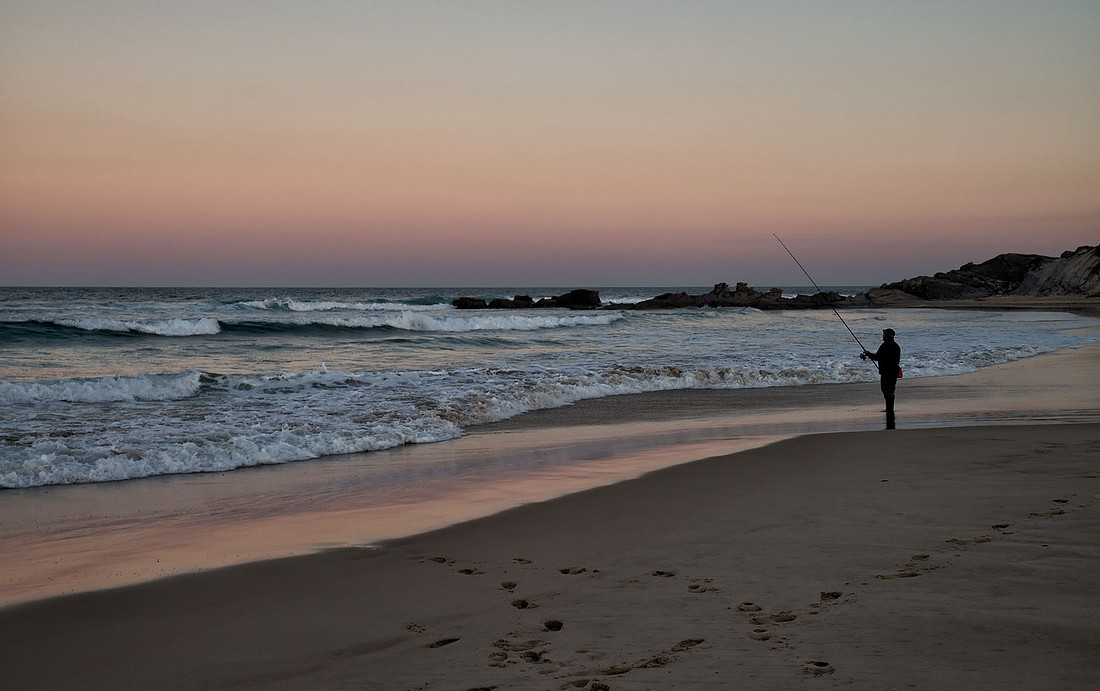
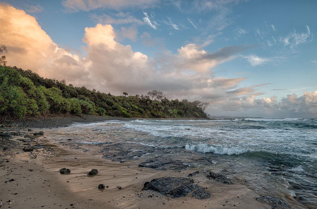 Morning near Boorkoom Campground, Yuraygir National ParkSunrise. More rocks than beach.
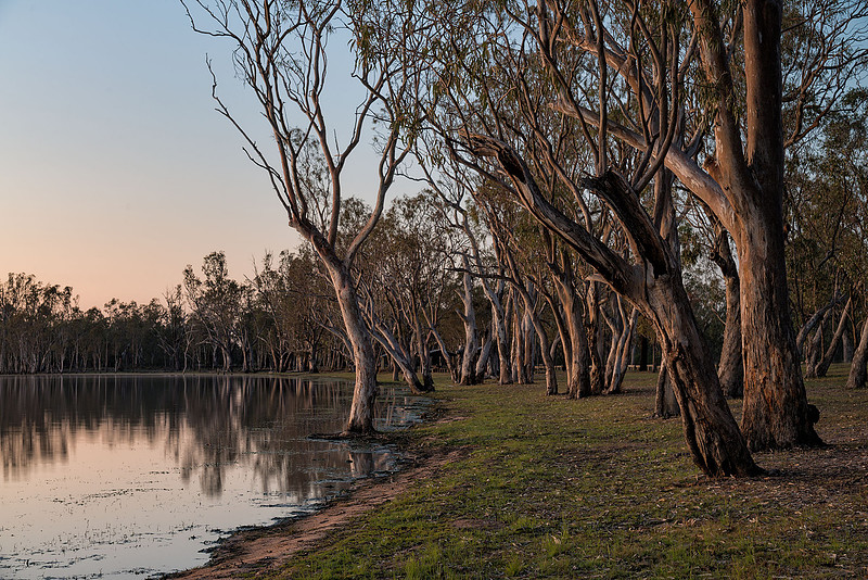
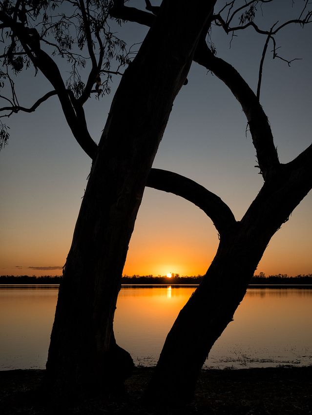
 Morning near Boorkoom Campground, Yuraygir National Park
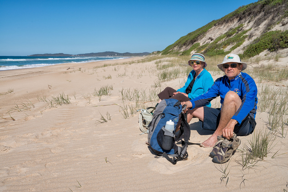
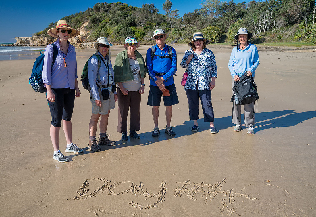
Later in the morning we drove the few hundred metres to Diggers Camp for a swim - it was quite hot again. Conditions looked a bit dangerous with a biggish swell, a strong set along the beach and a drop-off a few metres in. We went in but stayed near the edge, however we got out fairly quickly after Bev was knocked over a couple of times by the waves. It looked safer a bit further along the beach, but when we got there we could see the fins of sharks swimming around. We had a cold shower under one of the pipes set up that diverted water from streams on the hill.
After lunch we drove to Minnie Water for a walk on the beach and coffee and cake at the shop. We should have come here for our swim as it looked quite safe. it was now overcast with showers so at least it was cooler.
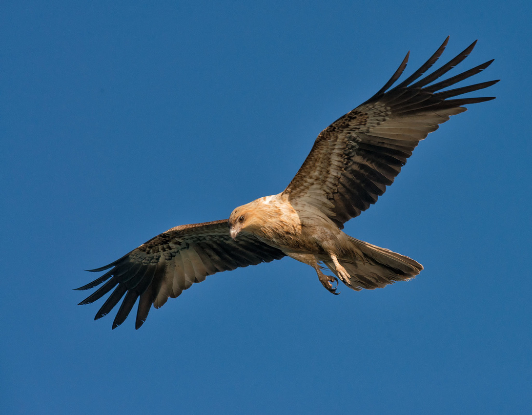
Later in the afternoon, I sat around for an hour at the cliff edge waiting for a sea eagle to fly past, but no luck. But as the sun was setting, we walked down to the cliff edge and had a sea eagle and a couple of kites fly past within five minutes of each other. Of course I had packed up the camera for the night.
]]>6 March 2016
I left Bev sleeping in the tent and went for an early walk along the beach and took a few photos. I tried to find the dunes we had visited in about 1983 but didn't find them. Perhaps I didn't walk far enough. This is looking north to Smoky Cape.
 South Smoky Beach, Hat Head National ParkSmoky Cape in the distance
The next two are looking back to Hat Head.
 Hat Head from South Smoky BeachHat Head National Park
 Hat Head SunriseHat Head National Park
Catching up on the washing and having a swim occupied the next part of the day. After hanging up the washing we had a look at the Smoky Cape Lighthouse. We had been here in 1976 but I don't think the lighthouse itself was accessible then.
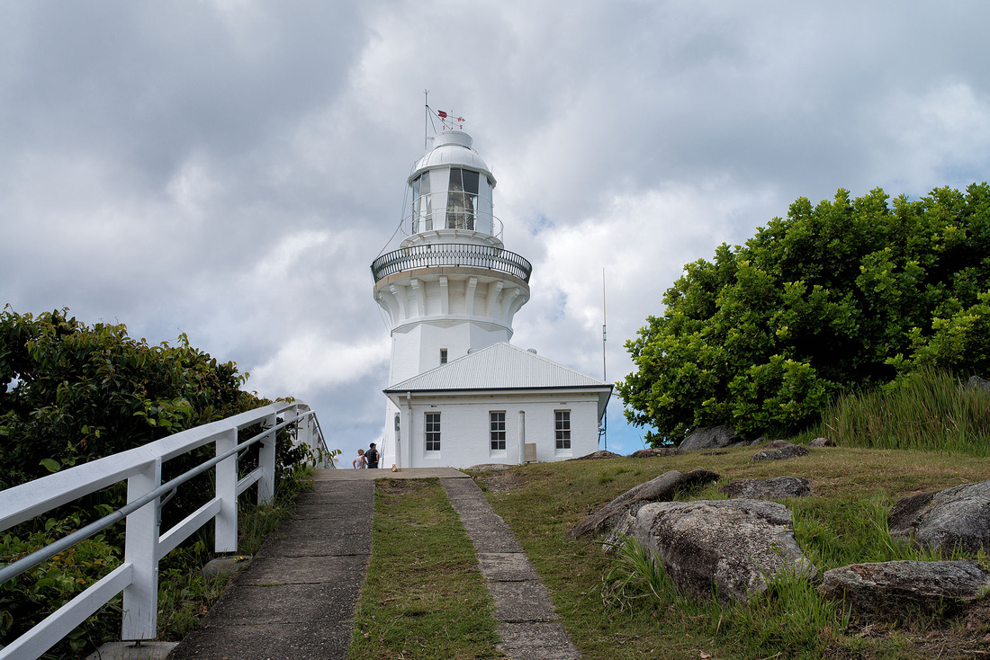
The view from beside the lighthouse is excellent.
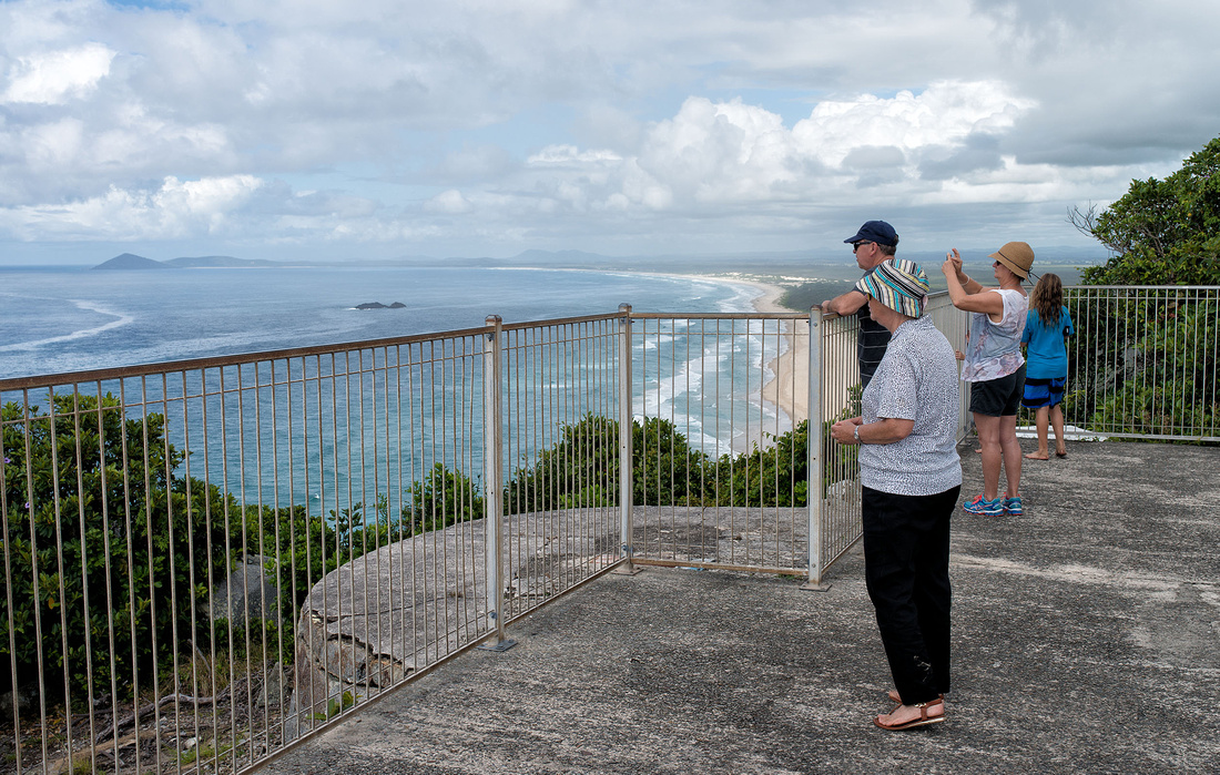 View from Smoky Cape Lighthouse
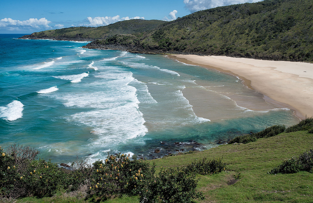
Bev seemed confident she would be OK for a short walk so we decided to try the Connors Track not far from the caravan park. The walk to the first beach, shown below, was easy, but the track to the next beach was quite rough and Bev was struggling a bit so we turned back. On hearing noise, I turned around and Bev had fallen and was lying between two rocks. She had bruised two fingers and her arm but wasn't badly hurt. No more walking on anything but smooth paths.
]]>
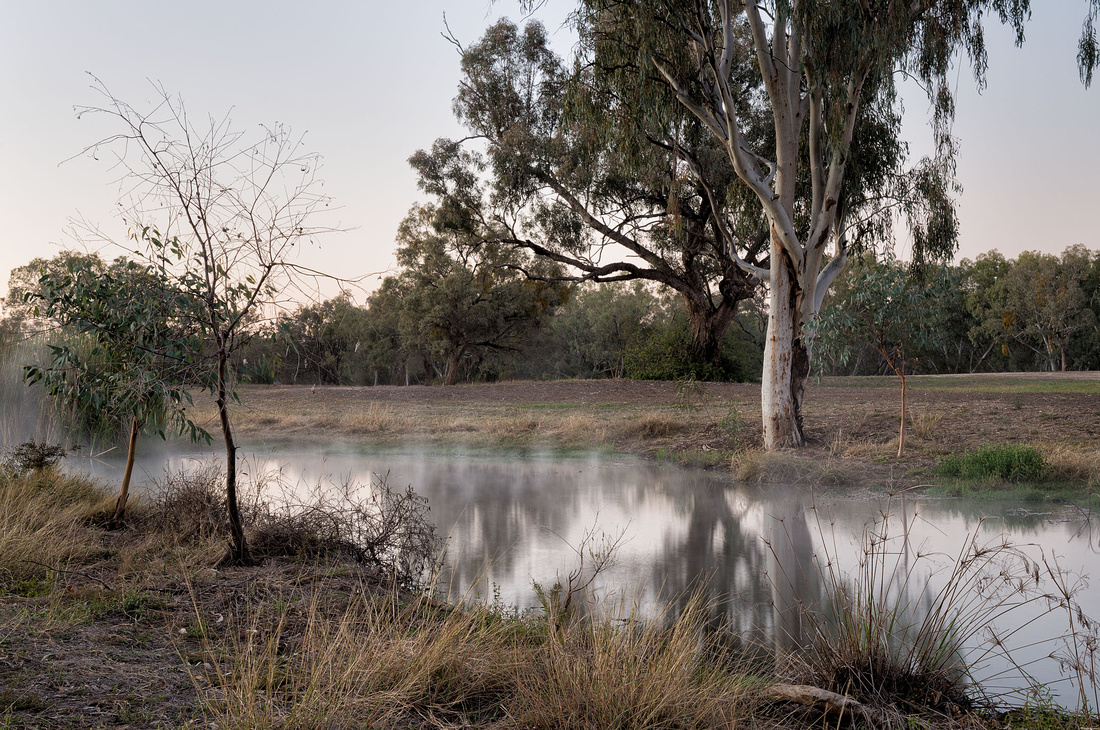
A clear, much colder morning greeted us when we woke, with the swamp covered by mist.
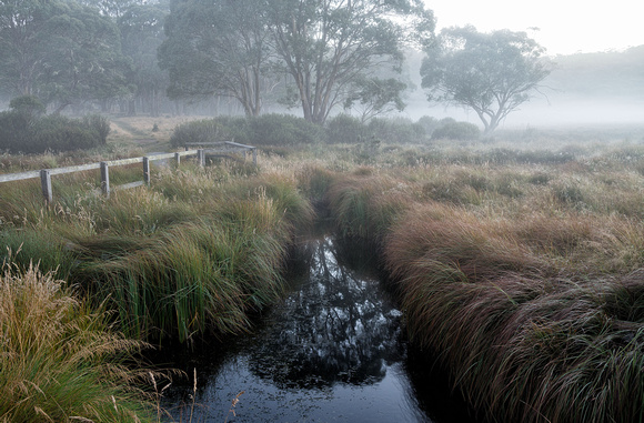 Polblue Creek in early morning mist
After an early breakfast we left for our next stop of Hat Head. We would have liked a cabin, but being Saturday we weren't hopeful and, sure enough ended up with a powered site. We couldn't book as we had been out of phone coverage.
Lots of people here but still plenty of room. The beach and creek are nice.
So here we are, crammed in with hundreds of other campers. While I prefer the quiet of the National Parks, it is nice to have clean toilets, hot showers and drinkable water on tap.
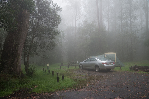
]]>Packed up quickly and had a quick dip in the river to cool off after the effort, then drove to the Polblue campground on the Northern side of the same national park. This is above 1400 metres and located next to the Polblue swamp.
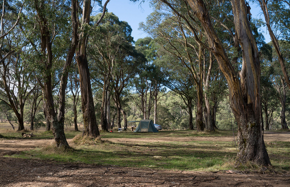 Camp at Polblue Swamp, Barrington Tops NTional Park
It has open grassy areas with lots of trees and signs saying 'Branches may drop'. I picked a shaded spot with no branches directly overhead. We arrived rather late so only had a quick look around the campground before dinner and bed. There was a bit of mist or smoke around, lit by the sun shining through the trees.
At Gloucester River we had the air force flying over periodically, here we have dump trucks driving up and down the road, presumably delivering gravel for the roadworks.
 Afternoon Light, Polblue CampgroundBarrington Tops National Park
4 March 2016
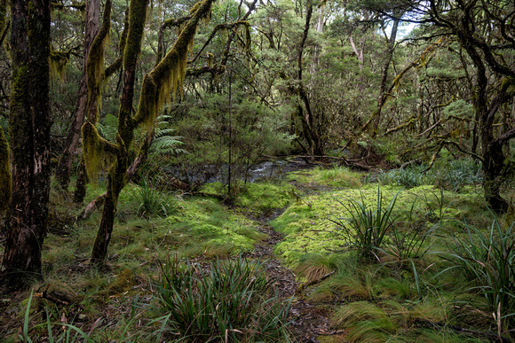
The swamp circuit walk is about three km but Bev wasn't feeling up to it, so I left her at the tent and went alone. An attractive walk but there were area of grass that had been dug up, by pigs I would guess.

 Polblue Creek flowing out of the swamp
When I returned we drove to a lookout, then to Polblue Falls.
During the afternoon I went chasing smaller things.
 Wildflowers, Polblue Swamp walk
]]>
Early in the morning we drove the 18km or so to Gloucester Tops to do a couple of short walks. The Gloucester Falls walk was a little disappointing as you don't get a good view of the falls. The River walk was pleasant and we saw this on the track.
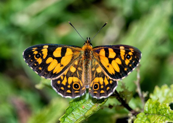
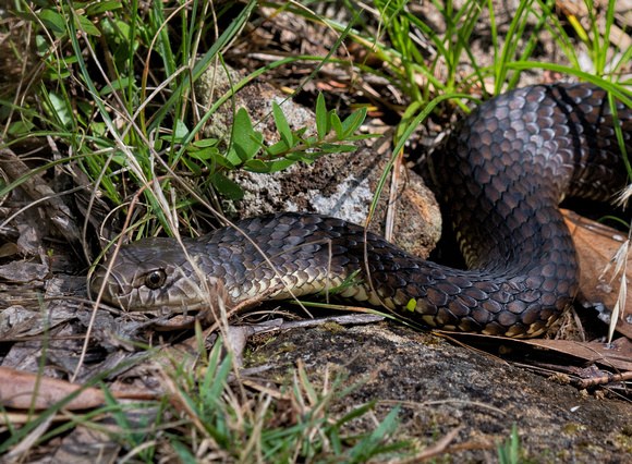 Snake, River Walk, Gloucester Tops
It looked alive but didn't move when I stamped my foot or threw sticks at it, so we carefully walked around it off the track.
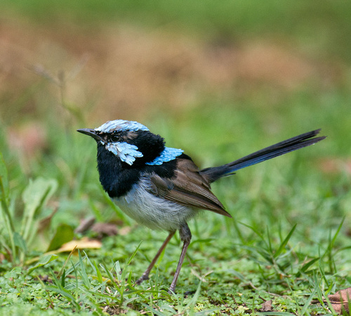
The fairy wrens were back for afternoon tea.
 Fairy Wren visiting for afternoon tea
A bit of extra effort for dinner and we enjoyed some excellent steak.
We had the campground to ourselves for the night.
]]>
We packed up our camp at Booti Booti, bought more supplies in Forster and started back to Gloucester River Campground, hoping the two days of fine weather had reduced the flow at the fords. I had hoped to get some close-ups of goannas but for some reason we didn't see much of them after the first day.
The Gloucester River Campground in Barrington Tops has lots of short green lawn but not much of it is level.
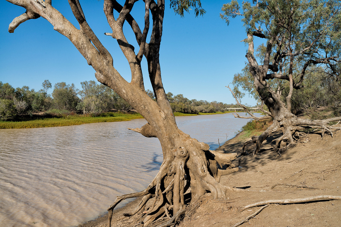
The river runs past just across the road.
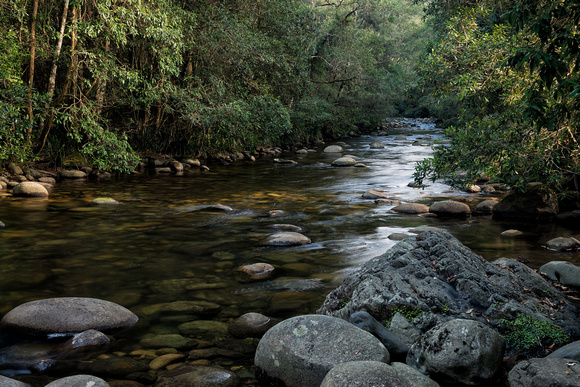 Gloucester River near the campground
As soon as we arrived, these fairy wrens were hopping around us, even going inside the car. They are tiny birds.
To add some excitement, we had the air force flying over periodically (FA/18s?)
Late in the afternoon, we sat by one of the pools hoping to see a platypus, but had no luck.
 Gloucester River, Barrington Tops National Park
I had a couple of dips in this pool. It's not very deep and the bottom is uneven but is very refreshing.
]]>
Leaving Gloucester, we headed for Gloucester River Camping Area in Barrington Tops National Park. The road fords the Gloucester River a number of times, and on reaching the first one I chickened out as the flow looked a bit strong after yesterday's rain. We implemented plan B and headed for Booti Booti National Park just south of Forster.
'The Ruins' camping area is just behind the beach and a few hundred metres from Wallis Lake on the other side. It also has hot showers. A number of goannas were doing circuits during the afternoon and some would come right up to you. They weren't aggressive though.
Another one is not visible behind the car. We had a quiet afternoon and had a walk on the beach at sunset.
29 February 2016
Bev wasn't up to strenuous walking so I did the Booti Hill/Lakeside walk by myself. That hill was steep in places and when I arrived at the next beach, I found you could drive there. The lake portion was pleasant though.
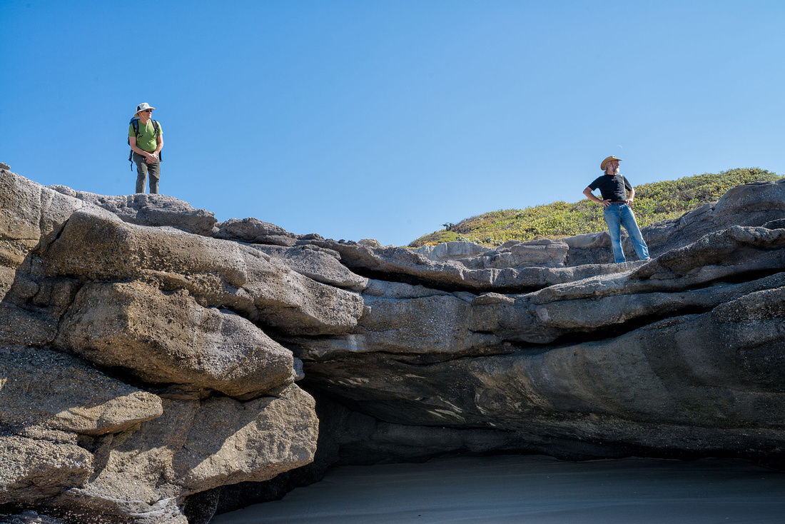
After my walk we drove to Seal Rocks and walked up to the lighthouse on Sugarloaf Point. This was a bit steep, but paved and short.
 Climbing to the lighthouse on Sugarloaf Point.
We ended up at Bulahdelah for lunch before driving back to camp.
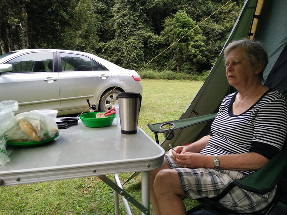
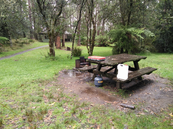
]]>Rain all day today but at least it's cooler. I'm pleased we got the cabin. We did go for a short drive and I went for a walk to check out the park, but otherwise a very quiet day.
It looks like less rain tomorrow so we'll probably have a look at Gloucester Tops and stay there if it's not too wet, otherwise we'll head for the coast. I'd prefer to avoid setting up in the rain if I can.
A bit too wet for photos except for a couple of the caravan park.
Apologies for the quality of the photos but I don't have any editing tools and some are with the phone.
]]>
On the way to Armidale yesterday, we stopped for lunch at Wollomombi Falls, in Oxley Wild Rivers National Park,and went for a short walk. The falls were dry except for a small trickle but the gorge is impressive.
 Bev at a lookout, Wollomombi Gorge
Today we drove to Dangars Gorge, also in Oxley Wild Rivers National Park, with similar geography to Wollomombi, but again the falls were dry. We set up camp but I didn't choose the site very well as the tent was in full sun for a few hours each afternoon. This photo is early morning.
This is the view down the gorge from the lookout near the falls.
 Looking down Dangars Gorge, near Armidale
Late in the afternoon I left Bev at the camp and drove back along the road to take some photos in the light of the setting sun. I also wanted to check the national parks web site as I thought camping was free but a pay station had been set up, although with a blank information board. Here are a couple of photos.
When I got phone reception, I checked the web site and it said free camping, so it looks like they are preparing to impose fees.
25 February 2016
Leaving early because of the heat, we tried the walk to McDirty's lookout (about 7km), but Bev had to stop about 1.5km from the lookout with a pain in the groin. So I went on by myself while Bev sat on a convenient log and waited. This track has some spectacular views. I thought the Rock Wallaby lookout was better than McDirty's. This is the view from McDirty's.
 View from McDirty's Lookout, Dangars Gorge.
Bev managed to walk back and her limp gradually disappeared. The campground here is quite small and we were a bit concerned when four caravans and a mobile home turned up together. Thankfully they just had a quick look at the gorge then drove off. One other group were camped here and two more arrived late and left early, so it was mostly quiet.
Finding the heat and dryness uncomfortable, we drove to Gara Gorge where we found water but nothing accessible for swimming. I did see some Kingfishers fishing.
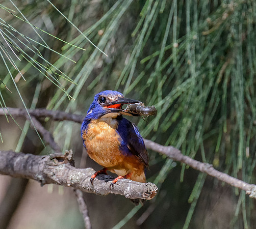 Azure Kingfisher with CrayfishBlue Hole, near Armidale
On arriving back at the camp, we found that the other campers had left and we had the place to ourselves.
I thought it would be cooler here but it has been unpleasantly hot during the day with cool nights. The forecast for tomorrow is 34 degrees.
26 February 2016
I had planned another night here or in another part of Oxley Wild Rivers National Park but had had enough of the heat and hoped to find an air-conditioned cabin in Gloucester.
On arrival at the caravan park, they had no cabins available so we checked out the tent sites. It's a large park beside the river, with lots of green grass for tents. On returning to the office ten minutes later, they advised they had a cancellation on a cabin, so we get air-conditioning.
Probable showers are forecast for tomorrow but it should be cooler. We will stay here tomorrow, do some washing and decide where to go next.
 Gloucester River, beside the caravan park
]]>
We spent today at and around the Mann River Caravan Park. After doing the washing we went for a walk down to the river where I had a swim in the beautifully clear water. The gravel bottom was very hard on my feet when wading through the shallow parts. Bev just sat and watched here.
After lunch we went for a short drive on Cangai Bridge Road and found a large cleared area with good access to the river. A low level wooden bridge crosses the river where it runs in rocky channels. Quite a few campers and swimmers here. We had a look around and left ahead of an approaching storm. The storm didn't come to much but it then rained all night.
21 February 2016
We got away reasonably early and headed for Grafton for fuel, food and water, and then on to New England National Park. We had intended to stop at Guy Fawkes River but the roads are dry weather only and, after last night's rain we decided not to risk it.
We set up the tent in fine misty rain, just before the heavier rain started. I managed to get rather wet getting the camp organised but we were able to eat lunch under the shelter of the tent. It continued to rain all afternoon. This is the view from the tent.
A mist descended as the rain eased. We are quite high here - about 1400 metres.
With the mist and drizzle, dinner in the shelter shed seemed a good idea.
22 February 2016
This morning is fine with just a bit of cloud around. We tackle the 4km Teatree Falls track and a very pleasant walk it was.
I tried the Cascades Track but its rating of 'hard' proved to be true, requiring rock-hopping up the creek. With Bev waiting back in camp, I decided not to risk it. It was a steep climb back to the top.
23 February 2016
We got up early and as it looked clear again, drove up to Point Lookout to see the sunrise. This is about 1560 metres above sea level and quite cool.
 Bev watching the sunrise at Point Lookout
As the sun rose clouds rolled in.
 Mist and clouds from Point Lookout
When the show seemed over, we drove back to camp for breakfast and breaking camp. I managed to get a couple of bird photos.
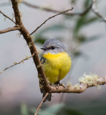 Eastern Yellow Robin, New England National Park
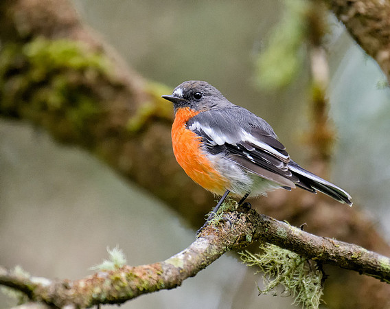 Flame Robin, New England National Park
We tried to drive to Gibraltar Range National Park again as everywhere seemed dry away from the camp. It was supposed to be 2wd, but turned out to be not much more than a rough track. I gave up when we encountered a pothole full of water across the whole track that looked like it might be too much for the Camry.
We headed for Armidale and another cabin, intending to head for Dangars Gorge tomorrow.
]]>We had the campground to ourselves last night but a couple of other campers arrived today.
We had planned to travel on to Guy Fawkes River National Park but were late leaving and decided to stop at a caravan park for washing, recharging batteries and re-setting up my phone.
The phone seems to have reset itself. I had turned it off to save the battery as there was no signal, and had put in the cupholder on my chair. After a while I noticed that the screen was on even though I had turned it off. When I picked it up, the text was in Chinese. I managed to set it back to English but all my apps had gone. I can only guess that the sides of the cupholder had managed to press the right combination of power and volume buttons to reset it.
While packing up we had a couple of the largest flies I have ever seen buzzing around.
We stopped at the Mann River Caravan Park because the river looked interesting. It's really hot now we are down from the mountains, so decided to get an air-conditioned cabin.
We'll be doing some washing tomorrow and leaving on Sunday. The phone is mostly set up now - I'm just missing some contacts.
]]>We arrived at the Boundary Falls campground in Gibraltar Range National Park yesterday, set up camp and had a look at the falls.
I saw a pair of Lyrebirds this morning on the path to Boundary Falls.
We walked to Lyrebird Falls this morning. Nice view but you don't have a close view of the falls. After the walk, we went back to Boundary Falls for a swim. The water was cold but not take-your-breath-away cold. Very refreshing.
After lunch we checked out some lookouts, picnic areas and went for another walk.
Here we are relaxing back at the camp.
I may post more when access and batteries permit.
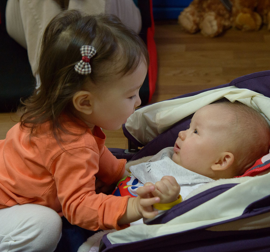
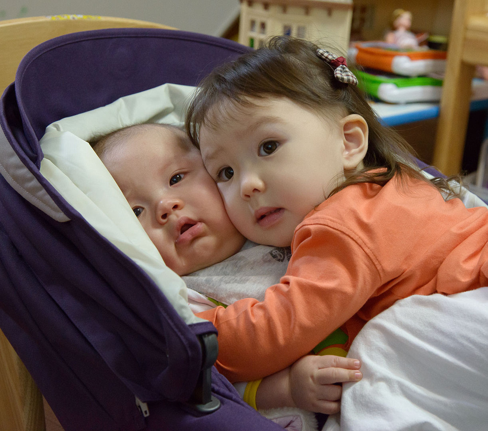
]]>Drew and Mia got on well most of the time.
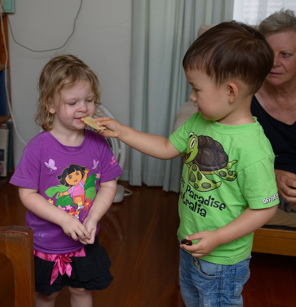 Drew Sharing Food with Mia
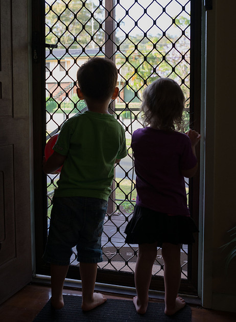 Drew and Mia
 Drew and Mia
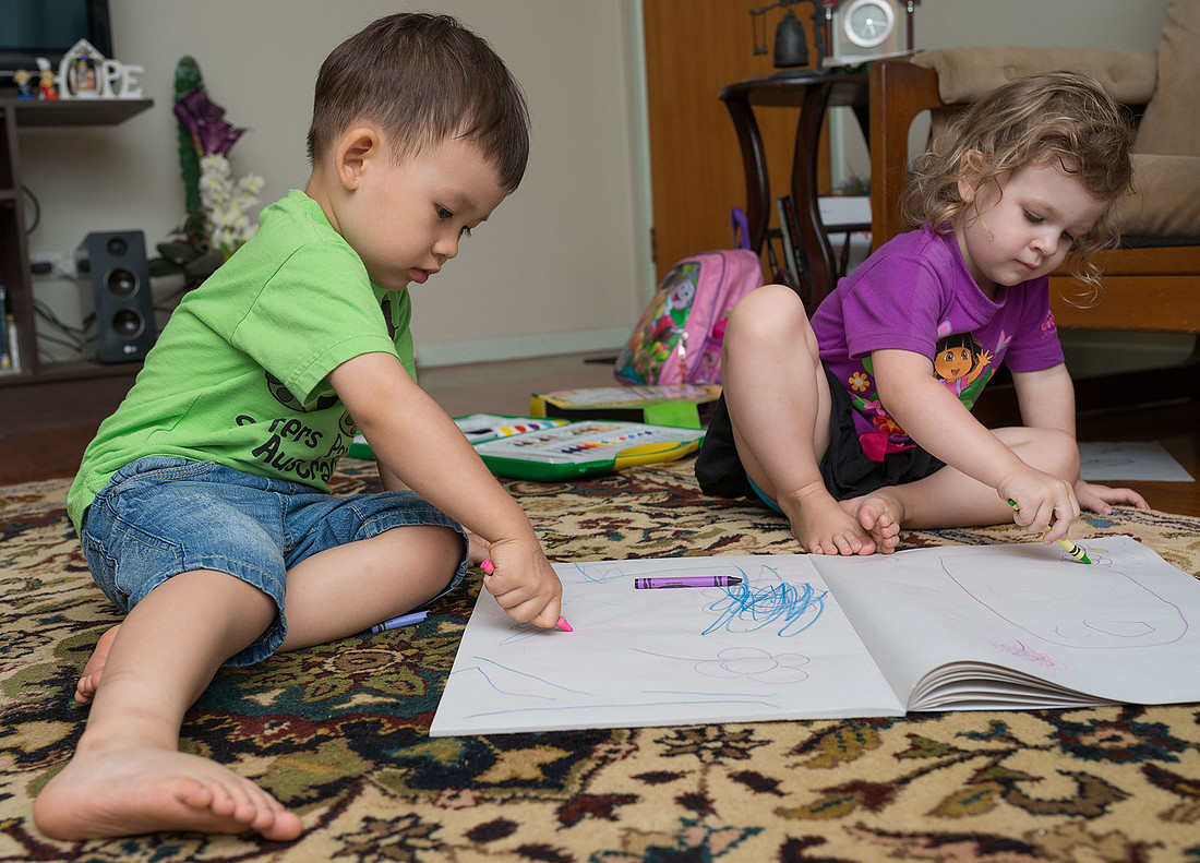 Drew and Mia Drawing
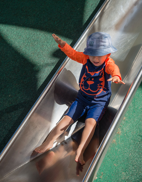
Drew loved the beach and the playground at Broadbeach.
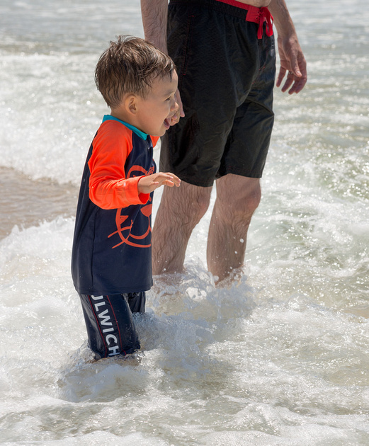 Drew at Broadbeach
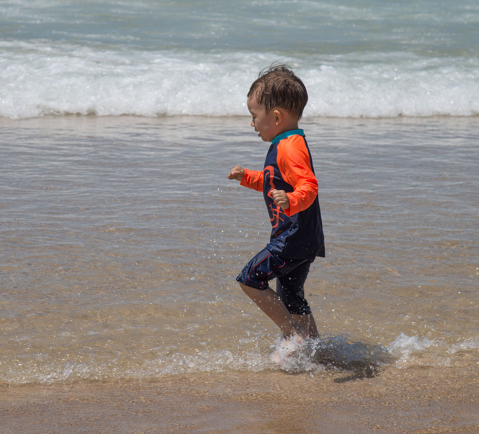 Drew at Broadbeach
Among many other activities, he also went swimming in Tamborine Creek,
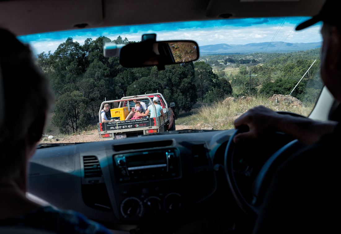
went for a ride in the back of a ute
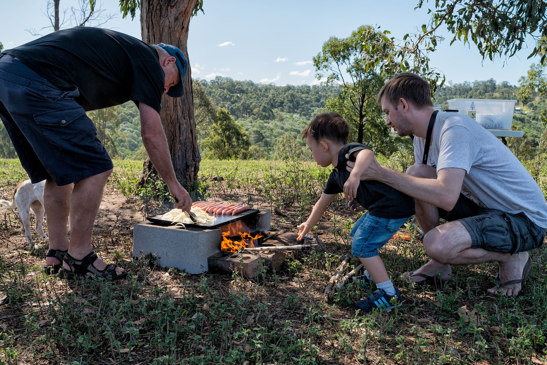
to an Aussie barbecue in the bush
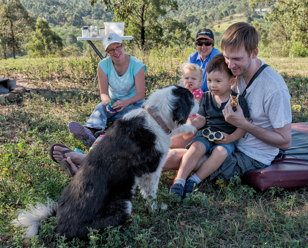
met some friendly dogs,
used a real saw without cutting himself,
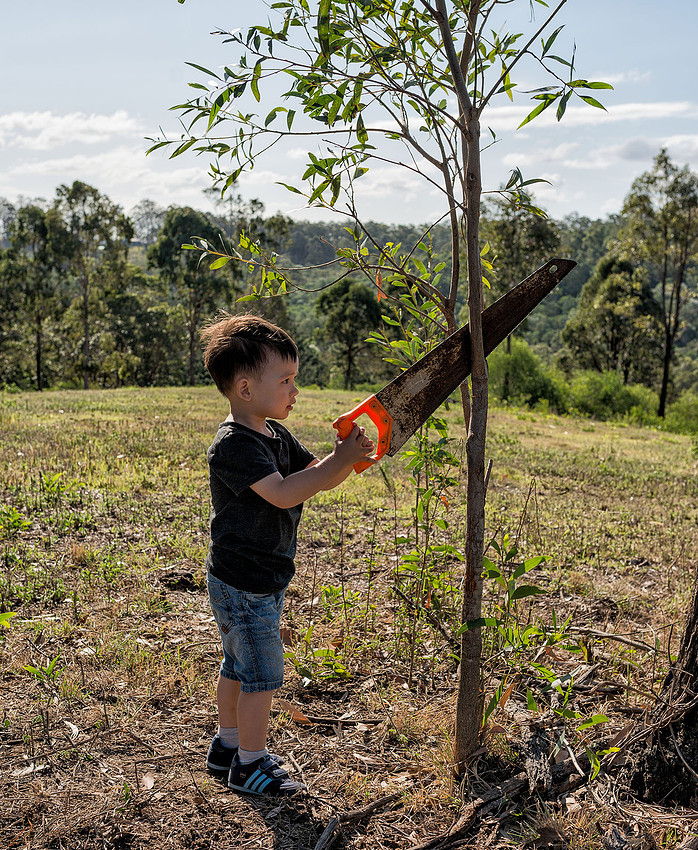 Drew using a real saw at Swattons
fed some cattle,
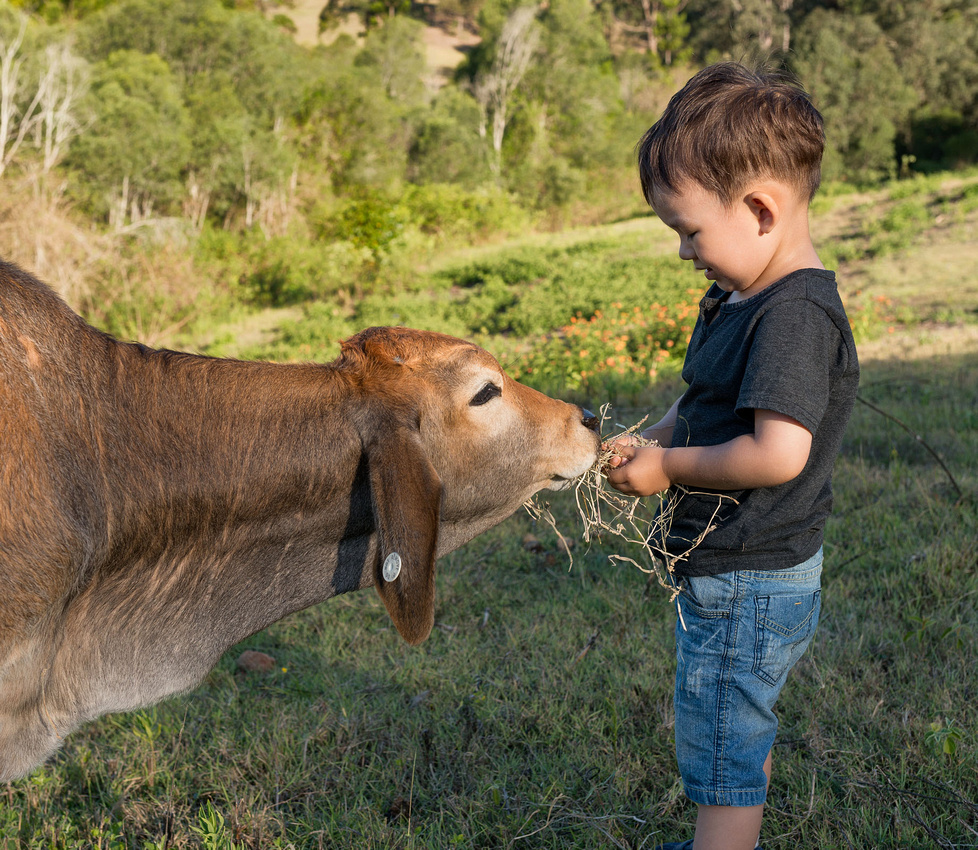 Drew Feeding the Cattleat Jake and Katie Swatton's
nursed a chicken,
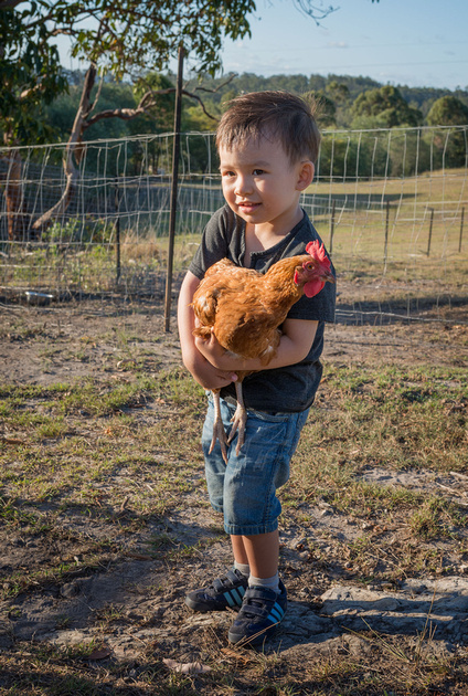 Drew Holding a Chickenat Jake and Katie Swatton's
and played on a trampoline.
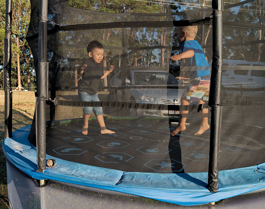 Drew and Joey on the Trampolineat Jake and Katie Swattons
More photos in the gallery.
]]>
This is a bit late but we have been rather busy for the last week or so.
We decided to drive home via Blackwater and Biloela instead of the shorter route retracing our steps.
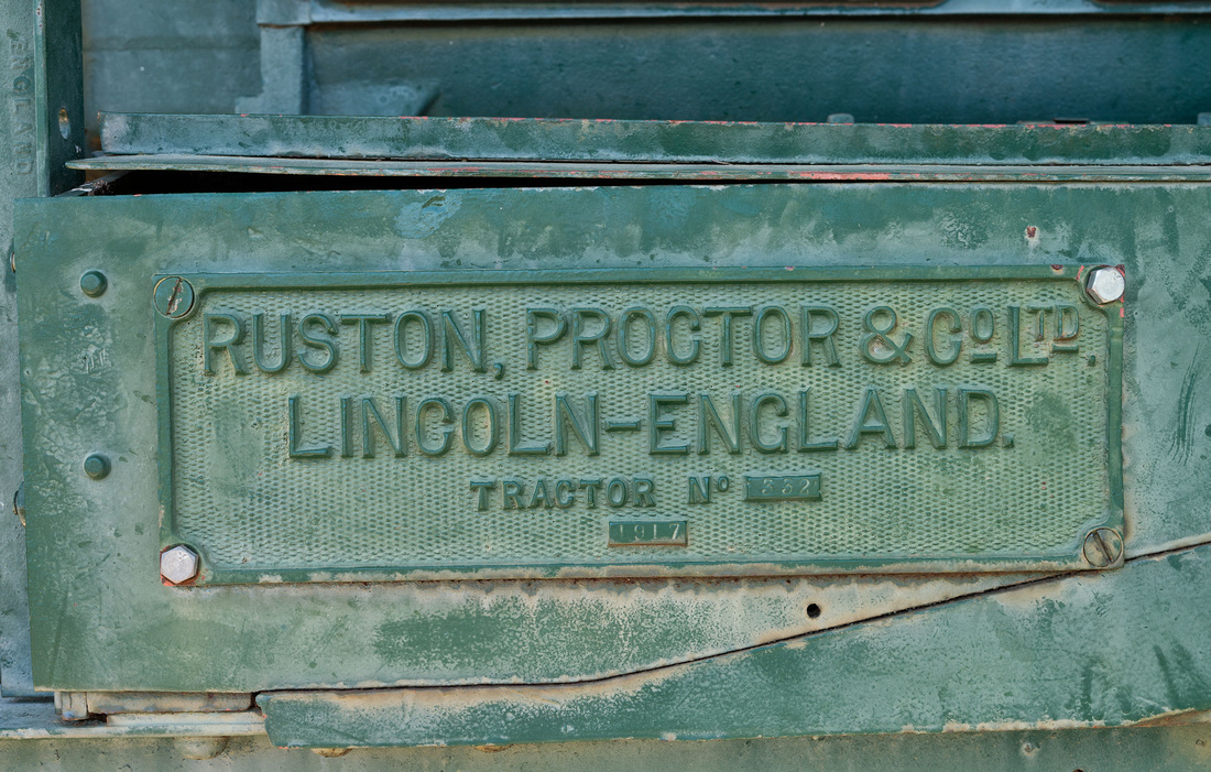
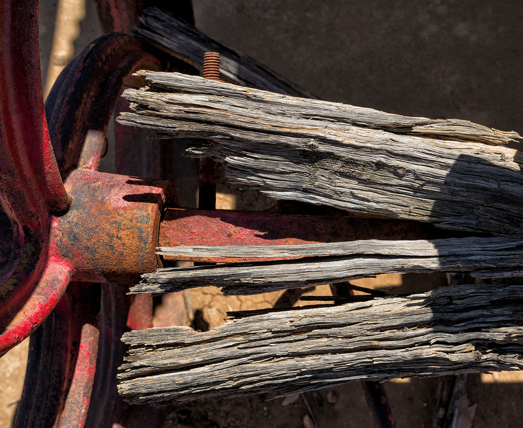
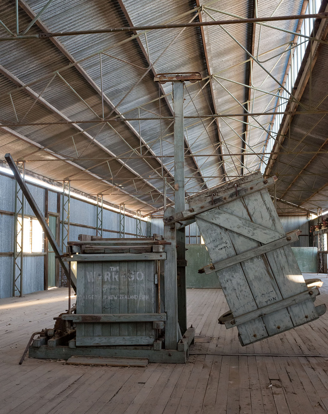
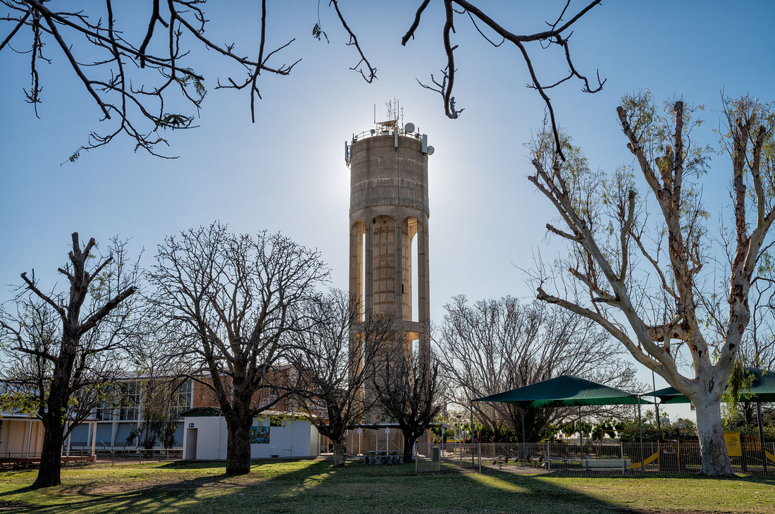
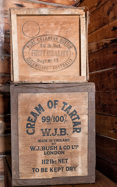
I couldn't resist the machinery on display at Ilfracombe even though we didn't have time to see it all. A large number of machinery is displayed alongside the highway. The 1917 Ruston crawler was interesting.
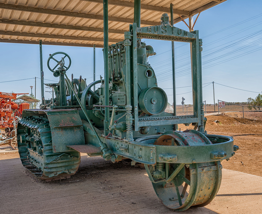 1917 Ruston Kerosene TractorIlfracombe Museum
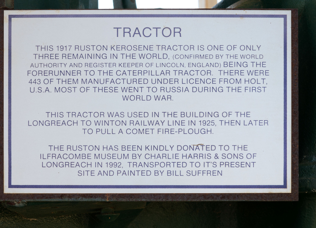 Description of 1917 Ruston TractorIlfracombe Museum
 1917 Ruston Kerosene TractorIlfracombe Museum
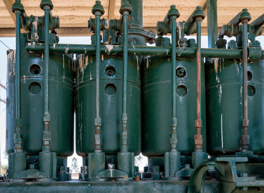 1917 Ruston Kerosene Tractor CylindersIlfracombe Museum
The drive appears to be by this massive chain.
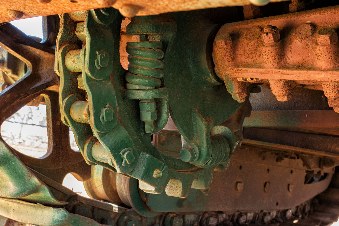 1917 Ruston Kerosene TractorIlfracombe Museum
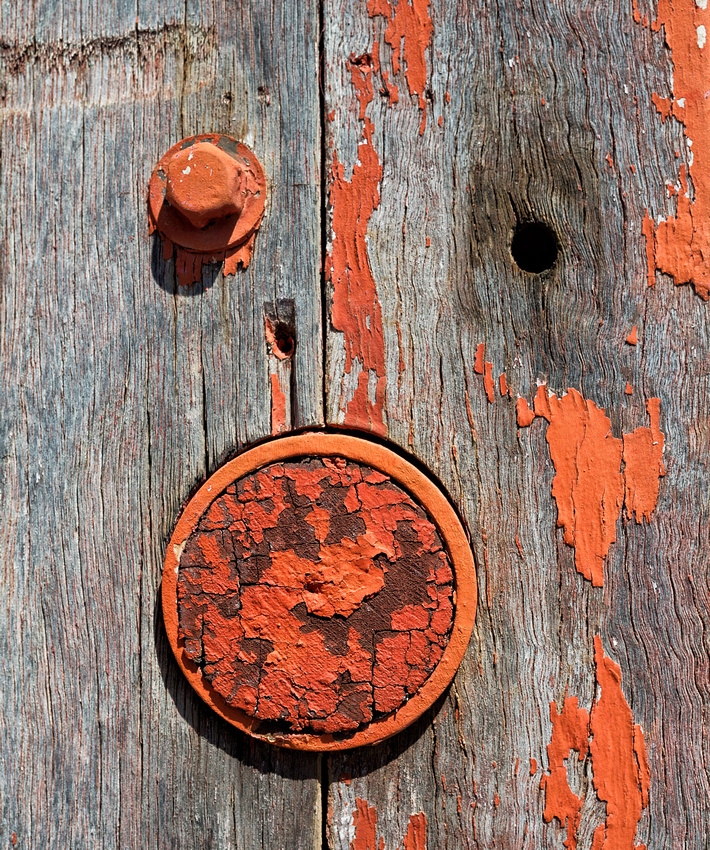
Details of a Southern Cross Boring Rig.
 Weatherd Timber and axleIlfracombe Museum
 Detail of Southern Cross Boring rigIlfracombe Museum
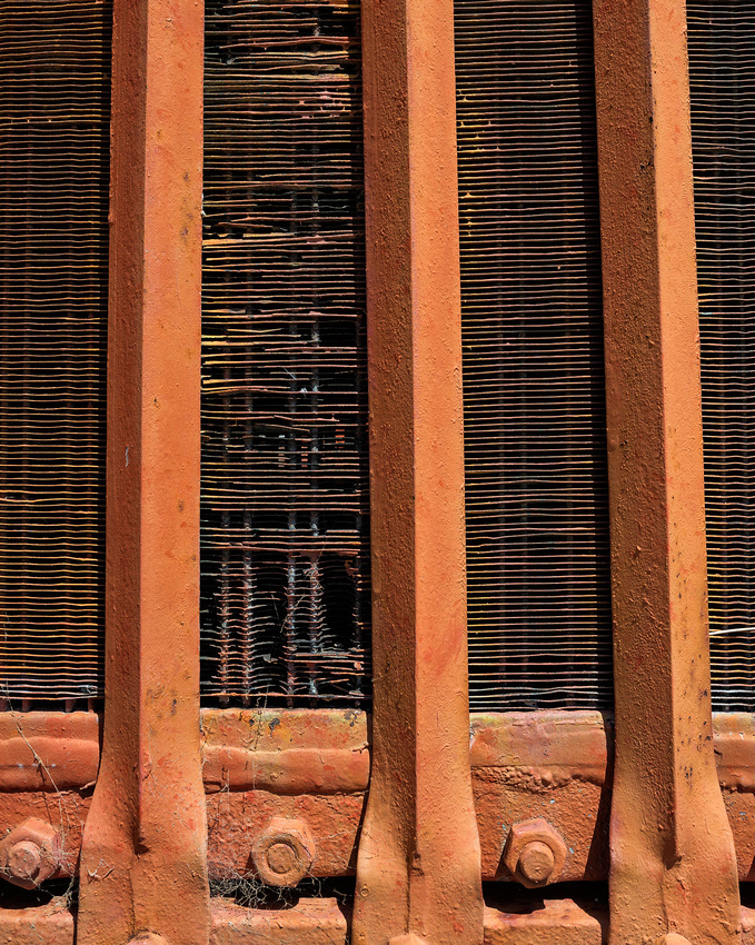 Detail of Southern Cross Boring rigIlfracombe Museum
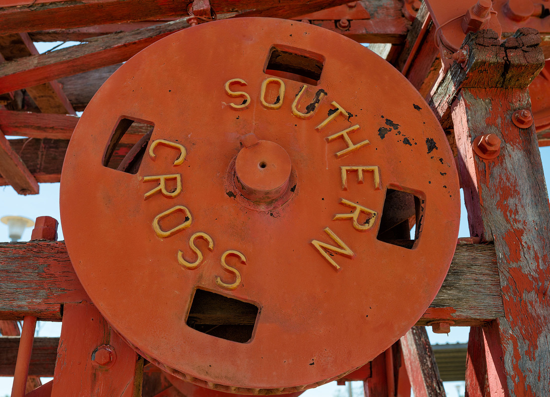 Detail of Southern Cross Boring rigIlfracombe Museum
A Furphy Water Cart that includes sentences in Pitman's shorthand.
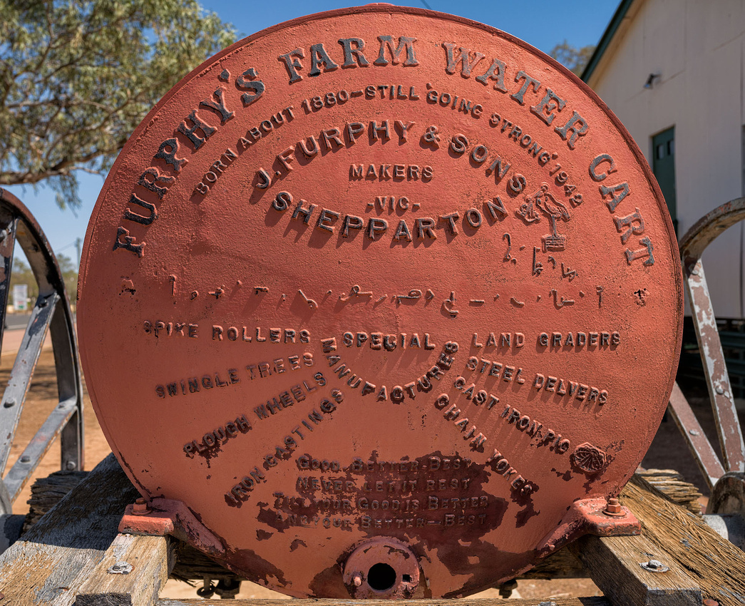 Furphy Water CartIlfracombe Museum. Note shorthand in centre.
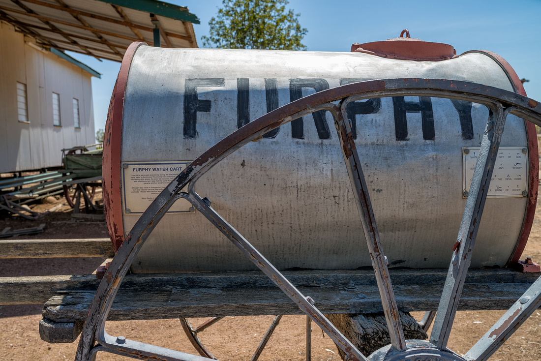 Furphy Water CartIlfracombe Museum
Signs from the water cart. The lower one is the decoded shorthand.
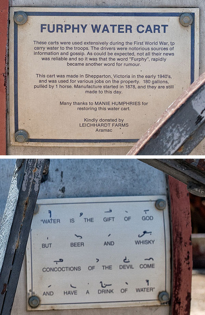 Signs on Furphy Water CartIlfracombe Museum
I think Bev was pleased to get away from here. We stayed the night at a motel in Blackwater and this was the only night we didn't sleep in the tent.
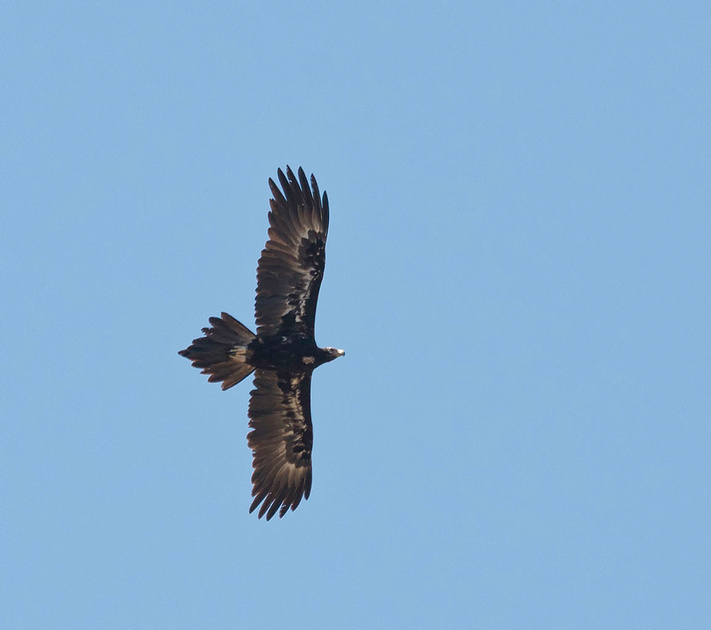
We didn't see a single wedge-tailed eagle on the trip until just past Monto when we saw one standing at a road-kill as we drove past. There were two of them but this was the only half-decent photo I managed to get.
]]>
We weren't sure whether it would be worth the 110 km each way drive to see the Lark Quarry dinosaur footprints but in the end we decided to do the drive. It was worth it for the landscape alone. This is the view from the car park back along the approach road.
While the footprints and the guide's description were interesting, I thought the lighting could have been better as it was placed low so the shadows would bring out the footprints but it was quite dim.
After the tour we tried the short Spinifex Walk (in the midday sun) which takes you to the top of a hill behind the building.
 Spinifex Walk, Lark Quarry
 Spinifex Walk, Lark Quarry
 Spinifex Walk, Lark Quarry
 Spinifex Walk, Lark Quarry
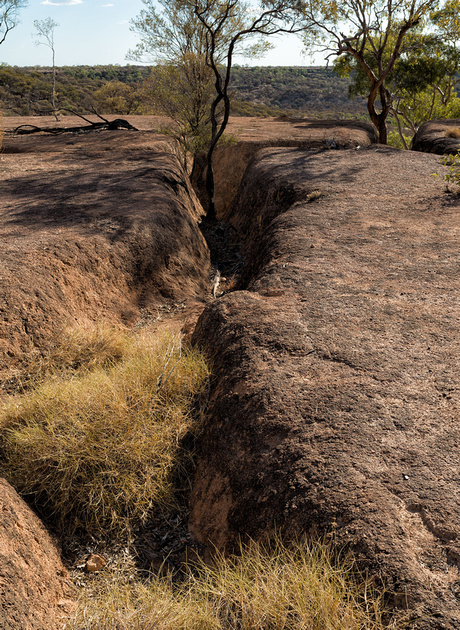
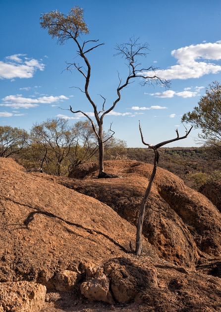
On the way back we took a short detour to the Nareen jump-up where the plain drops 60 metres or so. You are driving along on a typical flat plain when the plain suddenly drops and continues at a lower level. Here is the view looking South-West - what appears to be a ridge in the middle distance is the edge of the same plain I am standing on.
And here is the view from close to the same spot looking back along the road to the east.

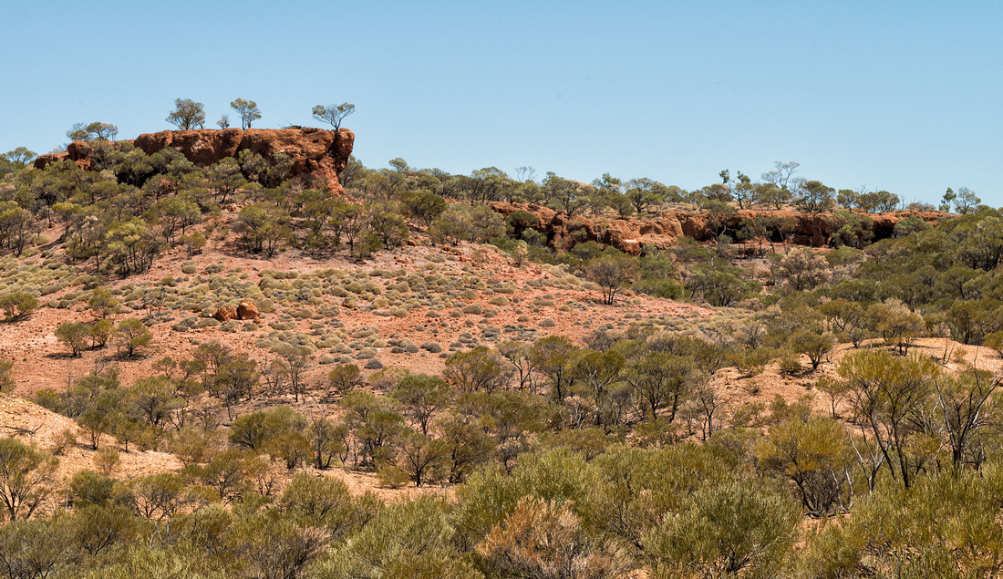
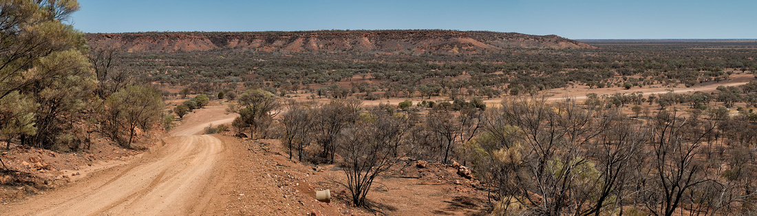
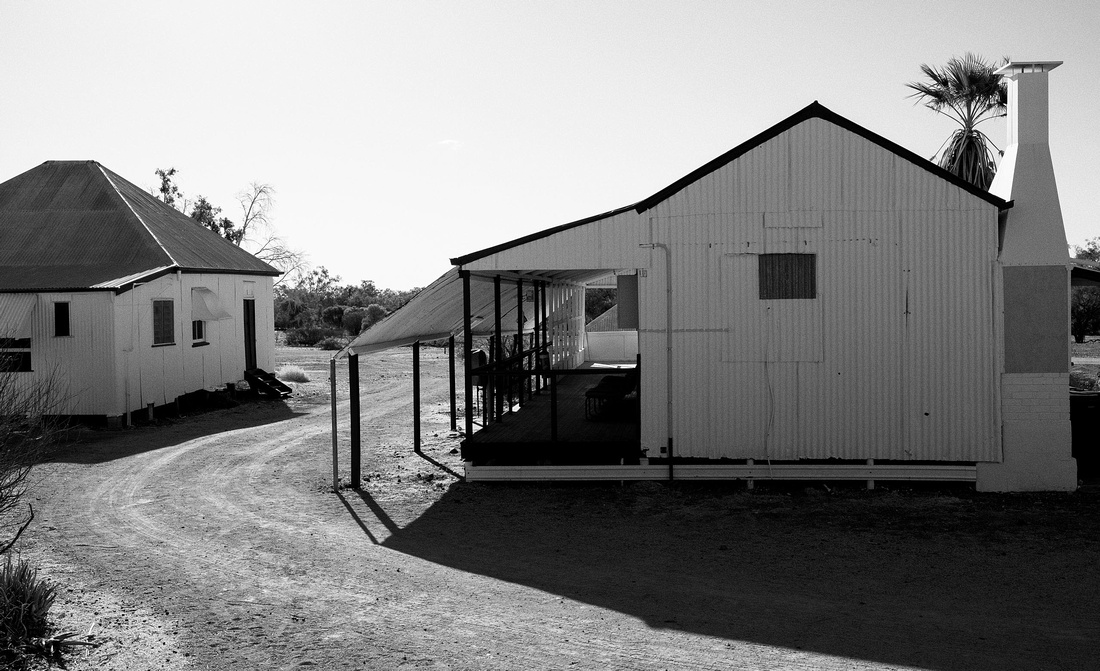
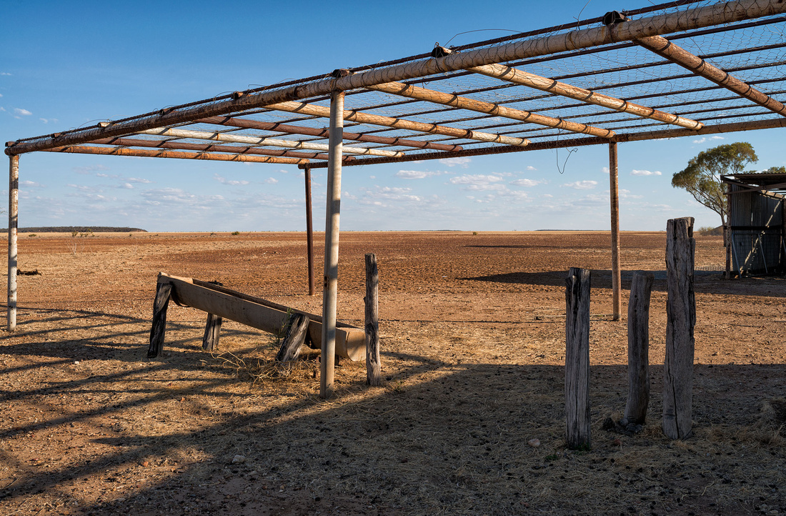
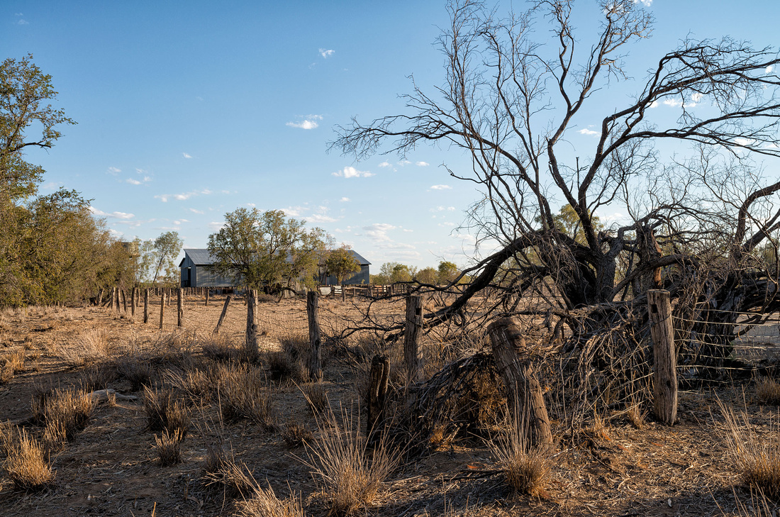
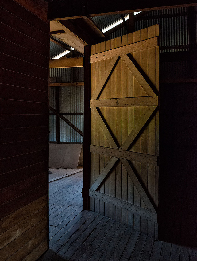
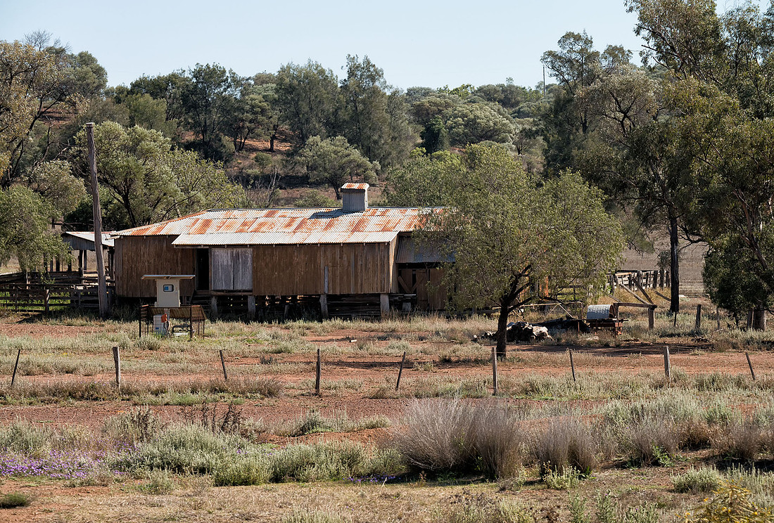
Later in the afternoon we returned to Bladensberg National Park to have a look at the homestead and shearing shed. This was a grazing property before being acquired as a national park.
 Bladensberg National Park Homestead
 Bladensberg National Park Homestead
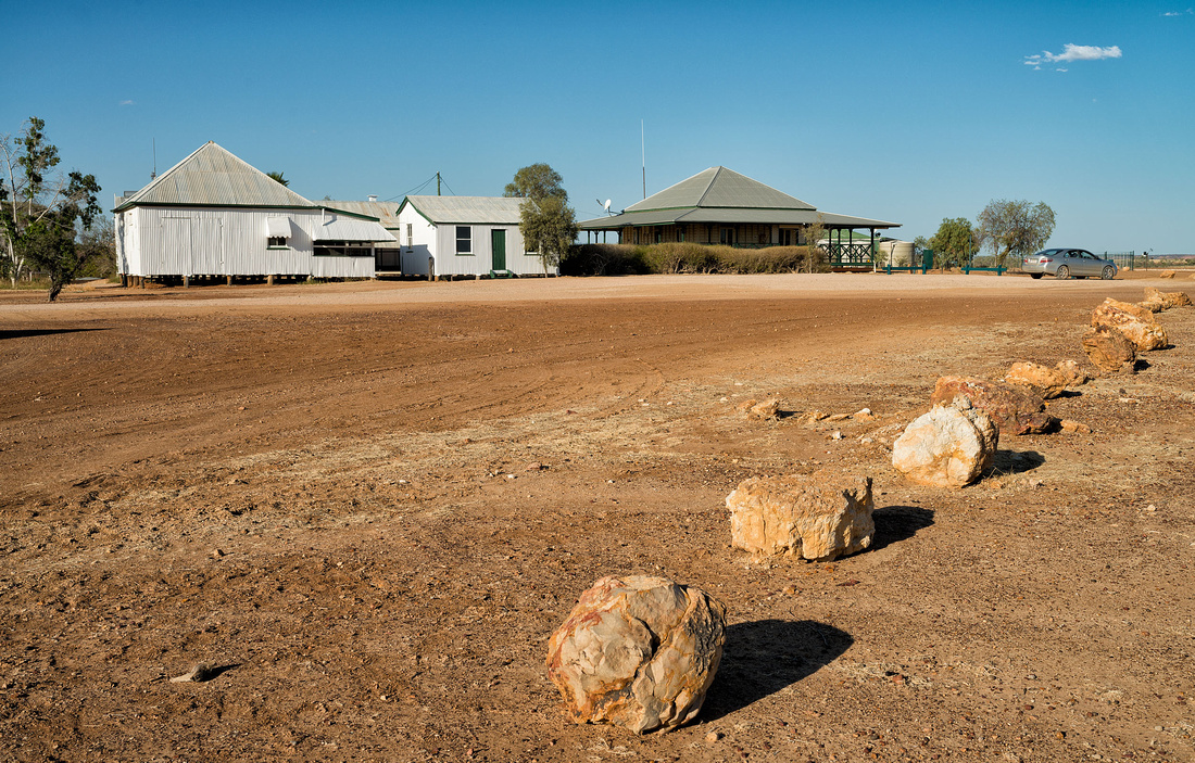 Bladensberg National Park Homestead
 Bladensberg National Park
 Bladensberg National Park Homestead
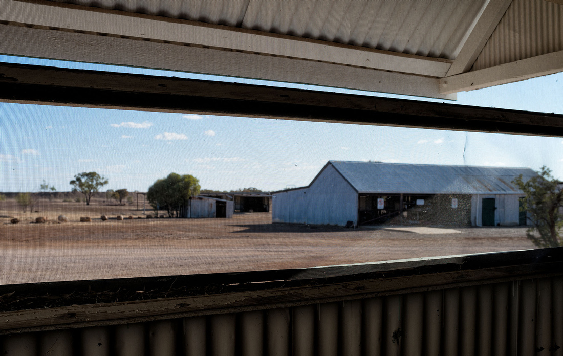
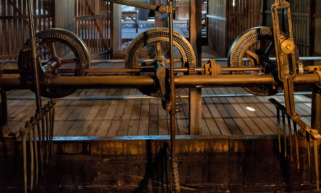
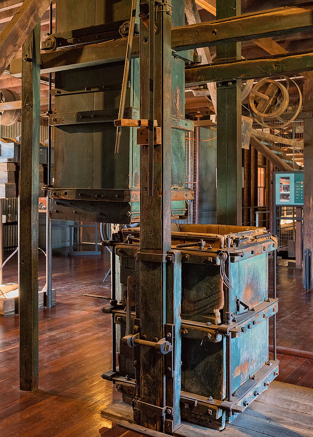
The shearing shed is a short drive from the homestead.
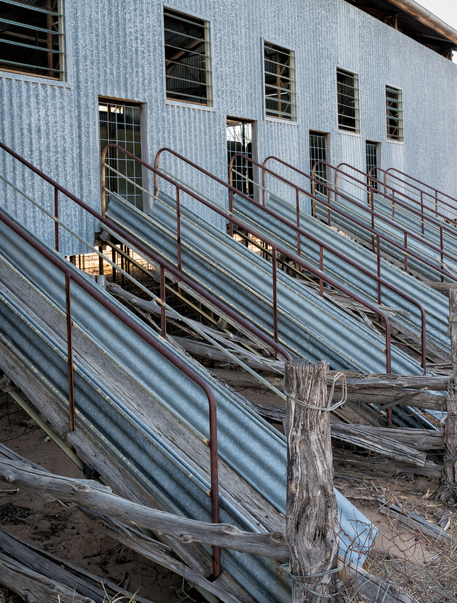 Shearing Shed, Bladensberg National Park, Winton
 Shearing Shed, Bladensberg National Park, Winton
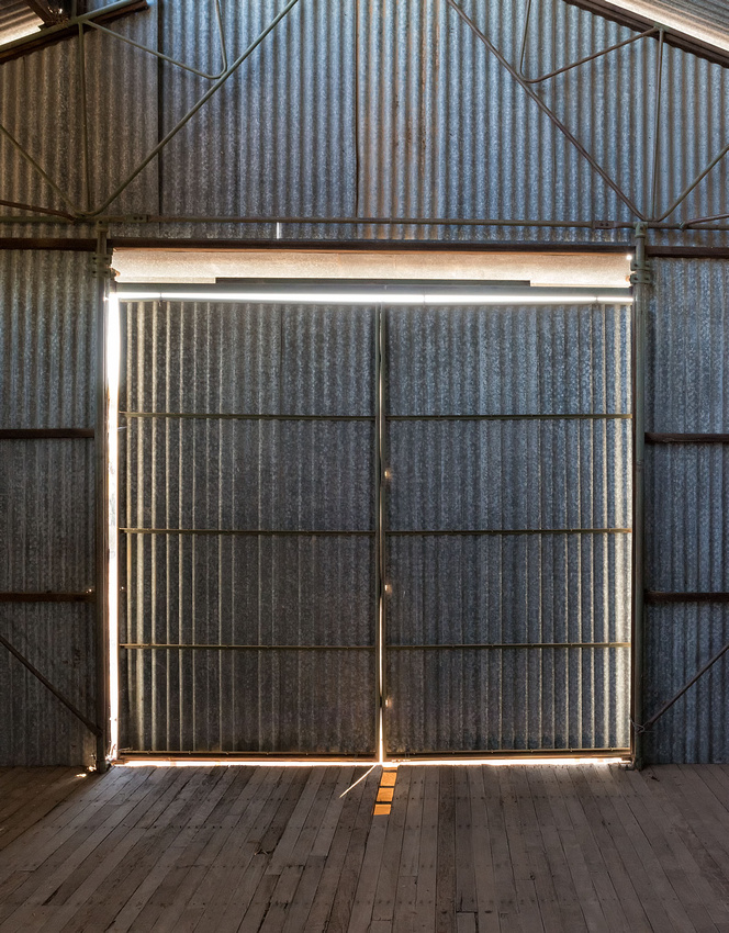 Shearing Shed, Bladensberg National Park, Winton
 Old Sheep Pens, Bladensberg National Park
 Old Sheep Pens, Bladensberg National Park
 Old Sheep Pens, Bladensberg National Park
Tomorrow we start the trip home.
]]>A little bit of excitement for some of the campers when a couple of Brolgas visited the caravan park.
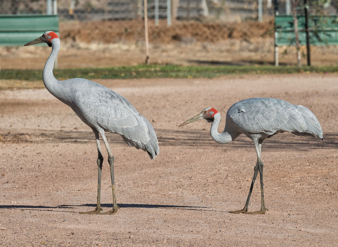 Brolgas visit the Caravan Park
The Age of Dinosaurs Museum is situated on the edge of a mesa a short distance from Winton. The location is spectacular and the main museum building blends with its location.
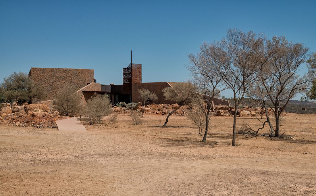 Age of Dinosaurs Museum, WintonSituated on a mesa near Winton, it blends into the landscape
The separate laboratory building is a short distance away, accessed by a path along the surprisingly flat mesa.
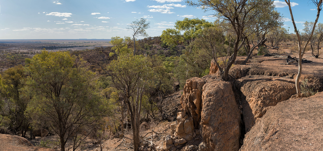 Landscape near the Age of Dinosaurs Museum, WintonSituated on a mesa near Winton
In the lab, volunteers work on the fossils.
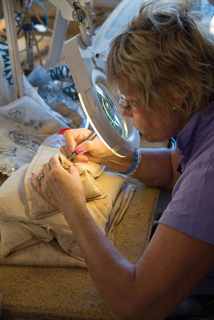 Volunteers working on Fossils, Age of Dinosaurs Museum, WintonSituated on a mesa near Winton
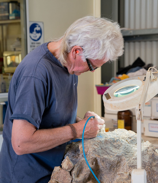 Volunteers working on Fossils, Age of Dinosaurs Museum, WintonSituated on a mesa near Winton
More views from around the museum.
 Landscape near the Age of Dinosaurs Museum, WintonSituated on a mesa near Winton
 Landscape near the Age of Dinosaurs Museum, WintonSituated on a mesa near Winton
 Landscape near the Age of Dinosaurs Museum, WintonSituated on a mesa near Winton
We tried a walk that went below the cliffs. The path wasn't all that well defined and we must have lost it at some point and the last part of the walk was a bit rough, but we made it back.
 Deep Gully Walk, Age of Dinosaurs Museum, WintonSituated on a mesa near Winton
 Deep Gully Walk, Age of Dinosaurs Museum, WintonSituated on a mesa near Winton
More photos in the gallery.
]]>
The pattern of the early morning sun on these tanks caught my eye while we were preparing to pack up at Longreach.
 Water Tanks, Tourist Park, Longreach
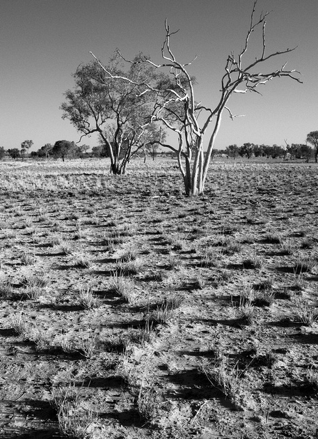
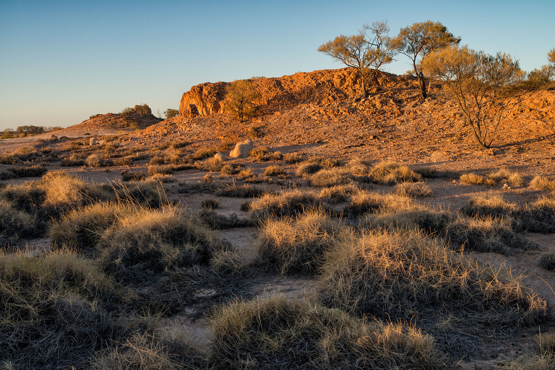
Very little grass is to be seen around Longreach and Winton. There is grass along the road, but the adjoining paddock is almost bare. This is on the highway between Longreach and Winton.
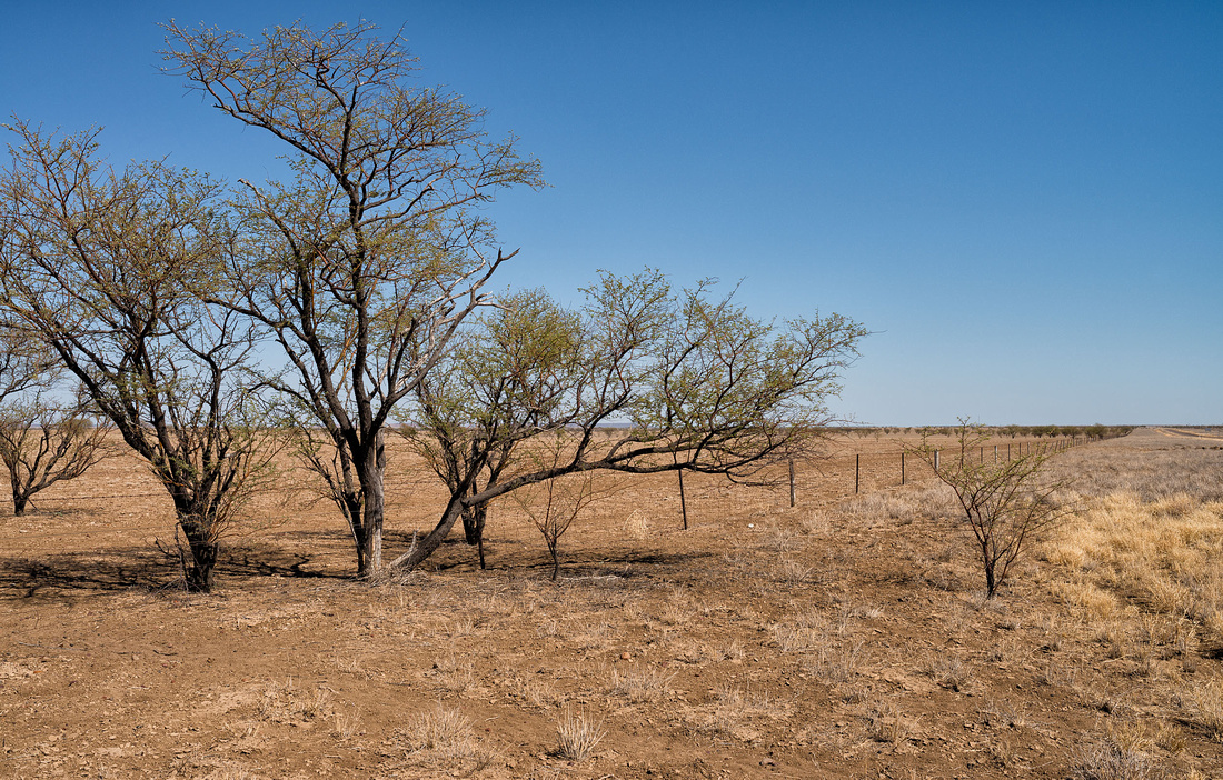 On the Longreach to Winton Road
I took this photo of Bev while we were waiting for our coffee to be served in the Winton Bakery.
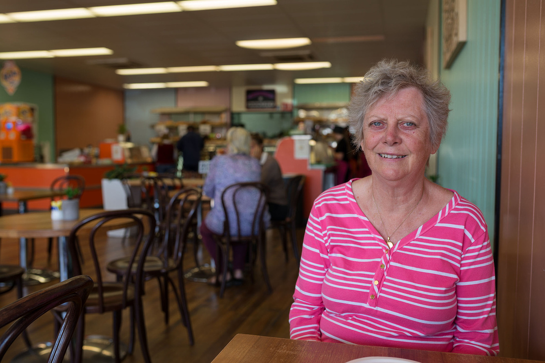 Waiting for coffee, Winton Bakery
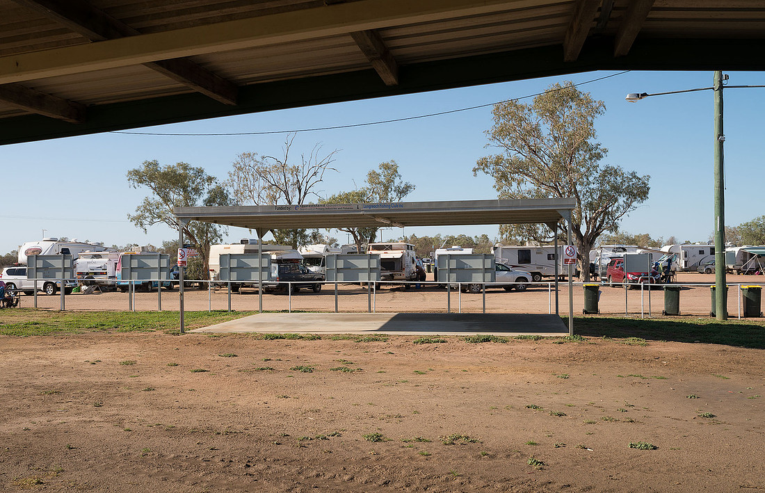
Unlike the Longreach Tourist Park, the Pelican Caravan Park had grass and shade-cloth.
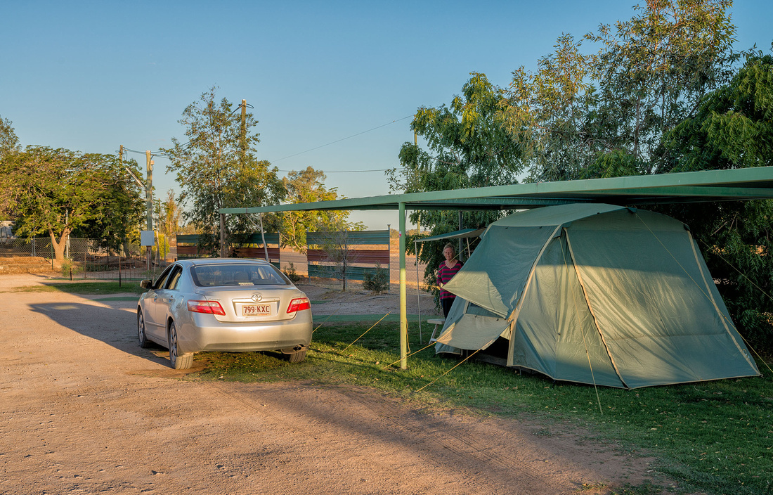 Camp site on grass and under shade cloth, Winton
After a quick look around town, we had a look at the nearby Bladensberg National Park and found it as dry as everywhere else. This is supposedly Mitchell Grass plains, but not much grass to be seen.
 Grassland with no grass, Bladensberg National Park, Winton
Although there were signs to points of interest, they didn't show distances, so we decided to get more information before going any further.
We relaxed at the camp site during the hottest part of the afternoon, then went to have a look at the long waterhole where a number of birds were drinking and feeding.
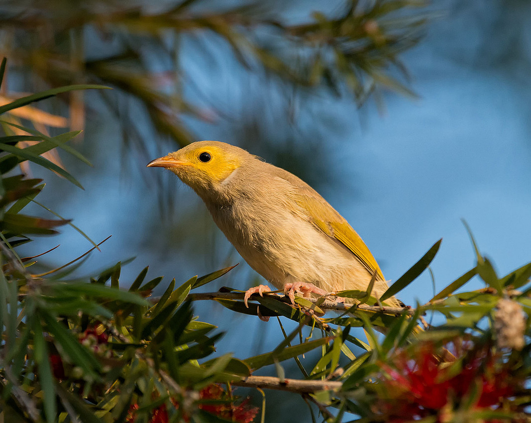
Whte-plumed Honeyeaters.
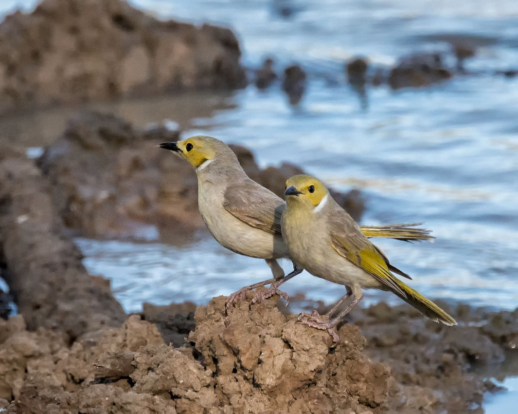 White-plumed Honeyeaters, Long Waterhole, Winton
Budgerigars
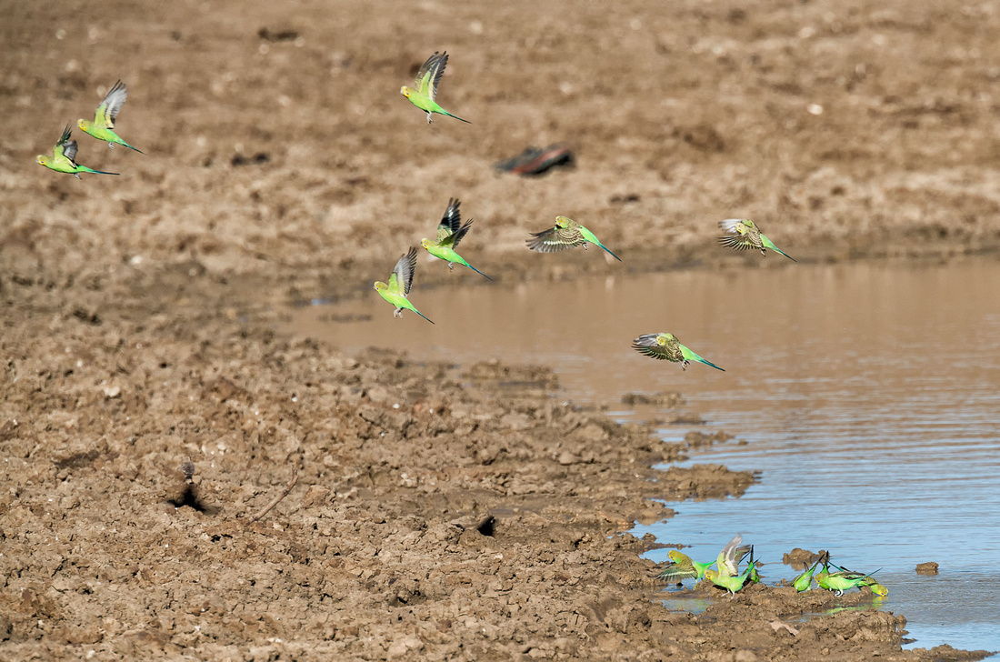 Budgerigars, Long Waterhole, Winton
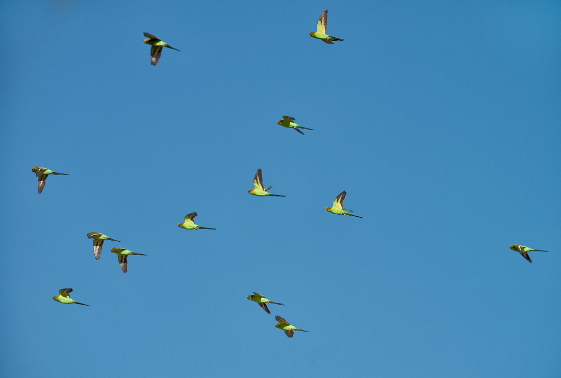 Budgerigars, Long Waterhole, Winton
Black-fronted Dotterel
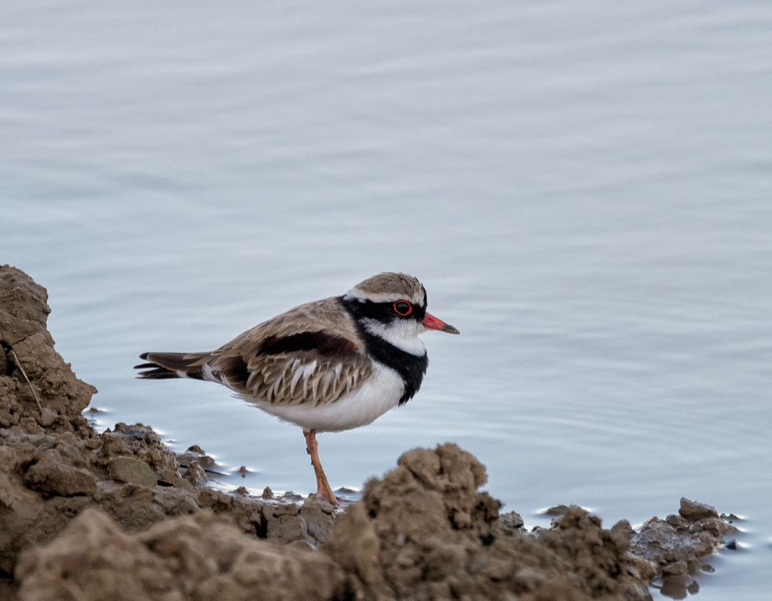 Black-fronted Dotterel, Long Waterhole, WintonElseyomis melanops
Prepared with a guide, we went back to the Bladensberg National Park. Everywhere is so dry.
 Mitchell Grass Plain, Bladensberg National Park, Winton
Engine Hole, Surprise Creek
 Engine Hole, Bladensberg National Park
 Engine Hole, Bladensberg National Park
On the Jump-up
 Spinifex on the Jump-up, Bladensberg National Park
 Spinifex on the Jump-up, Bladensberg National Park
Along Opalton Road.
 Spinifex in afternoon sun, Opalton Road, near Winton
Riverside Park on the Thomson River just outside of town was packed with caravans taking advantage of the free camping, but it did not look at all attractive with rows and rows of vans.
 Free Camping, Riverside Park, Longreach
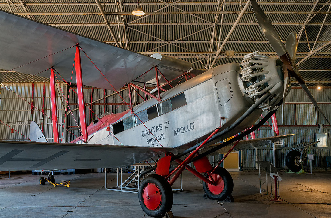
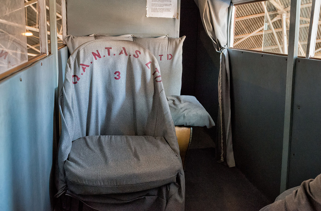
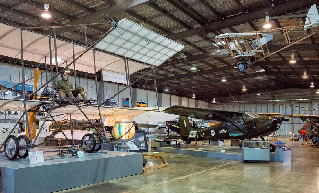
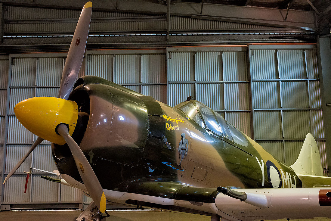
We used our pass to finish looking at the Qantas Founders Museum. They have a PBY Catalina that you can climb into.
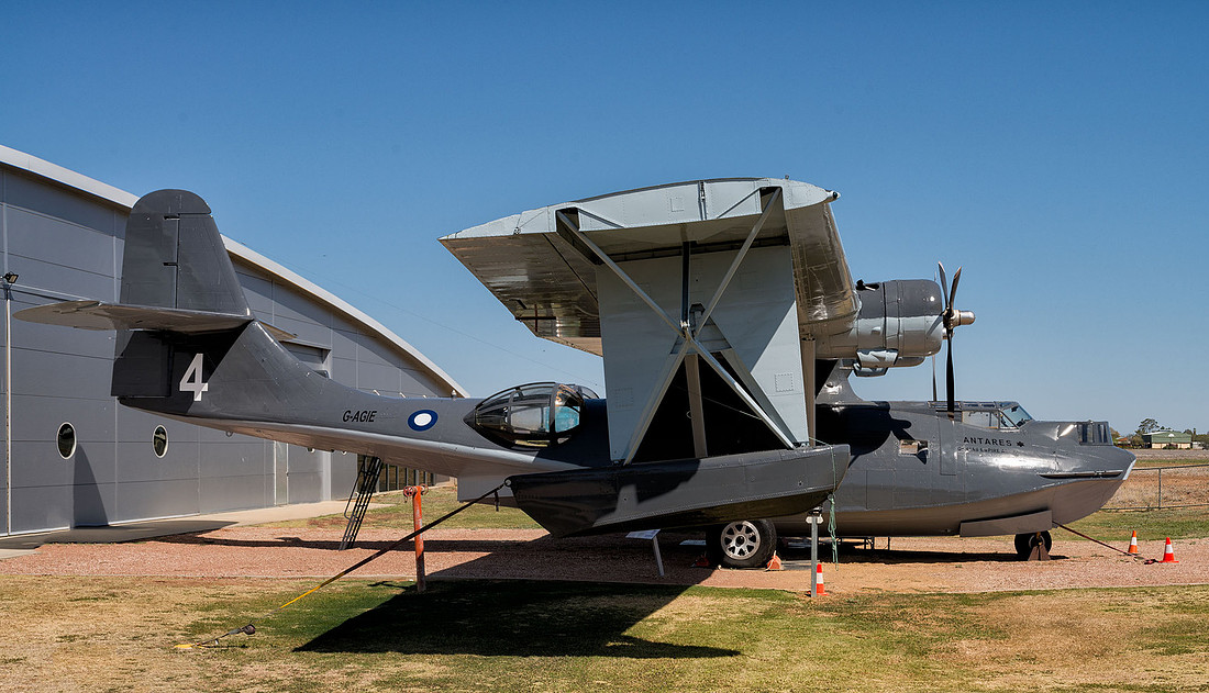 Catalina, Qantas Founders Museum
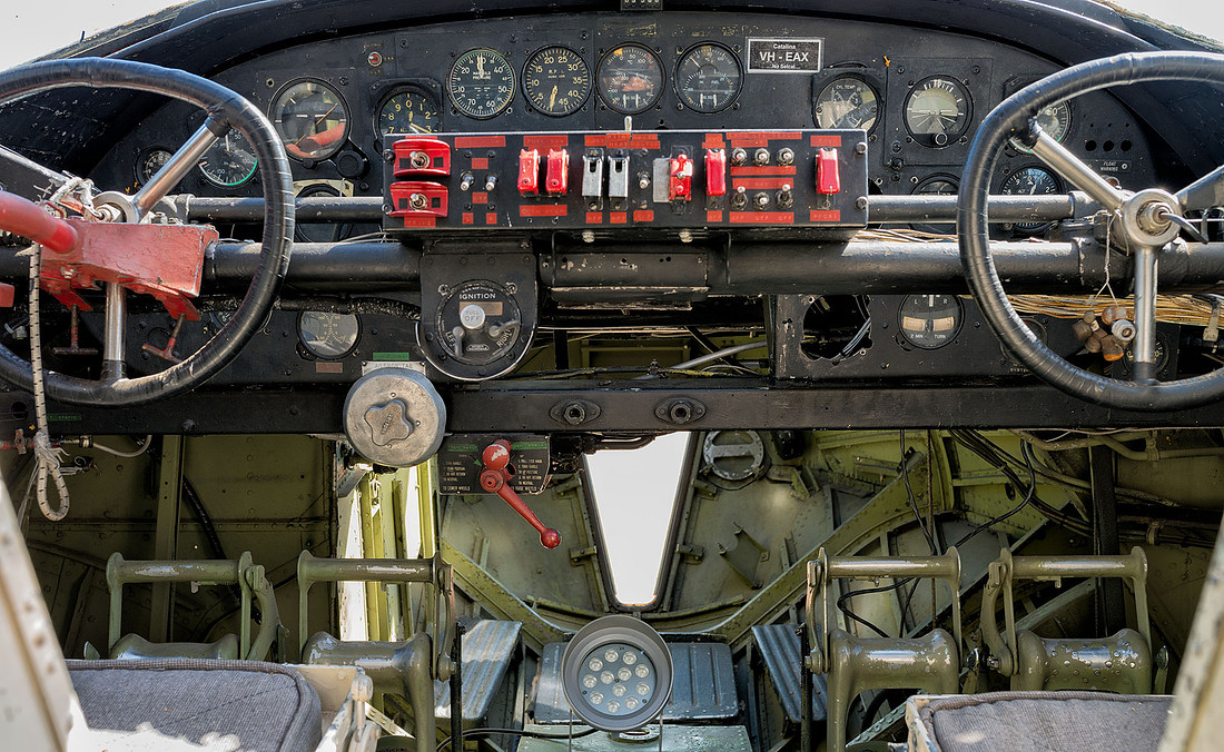 Catalina Cockpit
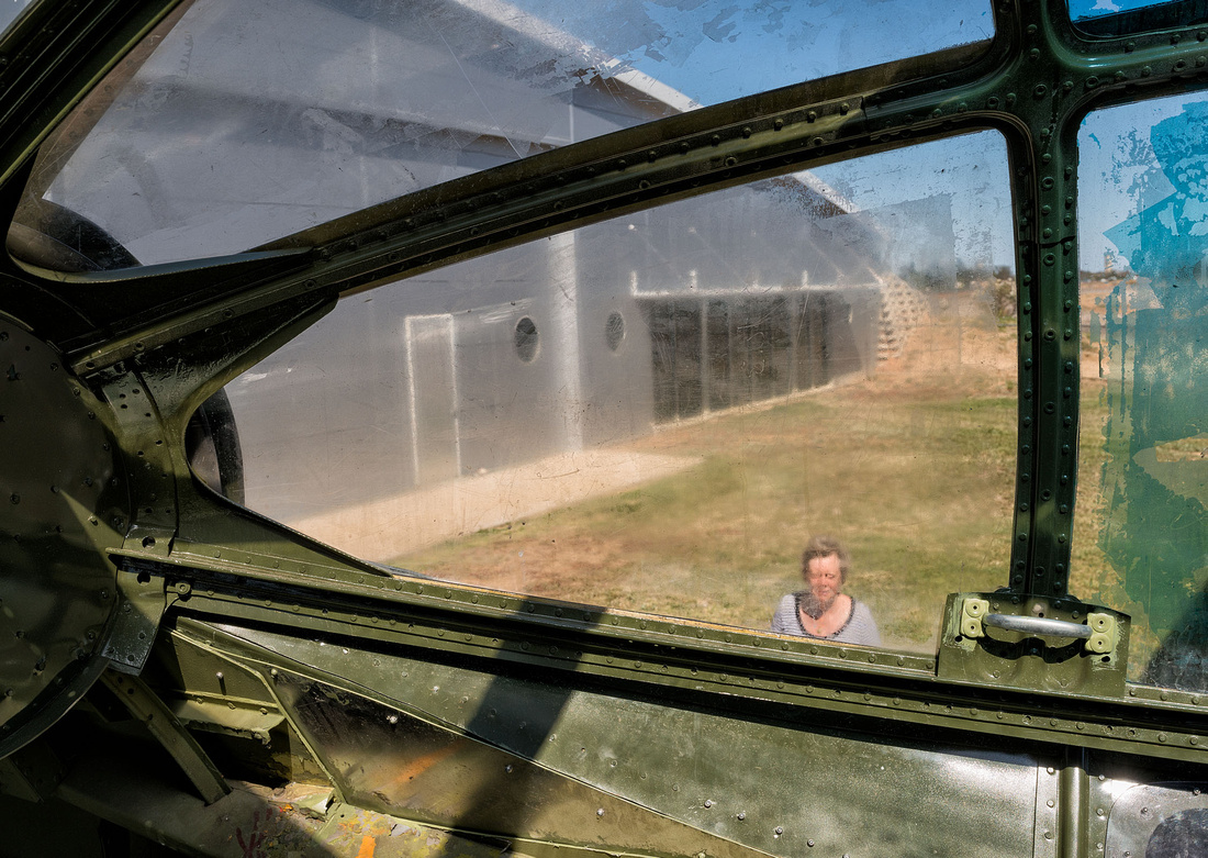 Catalina - view from the bubble
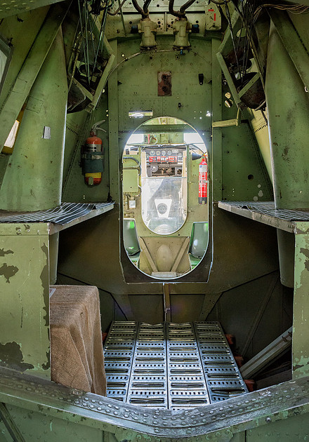 Catalina Interior
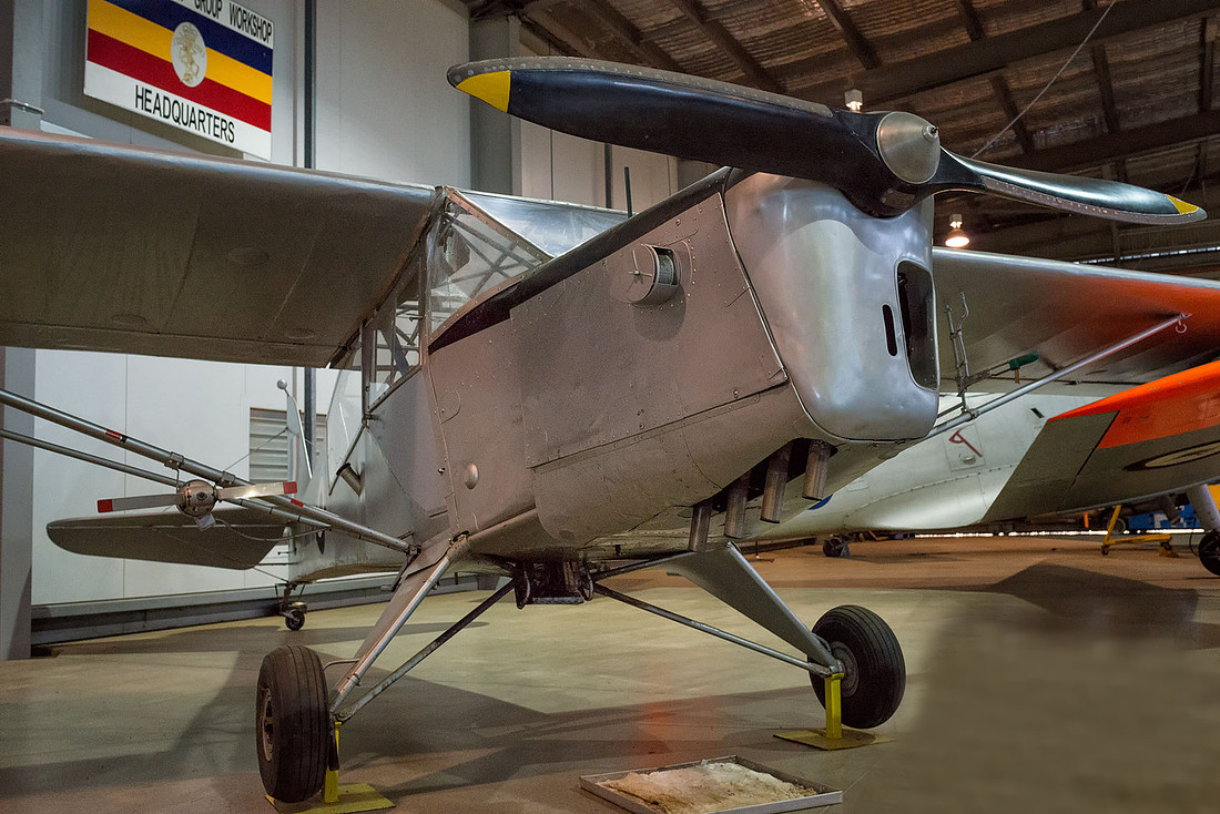
The De Havilland DH61 was one of the early Qantas passenger planes. The pilot sat in an open cockpit,
 De Havilland DH61.Early Qantas passenger aircraft
but the passengers had the luxury of an enclosed (tiny) cabin. I don't think I would have enjoyed travelling in this.
 Passenger cabin of DH61
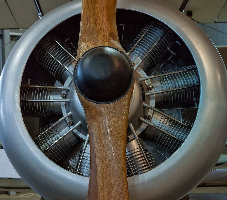
This is a cylinder of a radial engine.
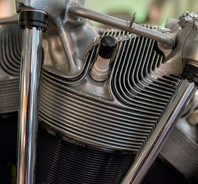 Radial Engine Cylinder, Qantas Founders Museum
We continued with the Stockman's Hall of Fame and decided to see the outback show, which I didn't find all that impressive. The Hall of Fame itself is excellent, but there is a lot to see and read.
 Stockman's Hall of Fame, Longreach
 Stockman's Hall of Fame, Longreach
 Stockman's Hall of Fame, Longreach
We will be heading for Winton tomorrow, so we have a look around the city centre, but there's not much happening on a Sunday afternoon.
]]>
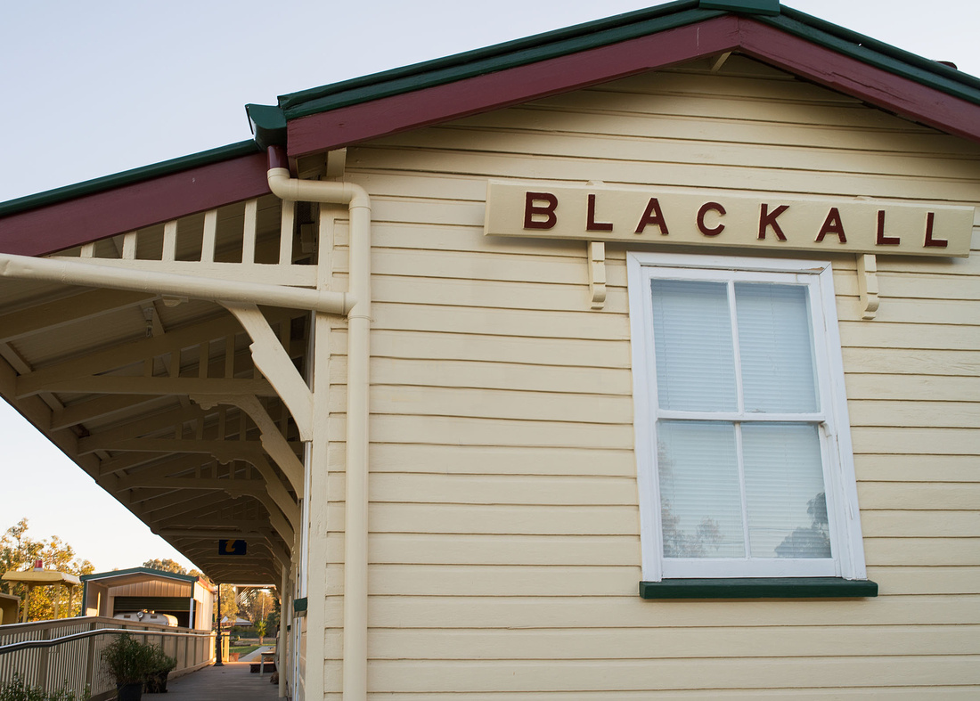
I left Bev sleeping in the tent and went out to take a few photos of Blackall before leaving for Longreach.
We had looked at the Barcoo River when we arrived and found it dry except for one small side channel. I had a closer look and found it was being fed from a bore. I couldn't easily cross it to the main river so left to check out some buildings instead.
 Bore Drain to Barcoo River, Blackall
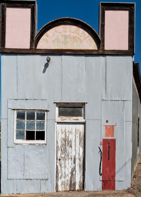
The next two of an abandoned garage.
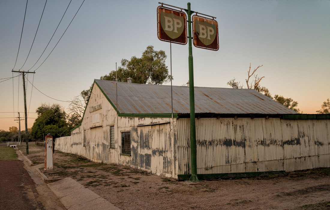
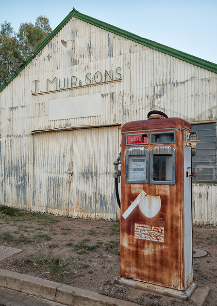
Then some old buildings in Ram park.
 Historical Building, Blackall
 Old Railway Station Building, Blackall
We managed to pack up and start on the drive to Longreach at a reasonable time.
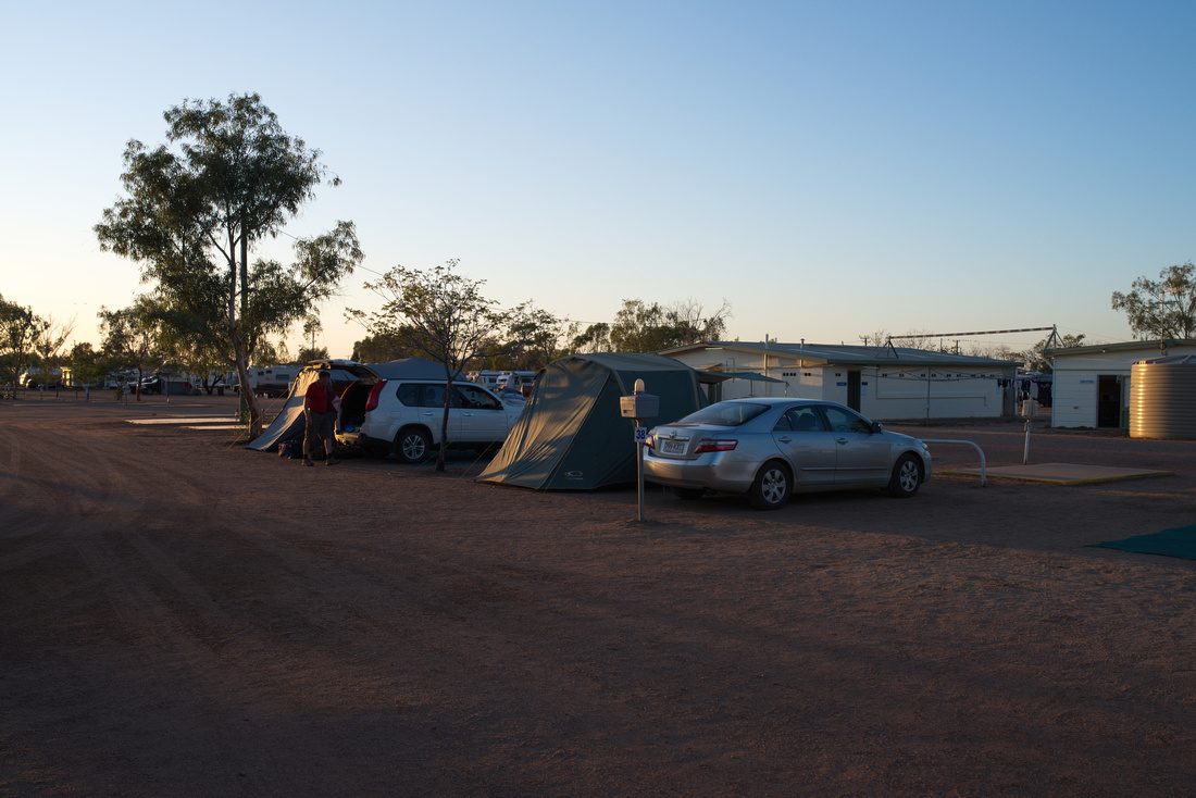
I wasn't too impressed with the caravan park we chose at Longreach; we had no shade (except first thing in the morning) and nothing to act as a wind-break. This photo was taken just after sunrise.
 Campsite - Longreach Tourist Park
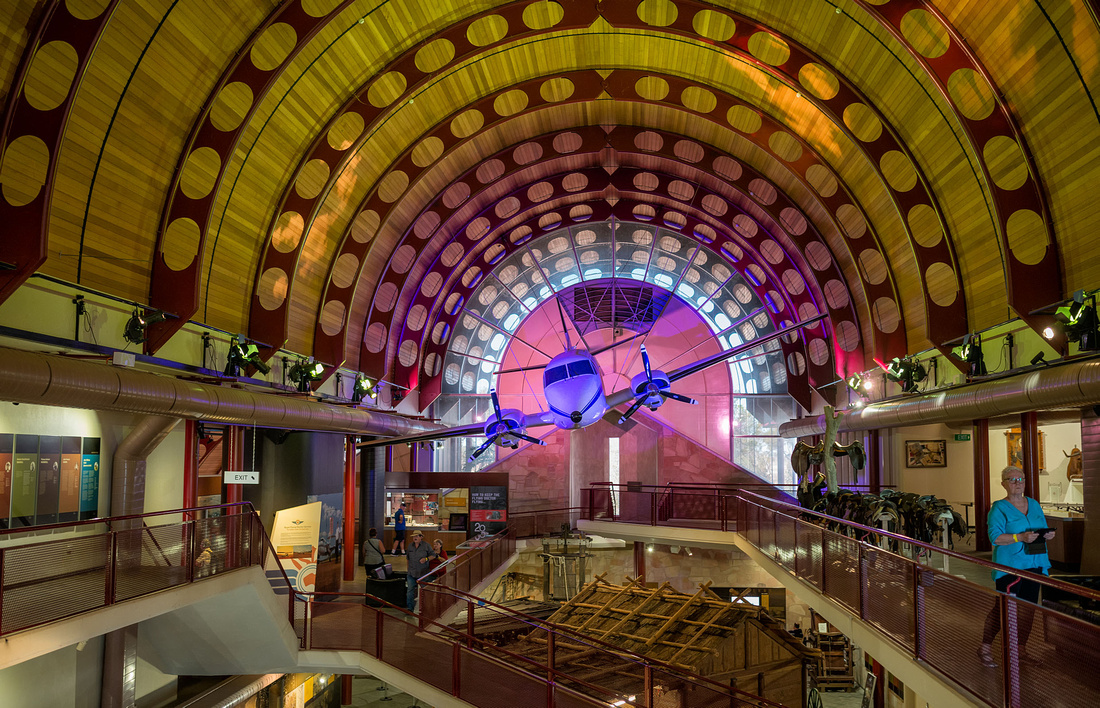
Once we had set up camp we visited the Qantas Founders Museum. We decided to try the 747 tour and only had time for a quick look in the museum before the tour started. The tour includes three planes: 747, 707 and DC3, although you don't get to go inside the DC3.
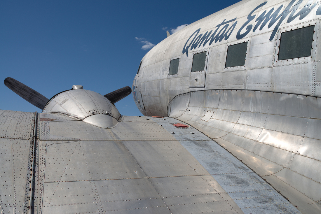 Douglas DC3, Qantas Founders MuseumActually C47 (Military Version)
The 747 is parked right beside the car park.
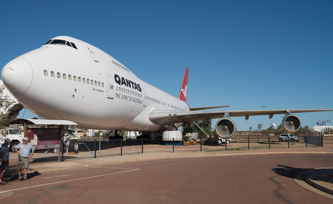 Boeing 747 at Qantas Founders Museum
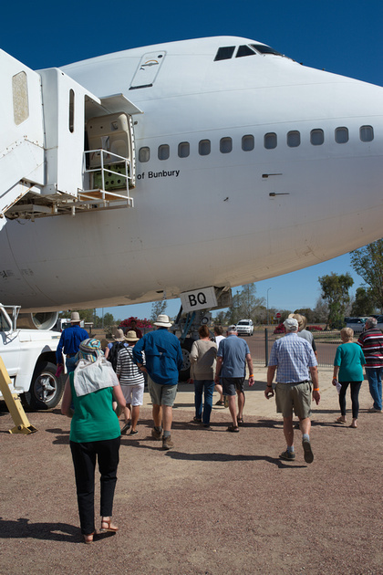 Boeing 747 Tour, Qantas Founders Museum, Longreach
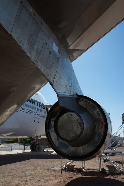 Boeing 747 Tour, Qantas Founders Museum, Longreach
Inside the 747.
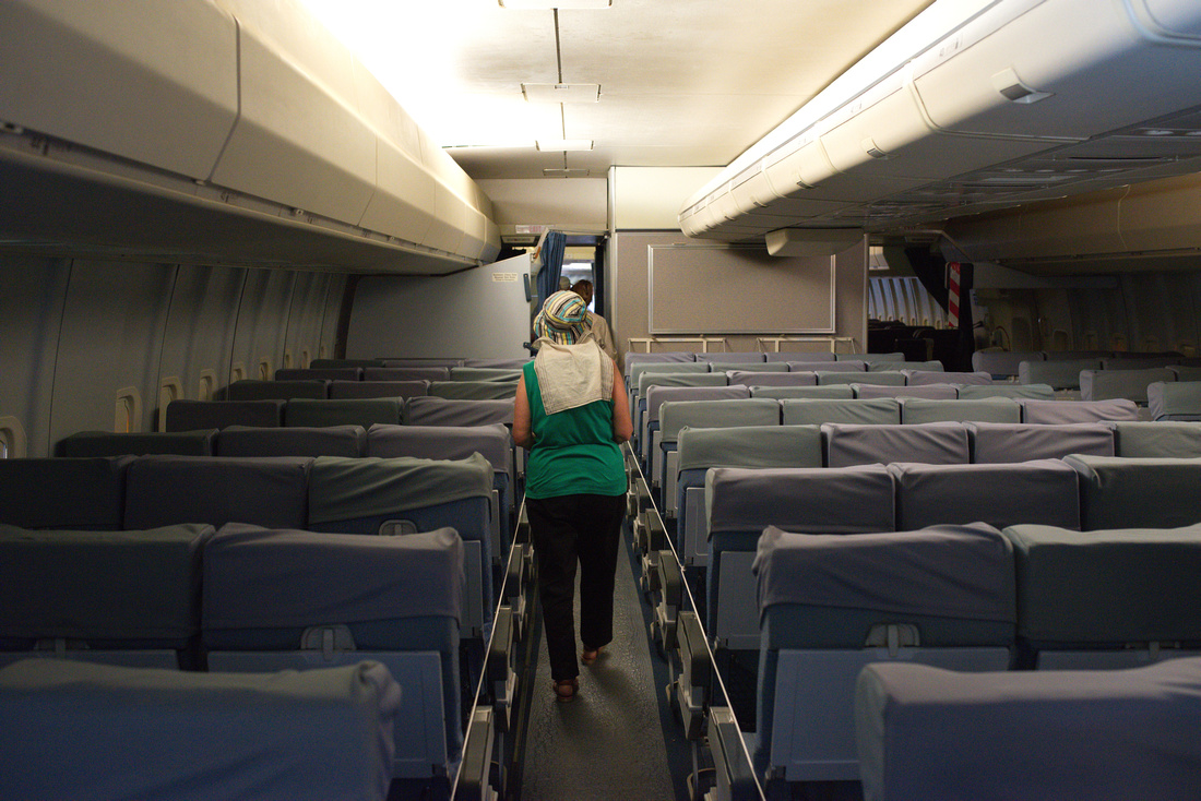 Boeing 747 Tour, Qantas Founders Museum, Longreach
747 Cockpit.
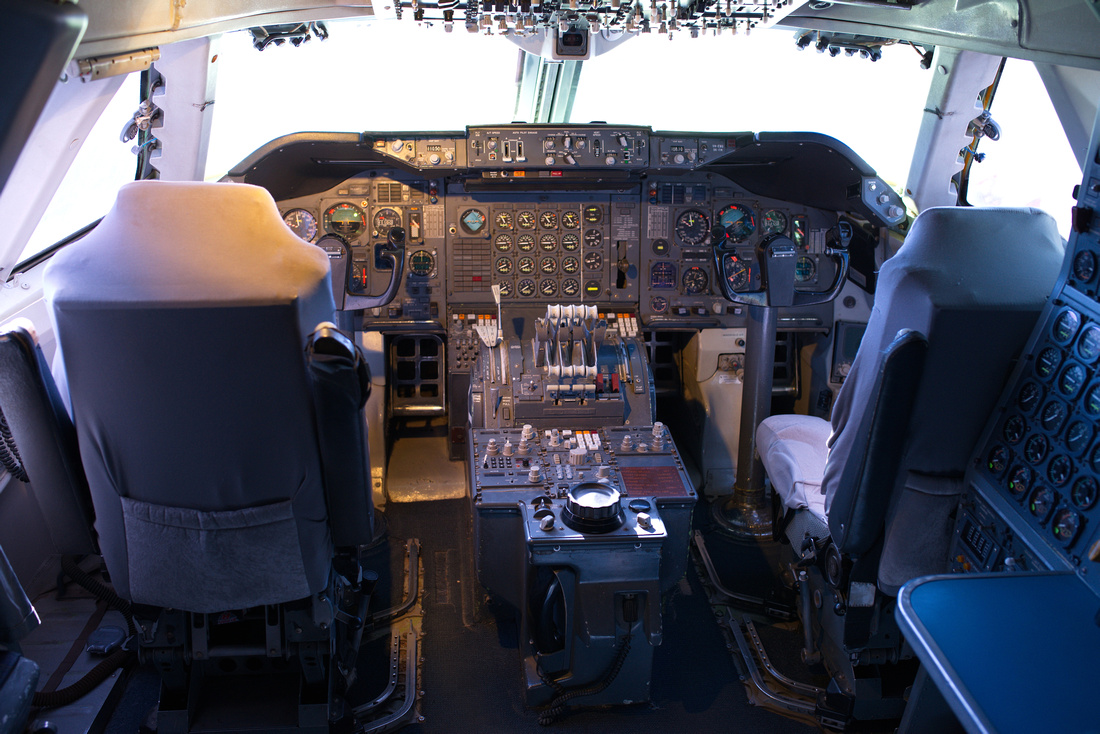 Boeing 747 Tour, Qantas Founders Museum, Longreach
It was almost closing time and we hadn't had a good look at the rest of the museum, so we obtained a pass to return tomorrow.
]]>
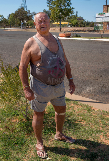
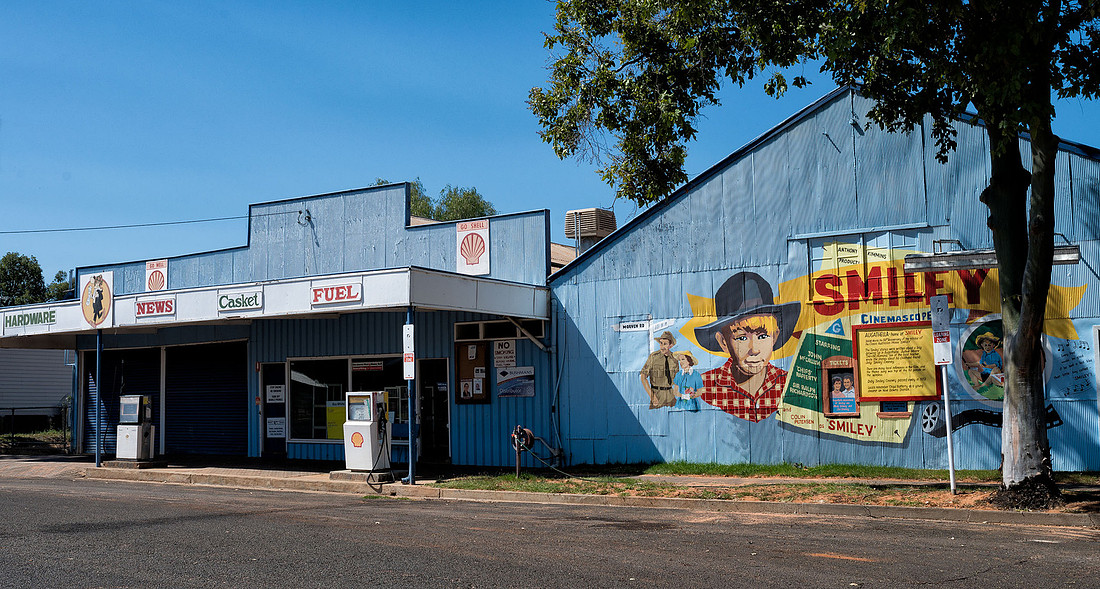
We decided to stop at Blackall to see the Wool Scour. It's only a short drive so on the way, we stopped to have a look at Augathella. I had a walk around the main street to take some photos and encountered this resident who was on for a chat.
A couple of photos of buildings.
 Store, Augathella
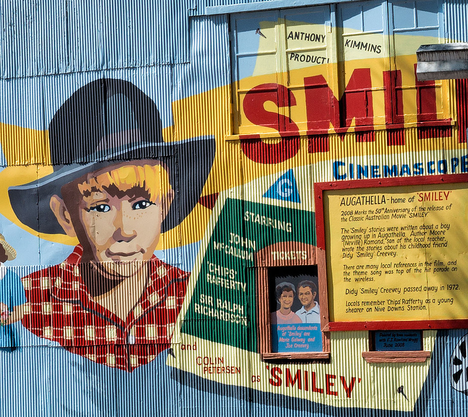 Smiley decoration, Augathella
 Old Garage, Augathella
On to Blackall and it ended up being a bit of a rush to set up camp and get out to the Wool Scour, but we made it in time for the tour.
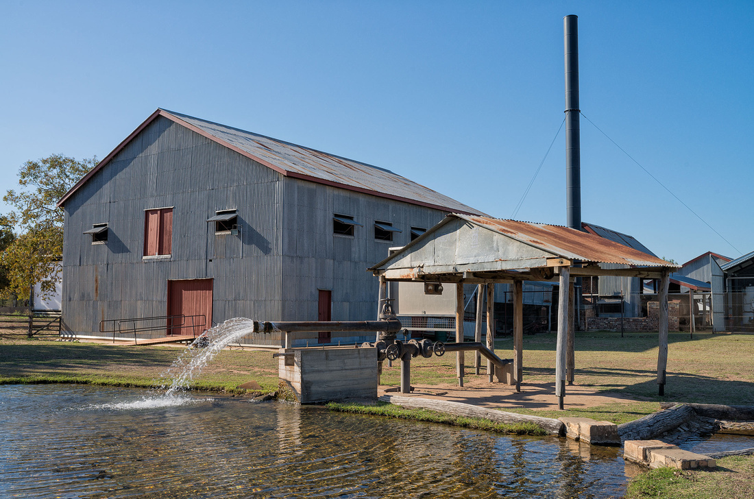
Our tour guide once worked here in the shearing shed (on the wool press if I remember correctly).
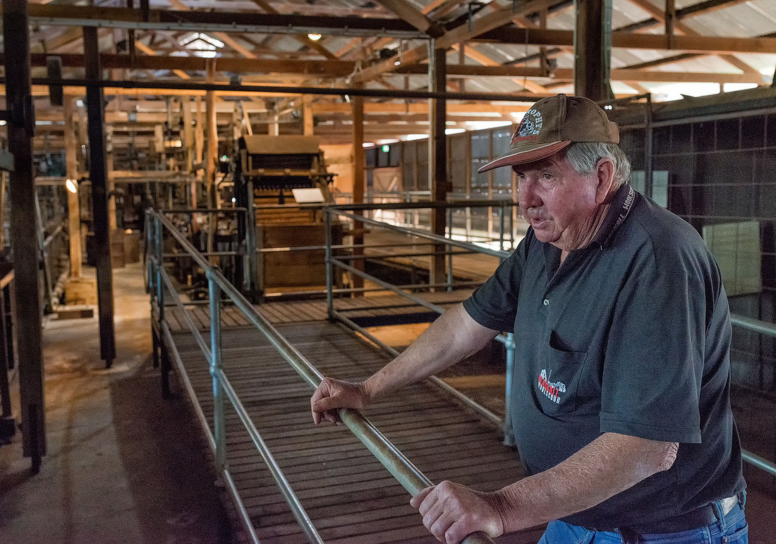 Tour Guide, Blackall Wool Scour
The scour has three boilers - a modern automatic one used to run the machinery during winter, and two older versions. These are boiler tubes from one of the disused ones.
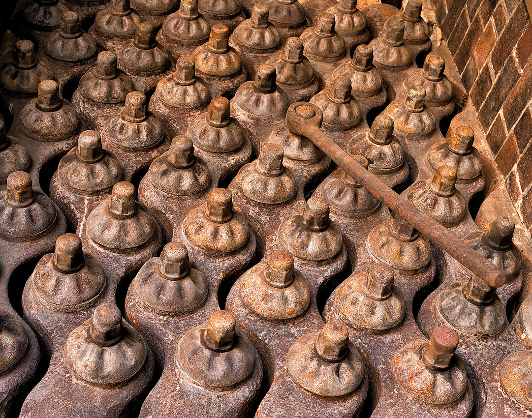 Boiler tubes in disused boiler, Blackall Wool Scour
Agitators used to wash the wool.
 Agitation Tank, Blackall Wool Scour
Much of the timber has been replaced using materials as near as possible to the original.
 Blackall Wool Scour
 Wool Press, Blackall Wool Scour
Back at the camp site, we have these White-plumed Honeyeaters feeding in the tree beside the tent. The golden colour is from the light of the setting sun.
]]>
We went for a stroll along the river walk during the morning and saw only one other person. Nothing exciting but the trees were interesting.
 Trees beside the Warrego River, Charleville
Some of the trees look like they are either trying to escape or are desperately hanging on.
I'm not sure whether this old car body beside the track is a feature of the walk or they couldn't be bothered moving it.
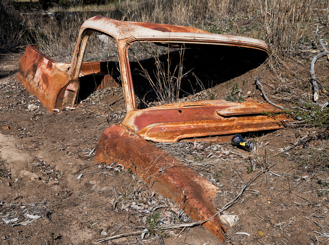 Bogged?River walk, Charleville
After lunch we went out to the Cosmos Centre for their "Astronomy by Day" session. It was Ok with the high point being able to hold some pieces of meteorite.
On the way back we stopped in a nice looking park for a walk and saw some of the common local birds.
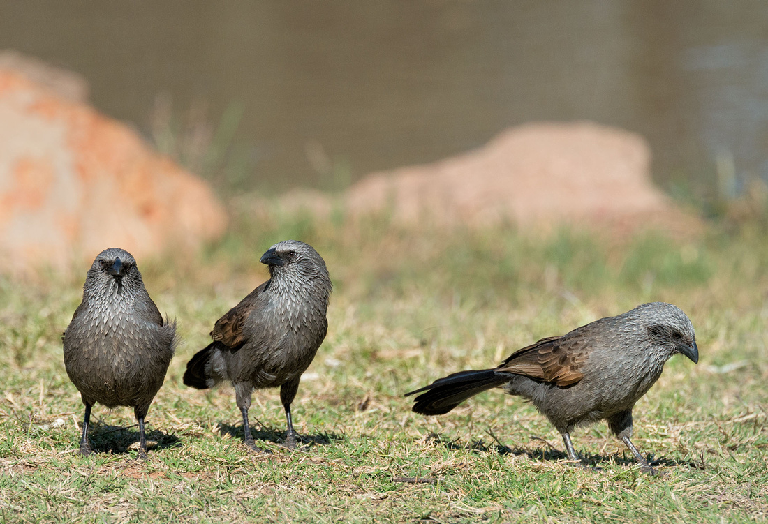 Apostle Birds, Charleville
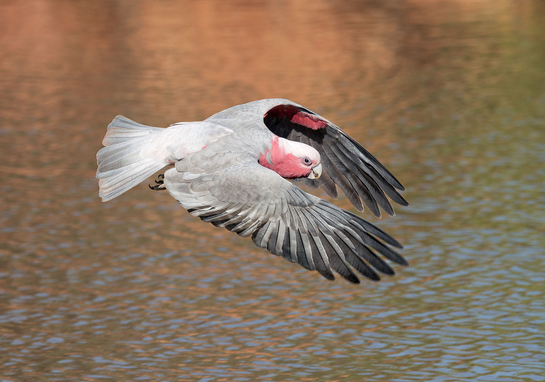
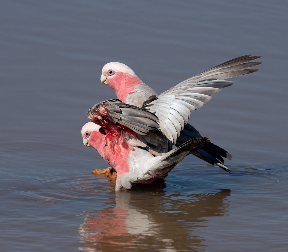 Galahs Drinking, Charleville
No cameras allowed at the Cosmos Centre Astronomy session but it was very good. They showed us an open cluster, globular cluster, binary star and Saturn.
More photos are in the gallery.
]]>We stopped at Mungallala cemetery to look at Jan's (John's wife's) grave before the short drive to Charleville. The grave behind is John Parents, and behind that, his grandparents.
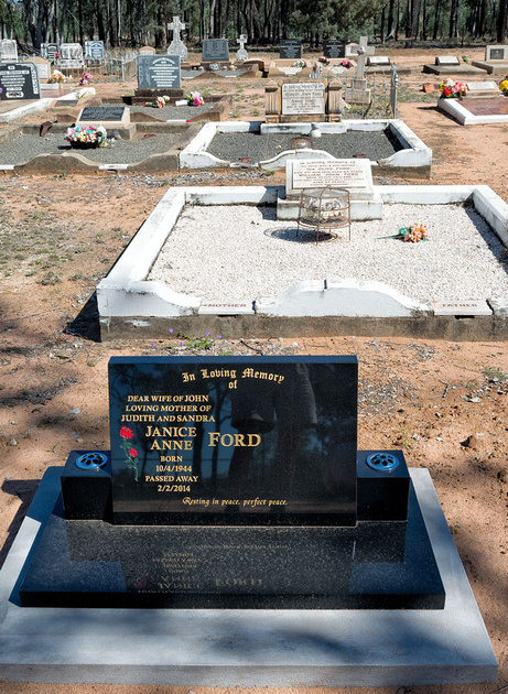 Grave of John's wife, Jan in Mungallala Cemetary
The Caravan Park we stayed at in Charleville had the smallest sites we encountered on the trip. We didn't do much today but set up camp, buy some groceries and book a session at the Cosmos Centre for tomorrow night.
We had a bit of a look around the town.
Had a look at another museum, at the Charleville Historic House. Every town seems to have its museum.
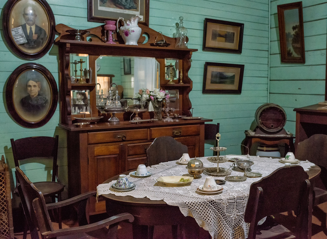 Dining Room, Historic House, Charleville
The next two photos are of a 1925 Dennis Fire Tender that was used originally at Charleville and then at Morven Auxiliary Station until 1970.
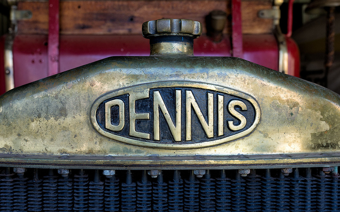 Radiator, 1925 Dennis Fire TenderHistoric House, Charleville
 Bonnet Vents, 1925 Dennis Fire TenderThis was retired from Morven Auxiliary Station in 1970.
One of the old outbuildings at the Historic House.
 Outbuilding, Historic House, Charleville
More images are available in the gallery.
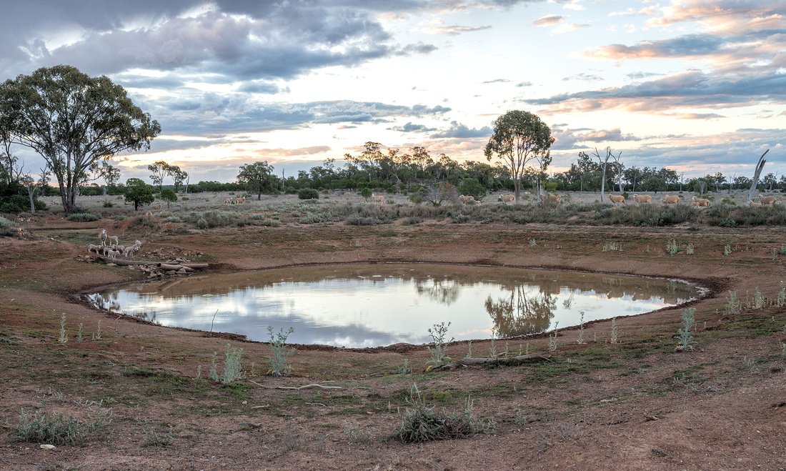
]]>We had a peaceful night with no dingo activity. The sheep came to the dam for their morning drink and this group of lambs decided to stay at the dam to play instead of going with their mothers.
The mothers came back for them a little later. We left the tent set up and went back to the house for breakfast and for John to feed his dogs.
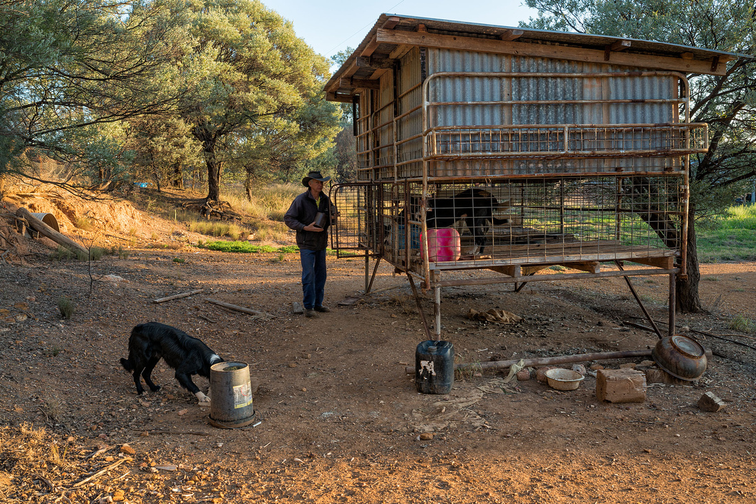 John Feeding the Dogs, Mungallala
I wish I'd noticed that the dogs head was behind the bucket when I took the photo. John had to go and move a dead sheep so Bev and I had a walk around the area near the house.
One of the sheds and a galvanised tank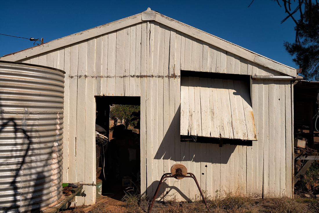
and a couple of birds

 Olive-backed Oriole, Mungallala
Back at the paddock during the afternoon, we went looking for a donkey John bought to keep the dingos away (it seems they don't like dogs). He was told to leave it wild as it would be more effective; the only problem is that now he can't find the donkey.
The pet ram wanted to follow us and it's an uncomfortable feeling to have those horns walking close behind you.
It isn't John's pet; it belonged to someone in town and came to the property when they wanted to get rid of it.
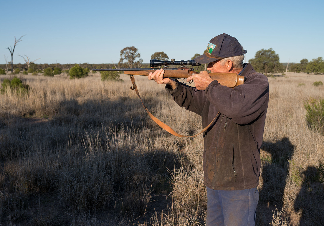
John with is rifle; he isn't shooting anything - he's just using the sight as a telescope to check out something in the distance.
With no wind or rain tonight, we are much more organised and settle down to the distant bleating of the sheep.
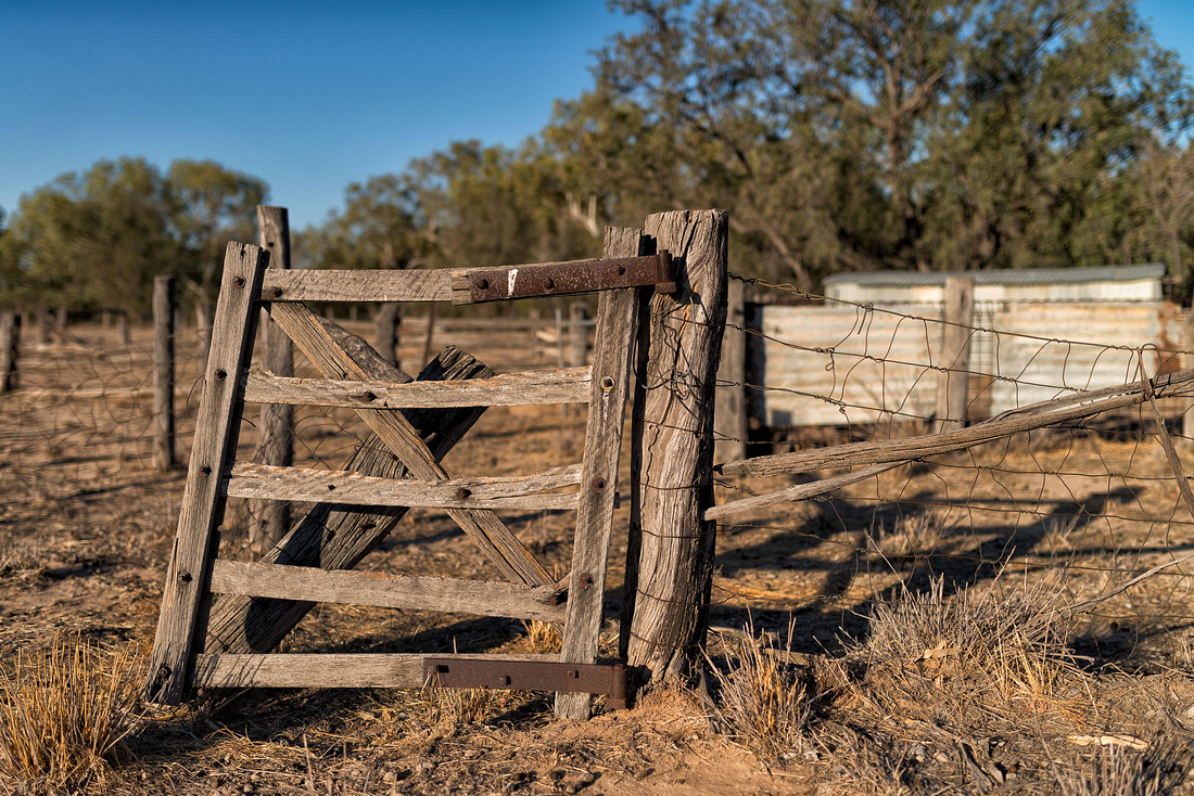
]]>We are going to stay a couple of nights with Bev's cousin John Ford, who has a sheep property near Mungallala, just west of Mitchell. We were going to buy some groceries in Roma on the way, but it was Sunday and we couldn't find an open shop, so we do some shopping in Mitchell and stop for a coffee at the bakery.
We also have a cup of tea with John's sister Minnie, who lives in Mungallala.
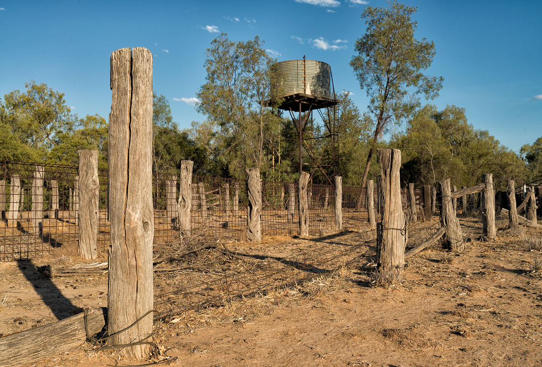
John has a lot of new lambs and is having trouble with dingos, so he intends to sleep out with the sheep to prevent losing any lambs. He invites us to join him, so we set up camp in his sheep paddock.
John is having a new electric fence built to keep the dingos away from his sheep and the kangaroos away from his grass. It's a long fence.
 New Electirc Fence, Mungallala
This is John's woolshed.
 Woolshed, Dreamland, Mungallala
This dam is beside our camp with sheep coming in for their evening drink.
 Sheep around a dam, Mungallala
That pretty pink glow is the setting sun shining on a rain squall that's about to hit us and our partially erected tent. Not a lot of rain but enough to get mud over everything.
 Approaching Shower, Mungallala
It takes us a while to get organised after the wind and rain but go to sleep with the sound of the sheep in the distance. The dingos don't put in an appearance.
]]>Our mysterious neighbour finally appeared this morning - a man in his sixties or seventies. We exchanged pleasantries but nothing more.
We are taking the time to stop at the Miles Historical Village as we see it every time we pass this way, but are always heading for somewhere else and reluctant to stop. It has a huge number of exhibits.
You know you are getting old when you visit a museum and find familiar items from your childhood. I remember using hurricane lamps on the farm.
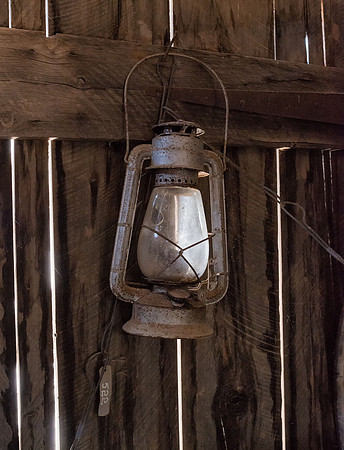 Hurricane Lamp, Miles Historical Museum
Kerosene refrigerators were still being used in the late 60's in the cabins on North Keppel Island.
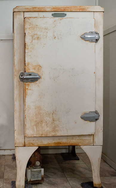 Kerosene Refrigerator, Miles Historical Museum
Who remembers pounds, shillings and pence? Here's a manual pre-decimal currency adding machine. I used something similar, although a later model, at work in the mid 1960s. The keyboard is interesting with "10" and "11" keys for pence, and a shillings column that only allows values up to 19.
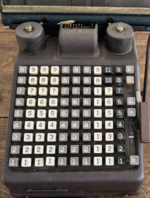 Pre-decimal currency manual adding machine, Miles Historical Mus
Butcher shops have certainly changed from the days they had sawdust on the floor and wooden chopping blocks.
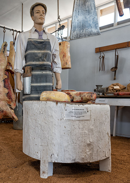 Butcher Shop, Miles Historical Museum
My mother's uncle had a printing business and I remember a hot metal type-setting machine like this. A bit different to today's computer software page layout systems.
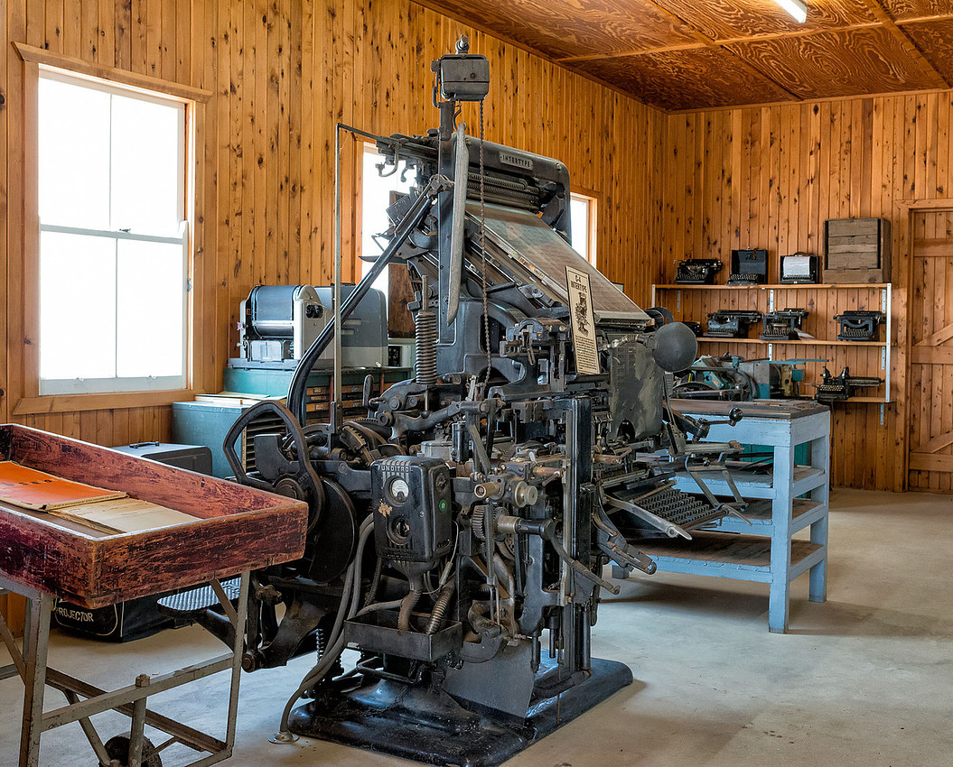 Print shop,, Miles Historical Museum
I sat at desks like this in primary school.
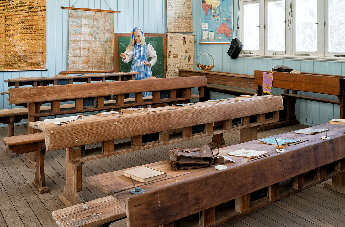 School Room, Miles Historical Museum
Here are a few other items I found interesting.
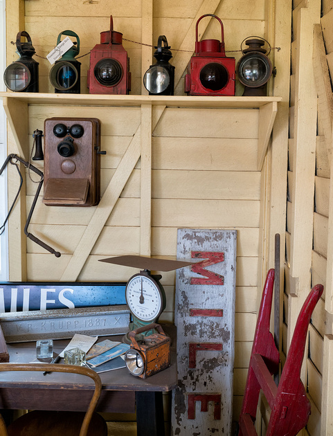 Railway Memorabilia, Miles Historical Museum
 Shipping cases, Miles Historical Museum
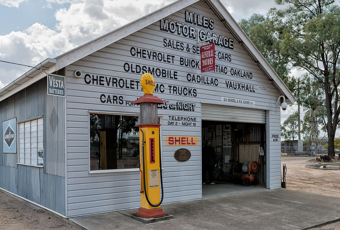 Motor Garage Reconstruction, Miles Historical Museum
We stopped for the night at Mitchell Caravan Park. We did look at a couple of free camping areas - the Weir and Fisherman's Rest - but there were too many people and too few toilets.
]]>Sunrise on our first full day was pleasant although a bit uninspiring due to the lack of clouds.
 Lake Broadwater before Sunrise
 Lake Broadwater before Sunrise
 Lake Broadwater before Sunrise
 Lake Broadwater at Sunrise
 Lake Broadwater at Sunrise
After breakfast we went for a walk along the lake shore to the bush camp, although we never actually found it. The cockatoos and corellas were noisily active in the trees.
 Little Corellas, Lake Broadwater
The walk was pleasant with small signs identifying some plants and points of interest but some of the signs were unreadable. This is the remains of a dingo fence from the 1800s.
We heard a few bird calls, but didn't actually see many apart from the cockatoos. These are Little Friarbirds.
 Little Friarbird, Lake Broadwater
We had asked the caretaker about the number of visitors on the weekends and were told that numbers were small until the ski season started. We heard the boat engines while returning from our walk, so sat and watched some skiing while we ate our lunch. Note the colour of the water.
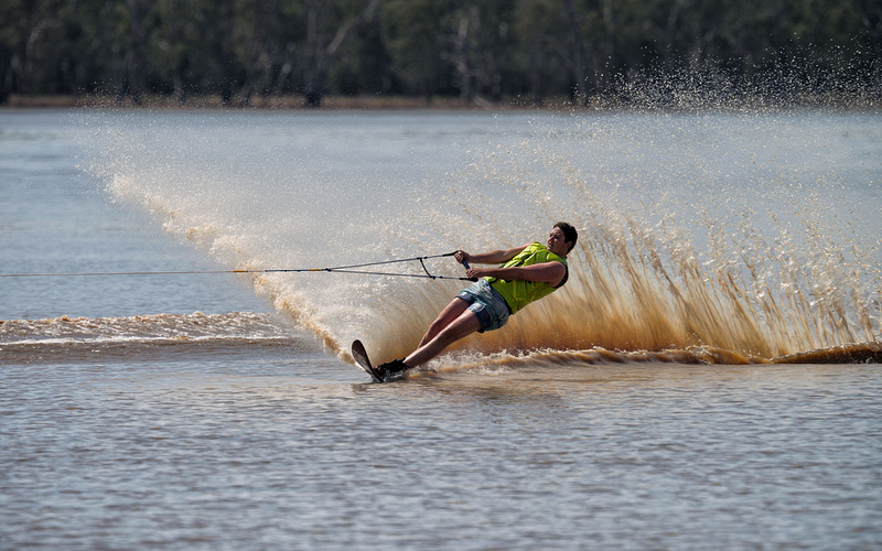
There were only a couple of boats and they didn't stay much after lunch.
Mid-afternoon we returned to the bird hide but didn't see much activity. We sat on a log in the shade for a while and enjoyed the quiet and watched a few birds. A pair of black swans with young, out on the lake, chased away an intruding swan. This Striped Honeyeater found a meal.
 Striped Honeyeater, Lake Broadwater
and a crow foraged along the shore in front of us.
Later in the afternoon, I left Bev resting at the tent and went for a walk looking for photos in the afternoon light.
 Around Lake Broadwater
 Around Lake Broadwater
We still haven't seen the mysterious inhabitant of the neighbouring tent - only heard coughing and a radio playing quietly.
A relaxing day. The sun was quite hot and Bev got a little sunburned as her hat doesn't shade the back of her neck. We will have to buy a hat for her tomorrow, although we might not find many shops open on a Sunday.
]]>
This is a record of our camping trip to Lake Broadwater (near Dalby), Mitchell, Mungallala, Charleville, Blackall, Longreach and Winton in September 2015.
We wanted to look at the Army Flying Museum at Oakey on the way to our first camp site, but were a bit early, so we stopped for a coffee at Picnic Point in Toowoomba to delay our arrival until after the museum opening time.
The museum has a range of planes used by the Army over the years.
This is the rotary engine of a Sopwith Camel.
Auster
 Auster, Army Aviation Musem, Oakey
Australian Designed Boomerang Fighter
 Boomerang, Australian Designed Fighter
Portion of the wings of a Bristol Boxkite (The army's first aircraft)
 Portion of wing of a Bristol Boxkite.
After a couple of hours at the Museum, we continued to Lake Broadwater. We didn't know if it was dry or not, so were relieved to find it filled. The water is quite muddy, but the reflection of the sky makes it appear blue in photos. It is quite shallow and can dry out for years at a time.
 Lake Broadwater in the afternoon light
After setting up camp and organising lunch we went for a walk to the bird hide. This is mounted on poles, giving a good view into the distance but looking down on anything close. There were few birds around but we came across a few other items of interest, like the remains of this 150 year old fence.
Very weathered timber of a dead tree.
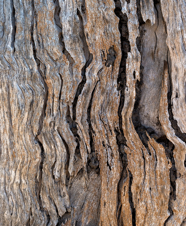 Dead Tree Patterns, Lake Broadwater
A wattle tree in glorious flower
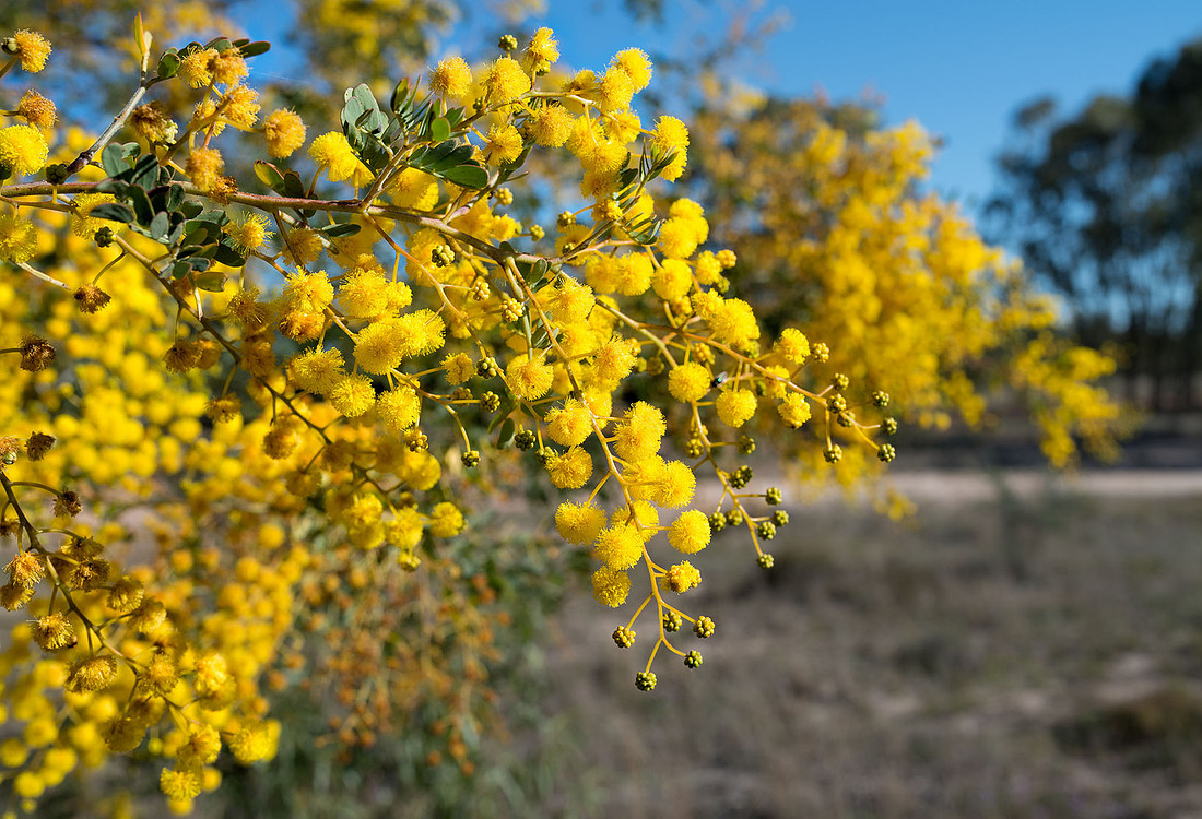 Wattle Flower, Lake Broadwater
Back at the campsite there were many cockatoos, corellas and galahs as well as a few other birds. I suspect the cockatoos were looking for nesting sites in the river red gums around the lake.
A pair of Little Corellas
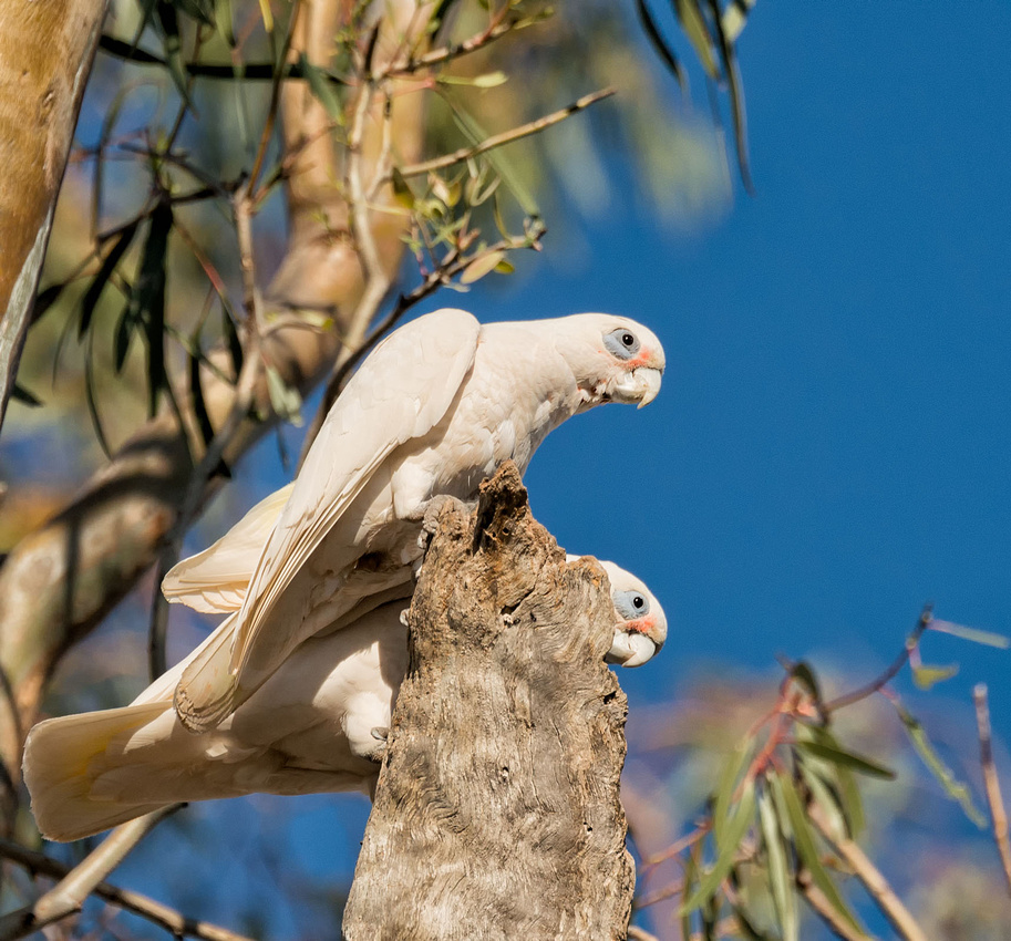 Little Corella, Lake Broadwater
Royal Spoonbill
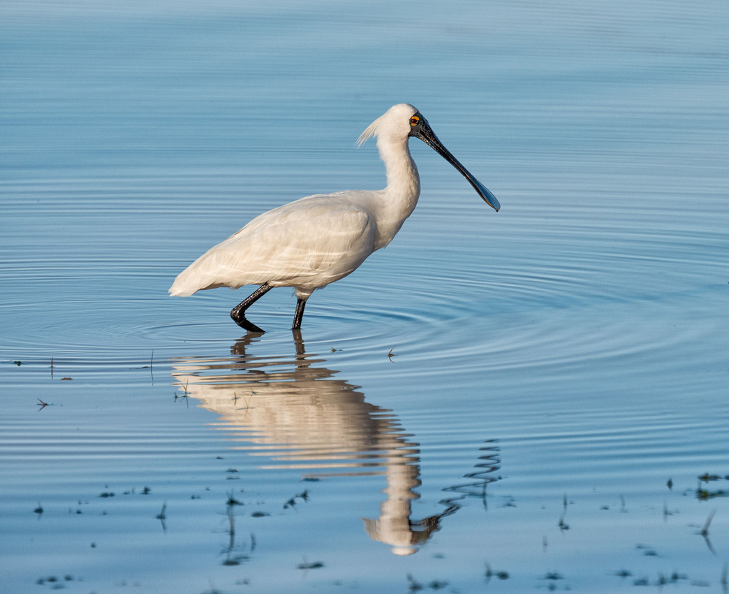 Royal Spoonbill, Lake Broadwater
 Spoonbill in Flight, Lake Broadwater
Nankeen Kestrels
 Nankeen Kestrels, Lake Broadwater
 Nankeen Kestrel, Lake Broadwater
The wind dropped late in the afternoon turning the lake into a mirror.
 Lake Broadwater in the afternoon light
 Pelican on Lake Broadwater
We had made camp not far from another tent (the only other tent in the campground). We had assumed that the occupants were away as there was no car nearby, but occasional noises indicated that there was somebody inside, although no one appeared outside the tent at all.
]]>We wake to find the river shrouded in a combination of smoke (from the bushfires) and mist. I find time for a few photos before breakfast and packing up.
 Early morning mist on the Wooli Wooli river
 Early morning mist on the Wooli Wooli river
 Early morning mist on the Wooli Wooli river
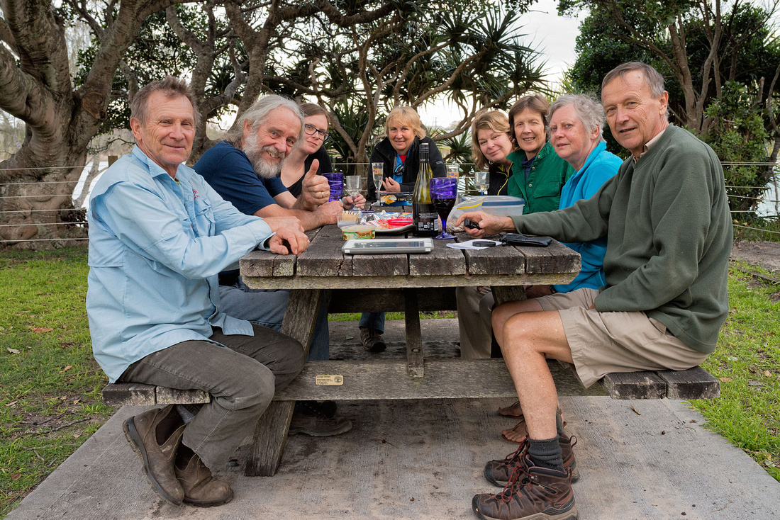
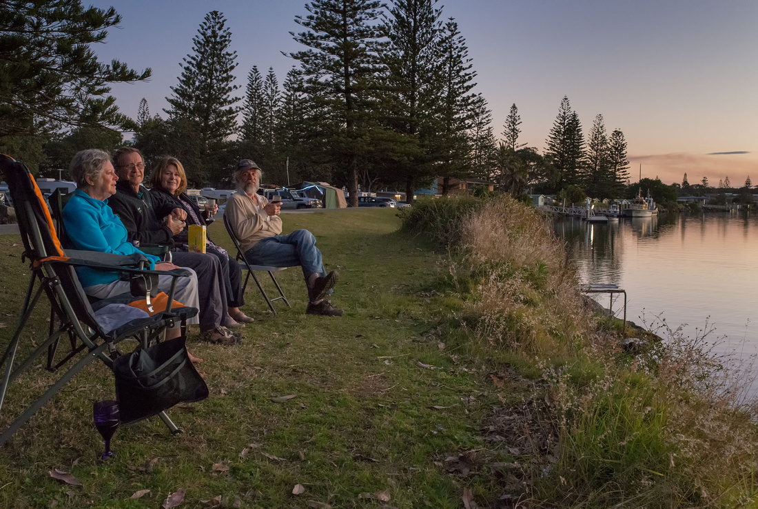
Rob, Bev and I enjoy the morning sun after breakfast, before packing up to head home.
 Enjoying the sun after breakfast at Wooli
More photos can be found in the gallery.
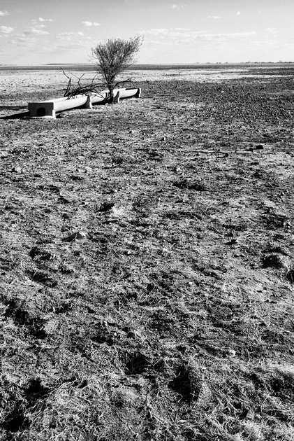
]]>6.5 km
A smoky haze from bushfires burning off to the South West, is visble out to sea this morning.
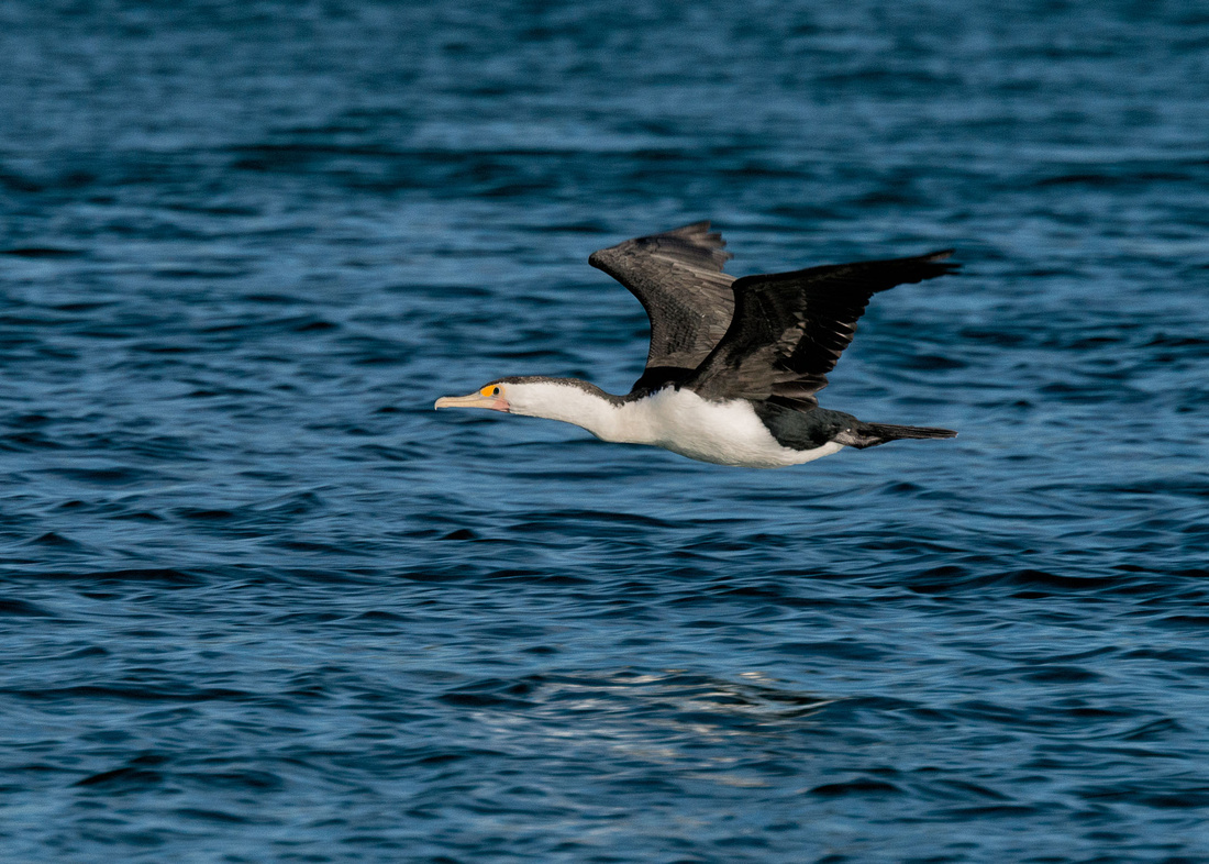
 Cormorant on rocks near Illaroo campground
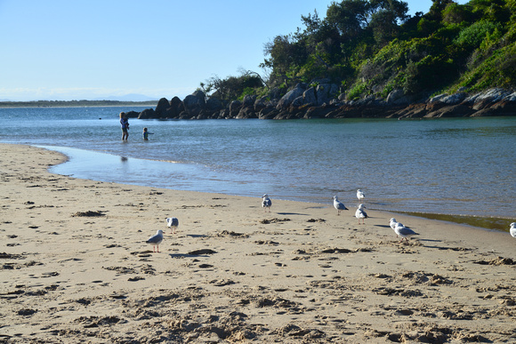
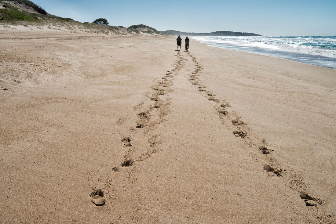
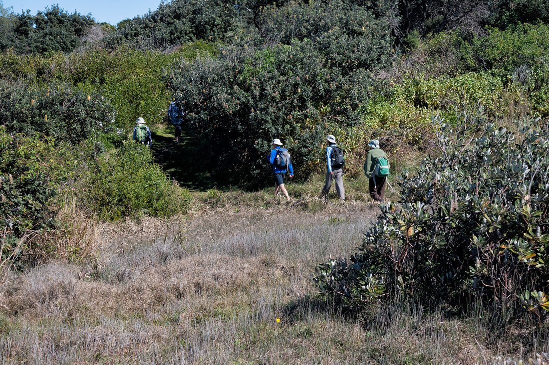
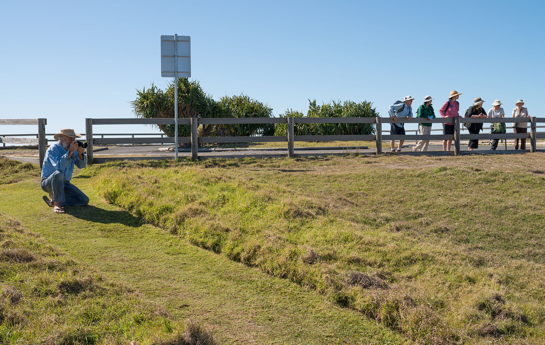
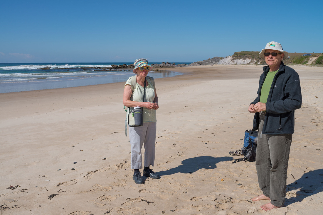
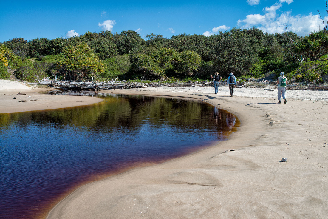
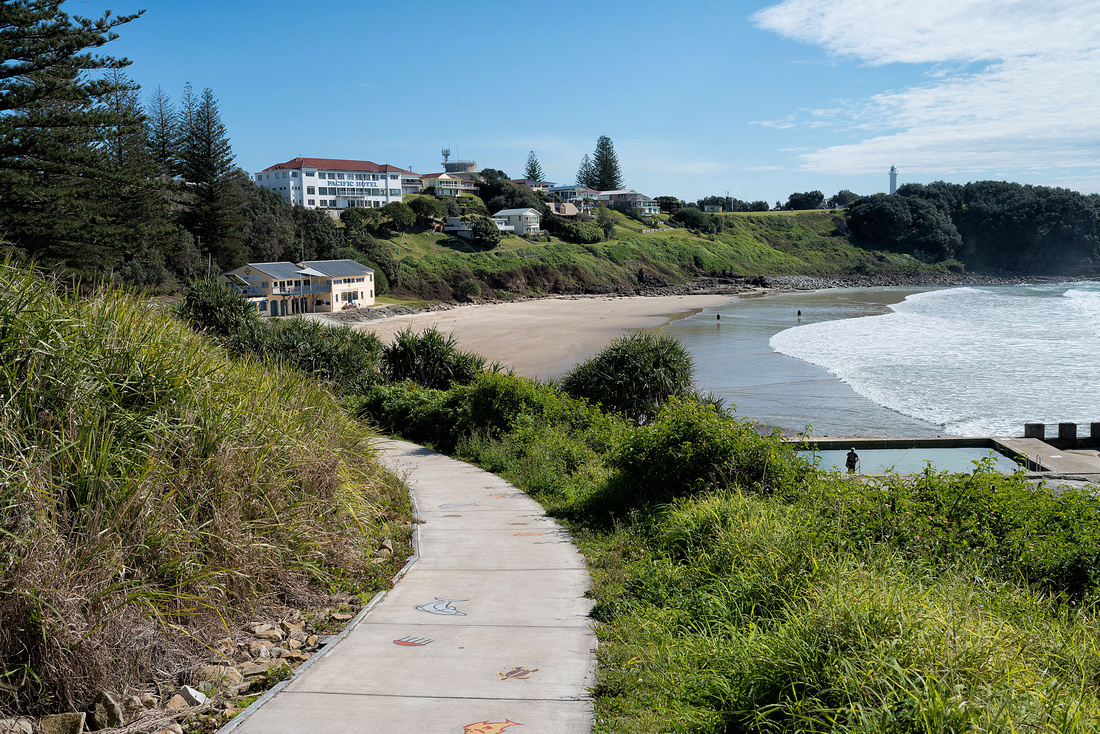
Rob, Bev and I drive to Wooli and walk North to meet the others walking south. Fons is organising sites at the Solitary Islands Marine Park Resort at Wooli.
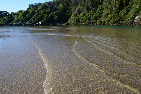
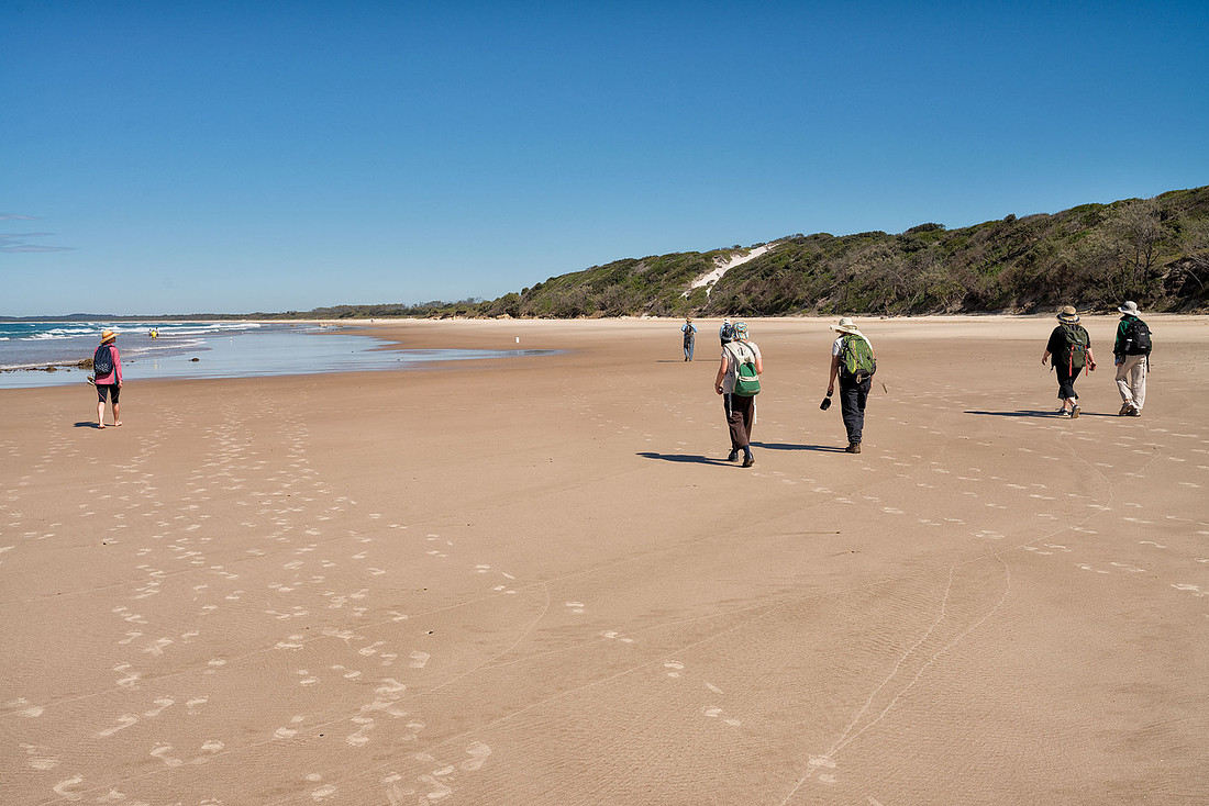
Wooli beach makes up most of the distance and much of it is rather soft sand.
 Making TracksRob and Bev on Wooli Beach
We come across a dead turtle.
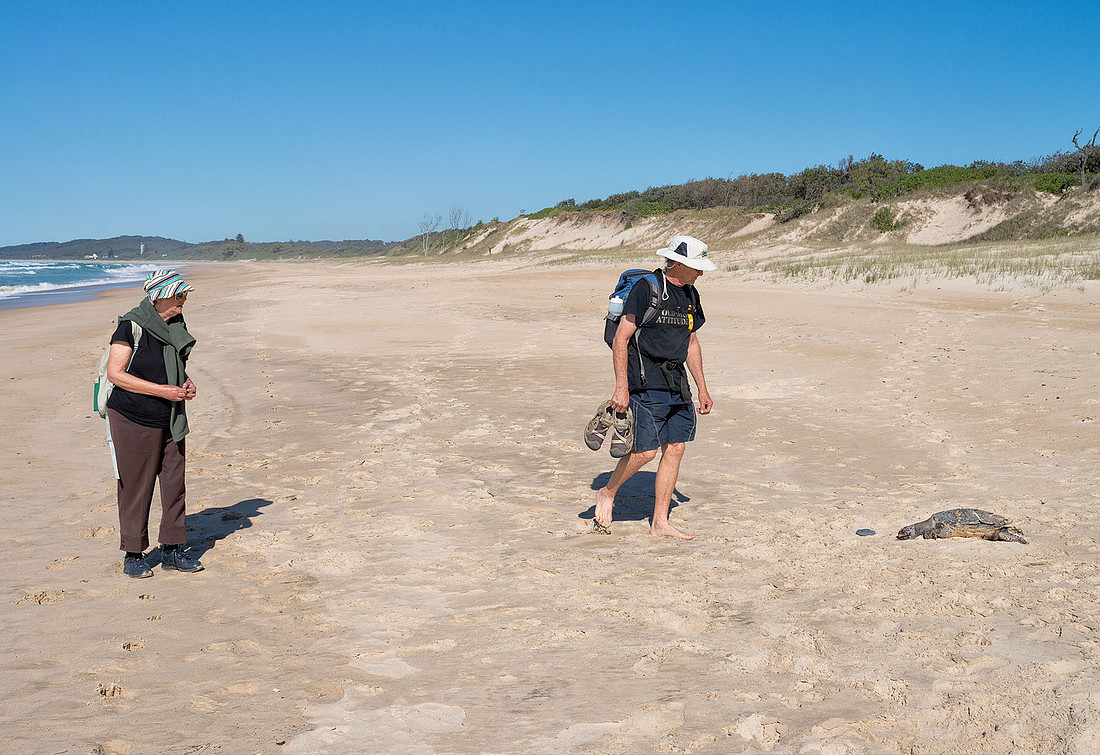 Rob and Bev lookin at a dead turtle, Wooli Beach
Grass and ripples in the sand make some interesting patterns.
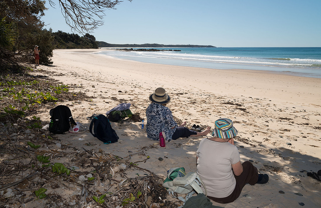
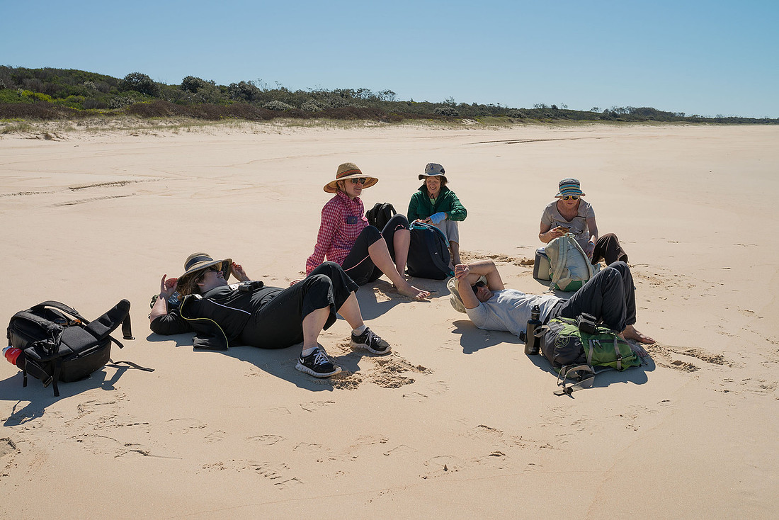
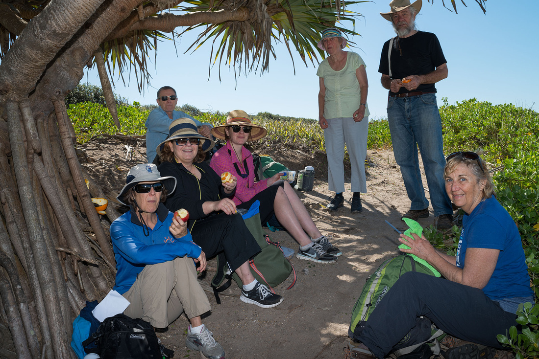
Time to break for a snack.
 Rob and Bev having a break, Wooli Beach
From the beach we seem some whales breaching well out to sea. We climb the dunes for a better look but only see some spouting.
We expect to meet the rest of the group along the beach, but we don't see them until almost at the Northern end of the beach. They have spent a lot of time watching for whales.
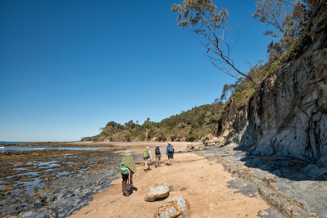
Bev returns to Wooli with Marg, Carol, Olive and Irene while Rob and I continue to have a look at Wilsons Headland at the Northern End of the beach.
In this view from Wilsons Headland, you may be able to make out the rest of the group part way along Wooli Beach with Wooli in the distance.
 Wooli Beach from Wilsons HeadlandWooli is at the far end of the beach.
Rob and I stop at a viewing platform and see some more whales, but they are too far away to photograph.
 Rob whale-watching on Wilsons Headland
Another view looking back towards Wooli.
 Wooli Beach from Wilsons Headland
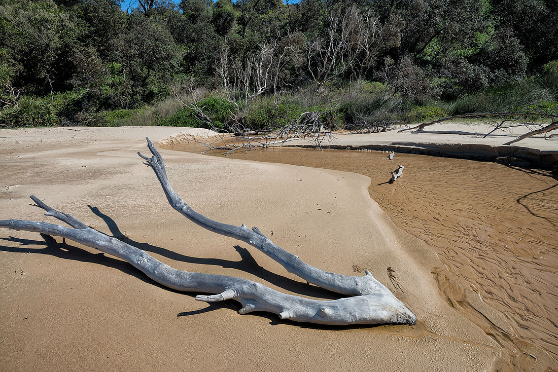
This lagoon is behind the Northern end of Wooli beach.
 Lagoon behind the northern end of Wooli Beach
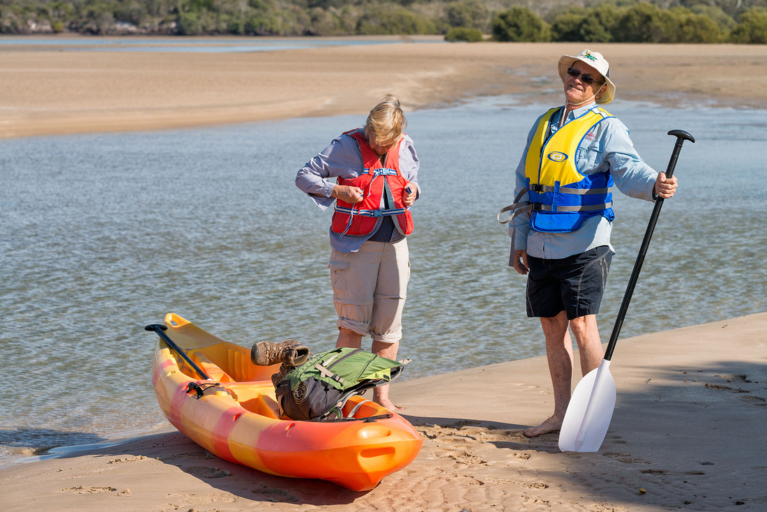
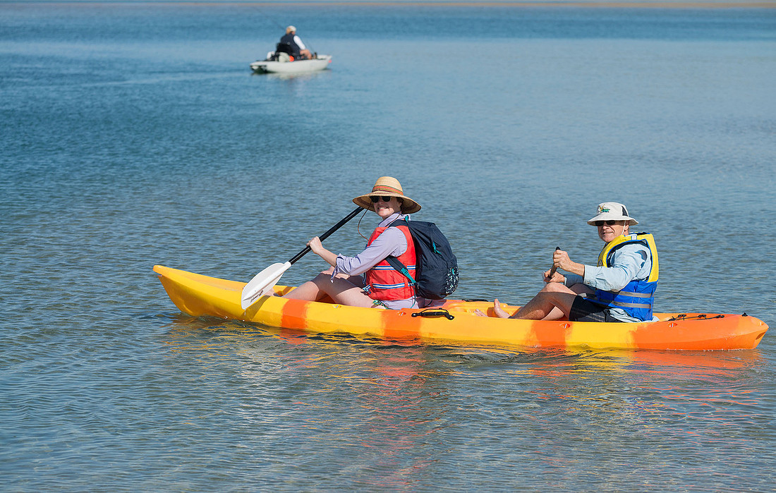
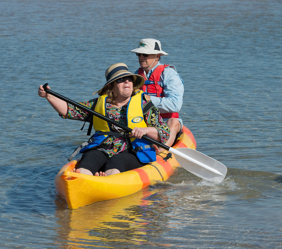
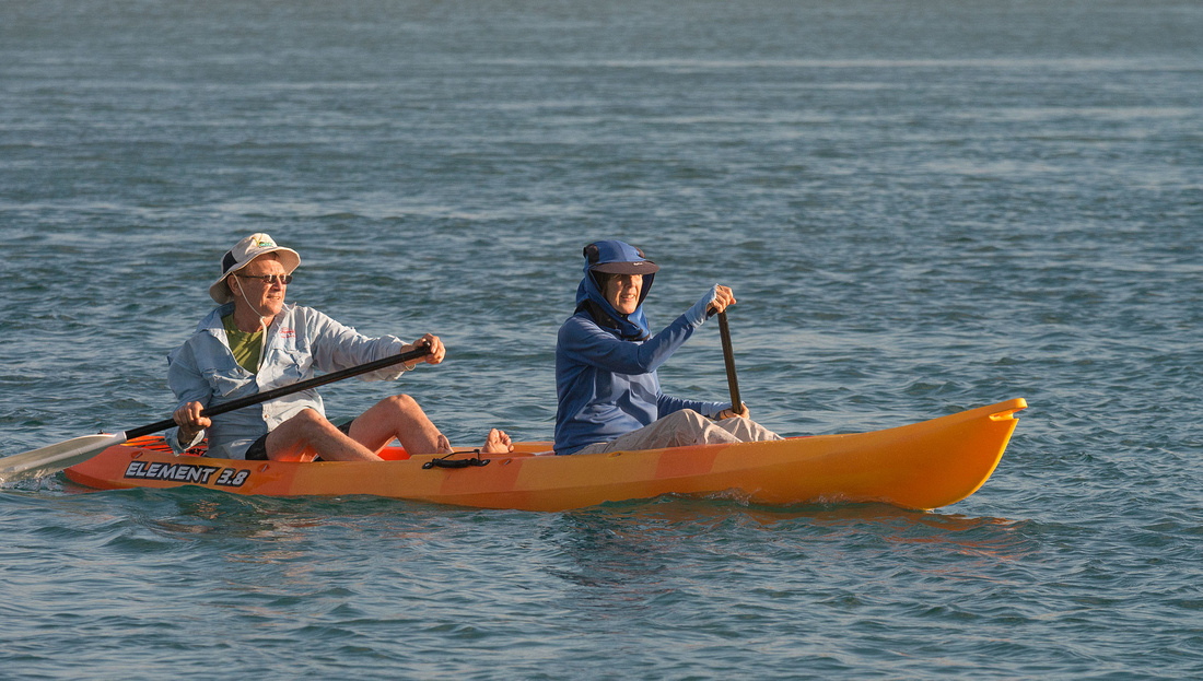
Wooli is the end of our walk. The caravan park includes free use of kayaks and canoes and we make use of them. Bev and I take a canoe, Olive takes a Kayak and Marg and Carol use their own Kayak. We spend a pleasant hour paddling on the river in the late afternoon sun. No photos as I wasn't game to take the camera in the canoe.
The hot showers (at last) at the caravan park are very welcome and we enjoy relaxing beside the river before dinner at the bowls club.
 Relaxing at Wooli, the end of our walk
Tomorrow we will go our separate ways; some, including Rob, Bev and I, returning home, while others will stay a little longer.
More photos can be found in the gallery.
]]>6 km
Because of the short driving distance, we decide to leave the camp set up at Illaroo and drive the walkers back from today's finish point and to tomorrow's start point. As well as saving several hours effort breaking and setting up camp, it means we can all walk together, except for Fons who is driving. No hot showers again.
More early morning photos.
 Marg enjoying the morning sun at Illaroo
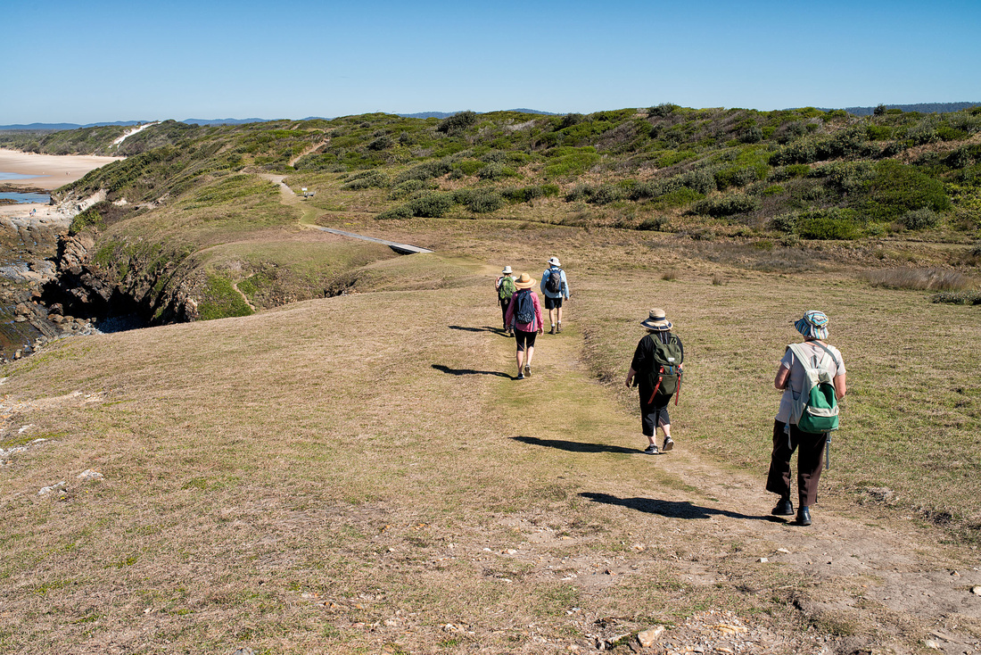
The start point of Illaroo Campground as about 900 metres north of Minnie Water.
 Ready for day 4Illaroo to Diggers Camp
The track goes over the headland and onto Minnie Water beach.
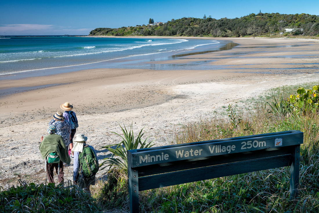 Walking onto Minnie Water beach
Minnie Water is on a hill above the beach which has some shelter from a rocky reef for launching boats. A ship is visible on the horizon.
Shortly after leaving Minnie Water, Irene seems to need a rest.
 Irene resting soon after leaving Minnie Water
From the headland we can see today's destination, Diggers Camp, in the distance at the end of Minnie Water Back Beach.
 Headlands near Minnie WaterMinnie Water Back Beach in the distance
In addition to the Banksias and Pigface, we see some Flannel Flowers.
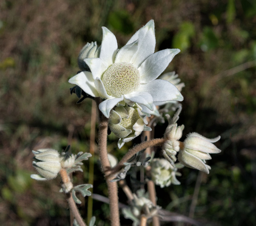 Flannel Flower beside the track
Off the beaches, the paths are mostly through coastal heath vegetation.
Many of the beaches we have walked are crossed by small creeks and seepages.
 Creek on Minnie Water Back BeachMany small creeks and seepages cross the beaches we walked
Approaching Diggers Camp.
Some of the group have a swim while others rest in the shade while we wait for Fons to arrive for the drive back to camp.
 Resting in the shade, Diggers Camp
Back at Illaroo, Rob tries surfing in the Kayak.
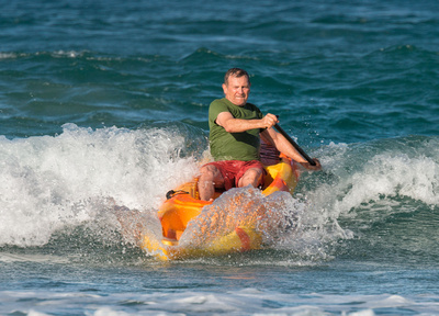 Rob trying the kayak in the surf
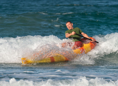 Rob trying the kayak in the surf
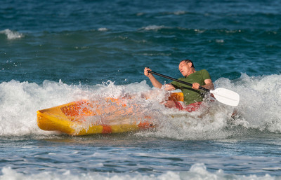 Rob trying the kayak in the surf
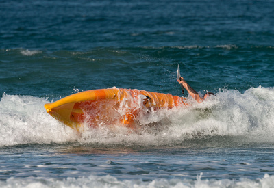 Rob trying the kayak in the surf
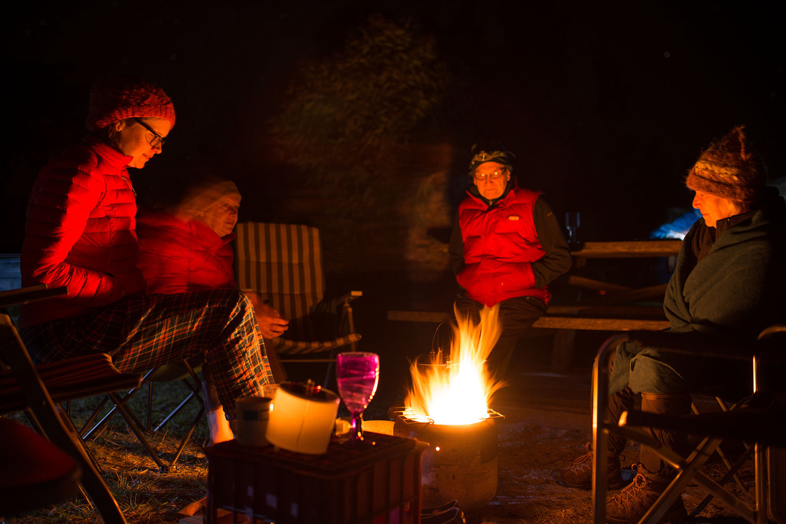
As on most evenings, we spend some time sitting around a fire.
More photos can be found in the gallery.
]]>11 km.
I managed to get up early again to see the sunrise.
 Mutton Bird Island, Sandon River
Another of the many beach sculptures.
The next campground at Minnie Water is over an hour away by road, so only Marg, Olive, Irene and Carol are walking this one. Rob, Bev, Fons and I will drive and set up camp at Illaroo, the national park campground near Minnie Water. No showers again.
There is no bridge over the Sandon River and, although narrow, it is too deep to wade, so Rob took the walkers across in the kayak. Here Olive is preparing for the crossing.
 Rob and Olive preparing to cross Sandon River
Carol on the way across.
 Ferry across the Sandon RiverRob and Carol
Irene was a bit apprehensive but handled it well.
 Ferry across the Sandon RiverRob and Irene
Fons captured the crossing on video.
 Fons photographing the crossing of the river
All made it safely to the other side without incident.
 Across the river and ready to go
The walkers arrived soon after we had set up camp at Illaroo.
 Camp at Illaroo near Minnie Water
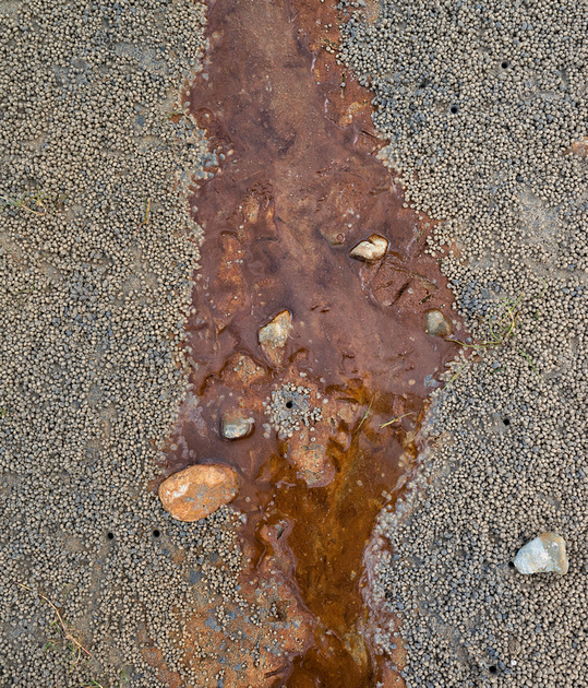
I found some patterns in the water seeping onto the beach.
During the evening a line of storms passed well out to sea, giving us a spectacular, though distant, light show.
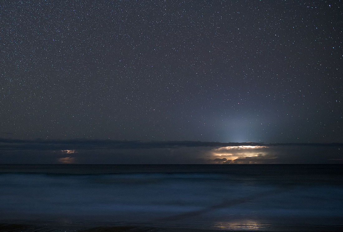 Storms out to Sea, Illaroo Campground
In the campground, away from city lights, the Milky Way was spectacular.
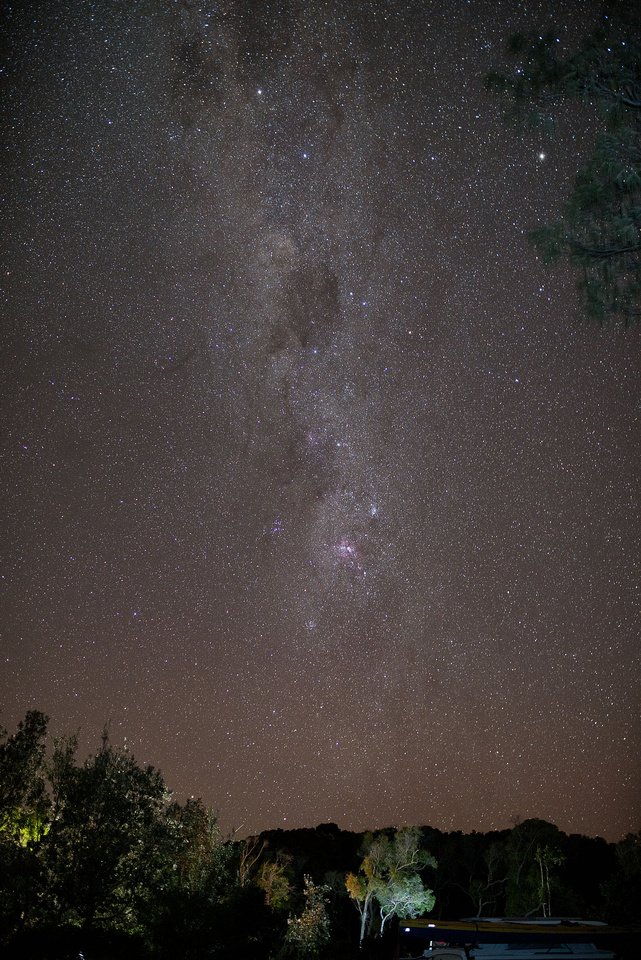 Milky Way from Illaroo Campground
More photos can be found in the gallery.
]]>Ospreys were nesting in one of the pine trees in the campground but I didn't manage to get a usable shot.
 Royal Spoonbills at Sandon River
 Pied Cormorant in flightPhalacrocorax varius, Sandon River
 Whistling KiteHaliastur sphenurus, Sandon River
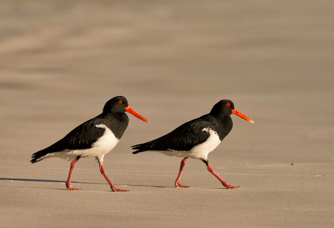 Pied OystercatchersHaematopus longirostris, Sandon River
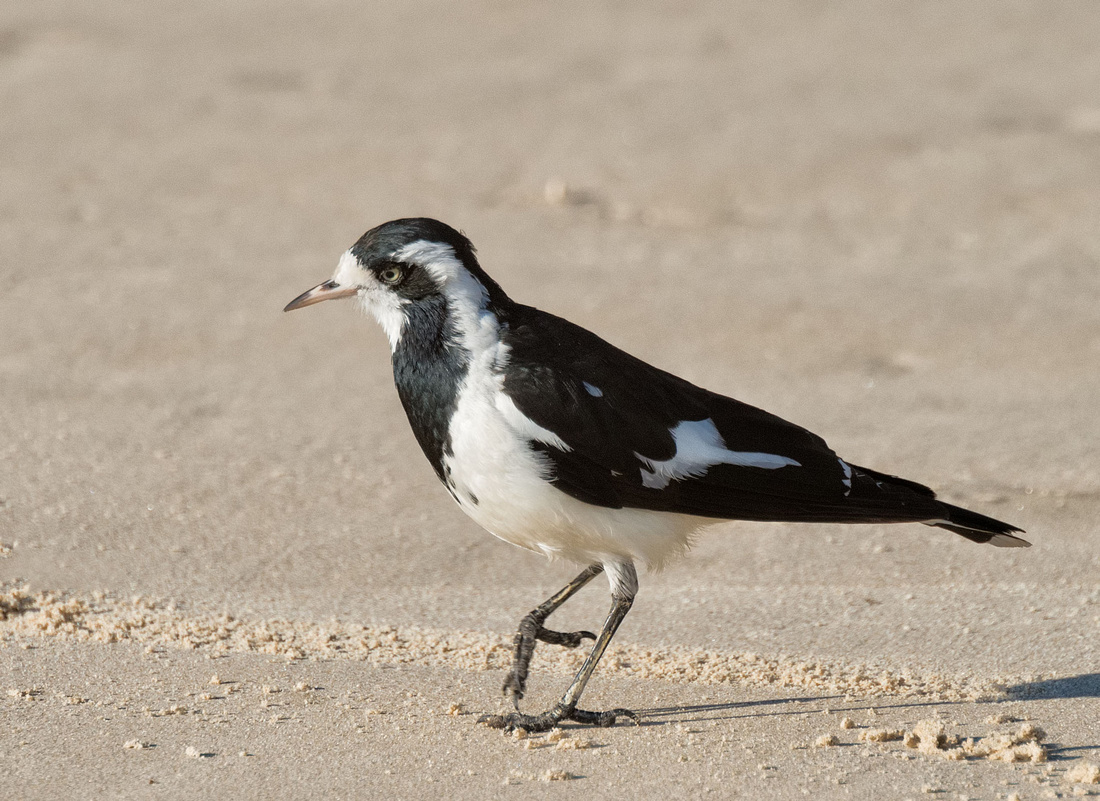
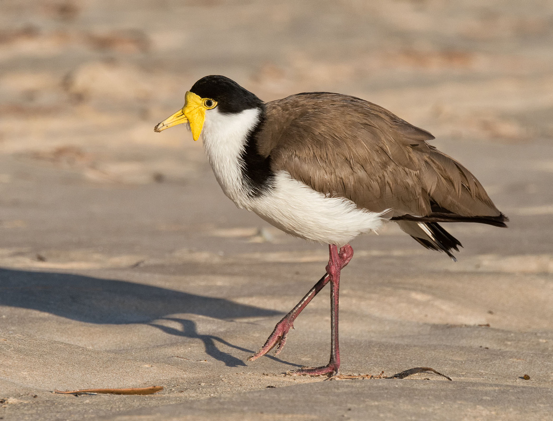 Masked Lapwing (Spur-winged plover)Vanellus miles novaehollandiae, Sandon River
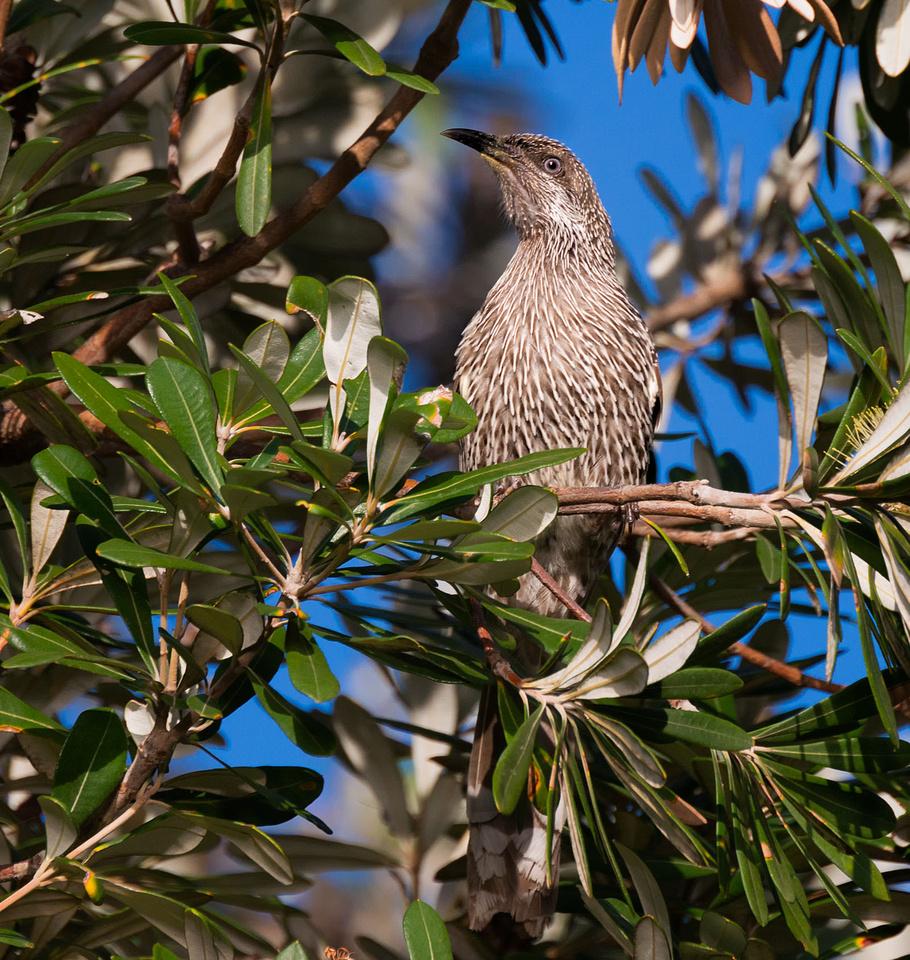 Little Wattle BirdAnthochaera chrysoptera, Sandon River
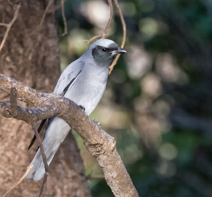 Black-faced Cuckoo-ShrikeCoracina novaehollandiae, Sandon River
 Magpie-larkGrallina cyanoleuca, Sandon River
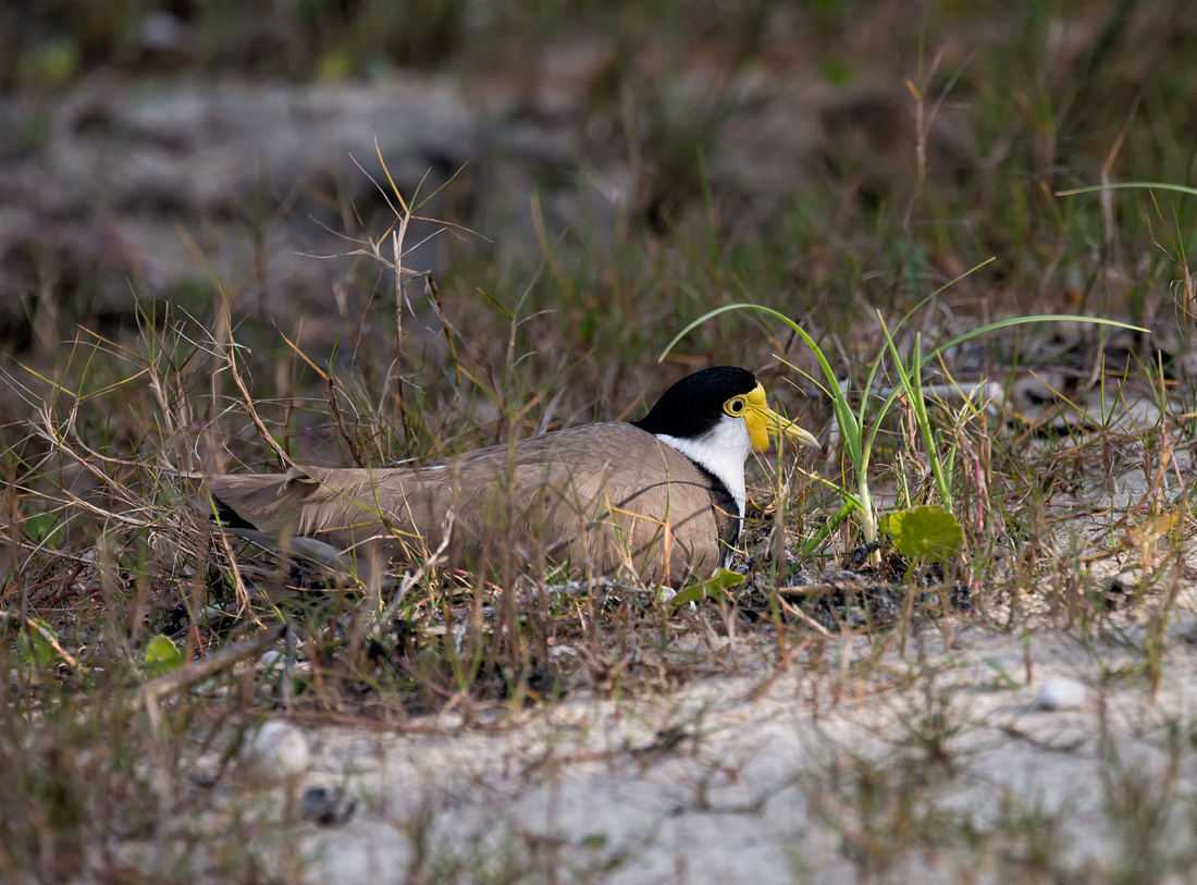 Masked Lapwing on Nest, Illaroo campground
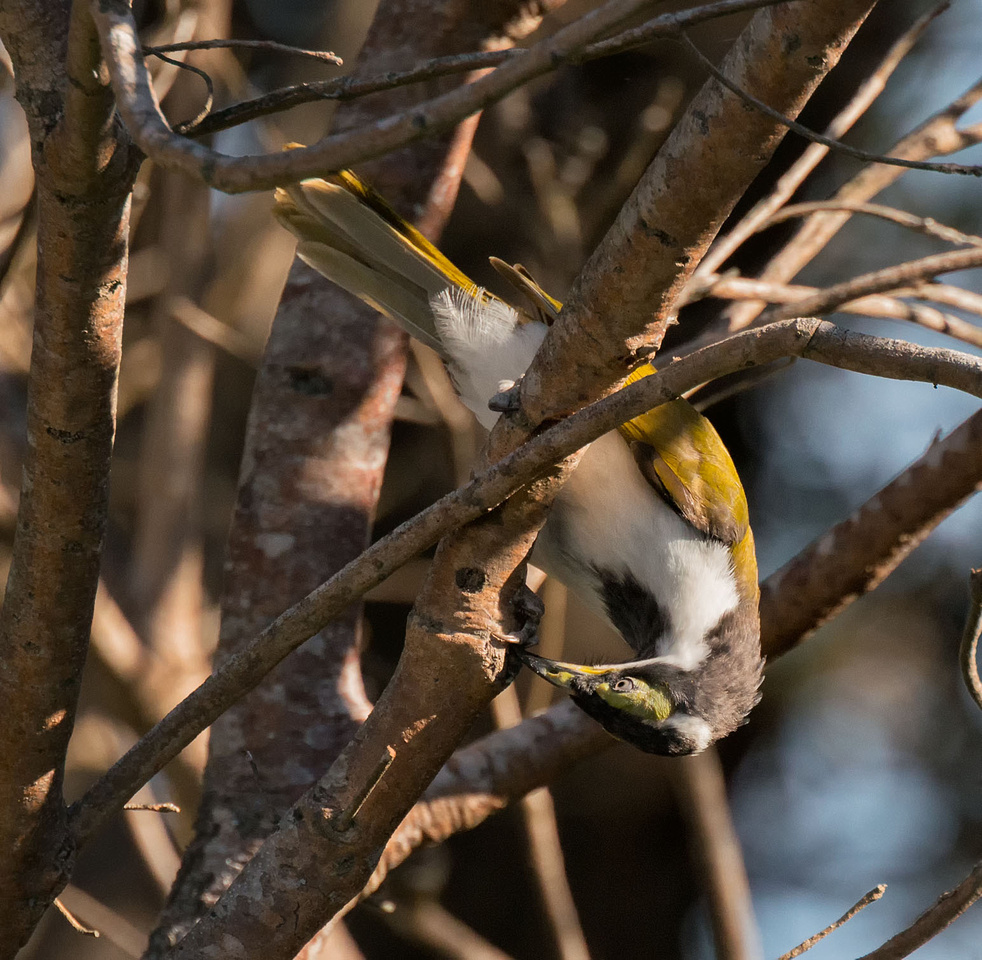
 White-cheeked HoneyeaterPhylidonyris niger, Illaroo Campgrond, Yuraygir National Park
 Brown HoneyeaterLichmera indistincta. Illaroo campground, Yuraygir National Park
 Blue-faced HoneyeaterThis is an immature bird, the face will turn blue when mature
13 km.
I was up early to enjoy the sunrise.
 Plumbago Beach at SunriseNear Lake Arragan
Rob, Fons and Irene on the beach just after sunrise.
 Rob, Fons and Irene on Plumbago Beach at SunriseNear Lake Arragan
The short drive to the next camp site at Sandon River means we can all walk together and perform a car shuffle to get both vehicles to the camp site.
Marg, Olive, Carol and Irene will walk to Brooms Head while Fons, Rob and I drive to Sandon River, claim a camp site and return to Brooms Head, meeting the others for coffee before continuing together. Here we are ready to climb the headland at Brooms Head. I don't know the significance of the "Marry Me" words on the hillside.
 Ready to start from Brooms Head to Sandon River
All lined up on the headland, looking at the beach we have to walk, except for Fons taking photos.
 On the headland at Brooms Head
Down to the beach.
 Heading down to North Sandon beach from Brooms Head
 Walking on North Sandon Beach from Brooms Head
Fons left their camper at Sandon River and drove back to Brooms Head with Rob, with the intention of later driving Rob back to pick up his car. Fons realises he will have to back the car and camper out of the camp site, back the camper in and unhitch to pick up Robs car and decides that he would rather walk part way with us then walk back to Brooms Head and drive Rob's car to the camp site.
Lunch on the beach - in the open as there is no convenient shade.
 Lunch break on North Sandon Beach
Approach Sandon River we see a couple sitting at a table. Coming close we see that their lack of movement is because they are sculptures. We find more of these around Sandon River.
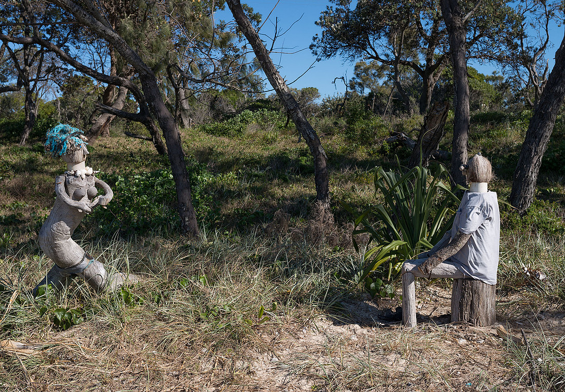 Beach sculptures at Sandon River
This was a fairly short walk so some have the energy left to put the Kayak in the water for a paddle around.
The whole group relaxing before dinner.
 Relaxing before dinner at Sandon River
See the gallery for more photos.
]]>11.5 km
The night's camp site is a forty minute drive, so Fons, Rob, Bev and I are driving there with the vehicles and walking North to meet the others on their way South.
After choosing a camp site, we are ready to start walking. This is Plumbago beach near Lake Arragan.
 Bev and Rob ready to start from Lake Arragan
Lake Arragan is separated from the sea by the beach.
We cross Plumbago Head to reach Caves beach. Rob and Fons standing on the rocks below the headland, above a shallow cave.
 Rob and Fons on Plumbago HeadWalking above a shallow cave
The track around the next headland (Shelly Head) leaves the beach at a creek. We don't want to miss the group coming south and not sure whether to stay on the beach or take the track. We have a chat to a passing walker (we don't see many others) who turns out to be a local from Maclean and advises taking the track.
As soon as we leave the beach we meet the others near a Pandanus tree that provides shade for lunch.
Bev and Fons join the other group to walk to the camp while Rob and I continue on the Shelly Head before returning.
From Shelly Head we look back along Caves beach and can just see Brooms Head in the distance.
 Looking South fromShelly HeadCaves beach in foreground, Brooms Head in the distance
This is a national park campground with no showers so some of us have a quick swim in the Lake.
There are many wallabies around, all very tame, and one visits our camp.
 Wallaby at Lake Arragan campsite
The only problem with the camp site is that it is shaded early in the morning and sunny in the afternoon.
Dusk on the beach.
]]>
 Breaking waves in an offshore wind, Turner's Beach, Yamba
 Breaking waves in an offshore wind, Turner's Beach, Yamba
Marg and Fons have a well setup camper. Here they are with Olive after breakfast.
 Marg, Olive and Fons at Marg and Fons's camper
Rob, Bev, Olive and I decided to look at the museum while Marg and Fons drove to Ballina to pick up Carol and Irene. We found the museum closed (only open in the afternoon on Sundays) so we went for a walk to Yamba beach and Clarence Head.
Below is Yamba Beach. The large white building at top centre is the Pacific Hotel where we are all planning to meet for lunch.
Irene and Carol, the final members of the group arrive and we have lunch together at the Pacific Hotel. The restaurant has great views over the sea.
 Lunch at the Pacific Hotel. Yamba
 Lunch at the Pacific Hotel. Yamba
The walk starts tomorrow and Rob, Bev and I decide to drive to Angourie to see the starting point of the walk. Due to the difficulties of getting vehicles to the next camp-site, we will be walking most legs in reverse to meet the other walkers and then return with them so we wouldn't otherwise see Angourie.
 Angourie Head, New South Wales
We finish the day relaxing and watching the last of the sunset.
]]>
The plan is to walk 50 km of the Coastal Walk from Angourie to Wooli over five days. We are meeting up in Yamba to prepare.
Rob, Bev and I travelled to the Calypso Holiday Park at Yamba to meet Margaret and Fons. Carol and Irene are arriving from Melbourne tomorrow. We arrived around lunch time and set up Rob's camper-trailer. Margaret and Fons arrived with Olive later in the afternoon.
Fons set up their camper while Olive, Margaret and Rob tackled Olive's tent.
The park is beside a part of the Clarence River.
Late in the afternoon, we walked out along the breakwater on the southern side of the river. We enjoyed the light from the setting sun and saw some dolphins in the river.
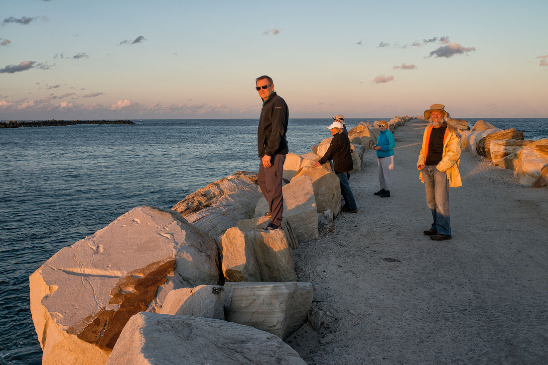
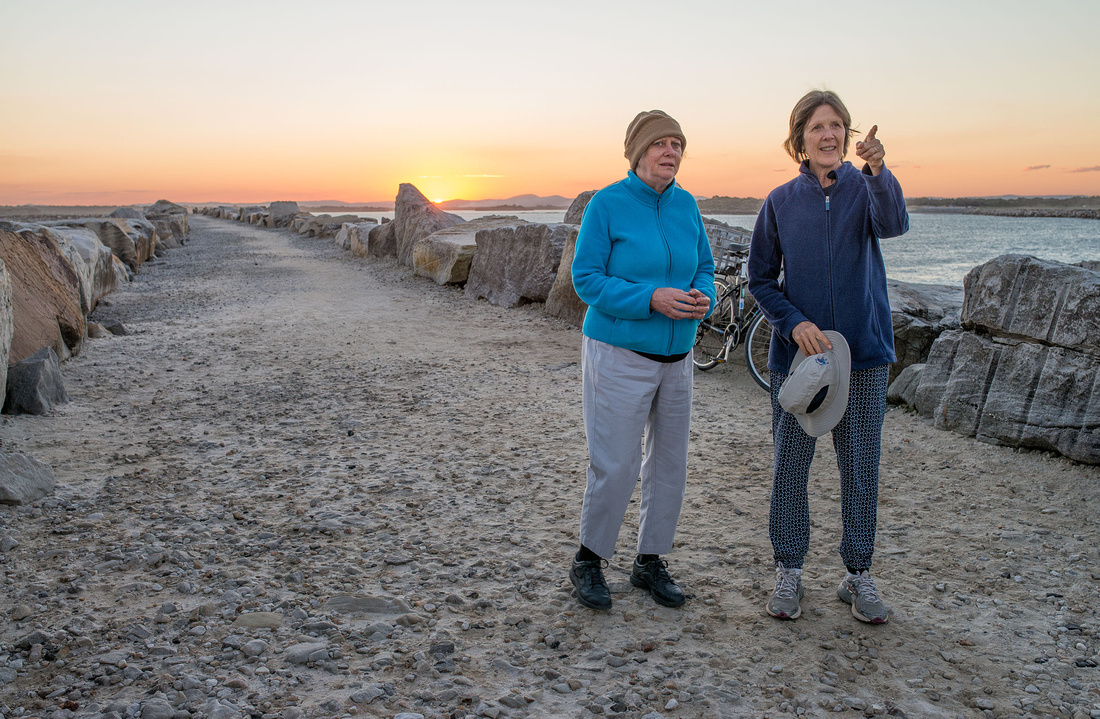
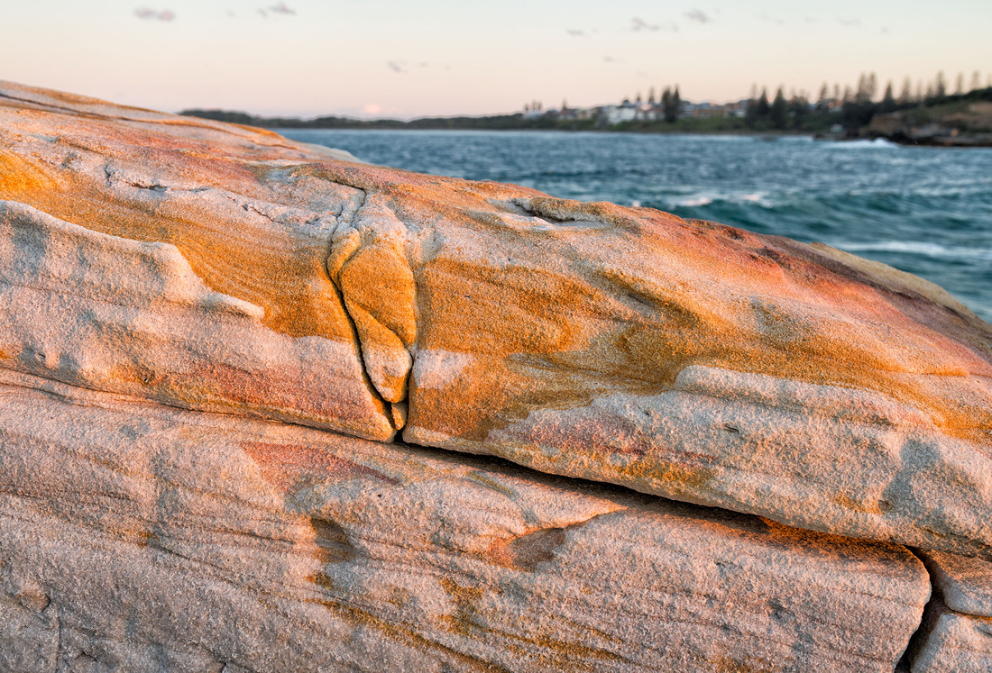
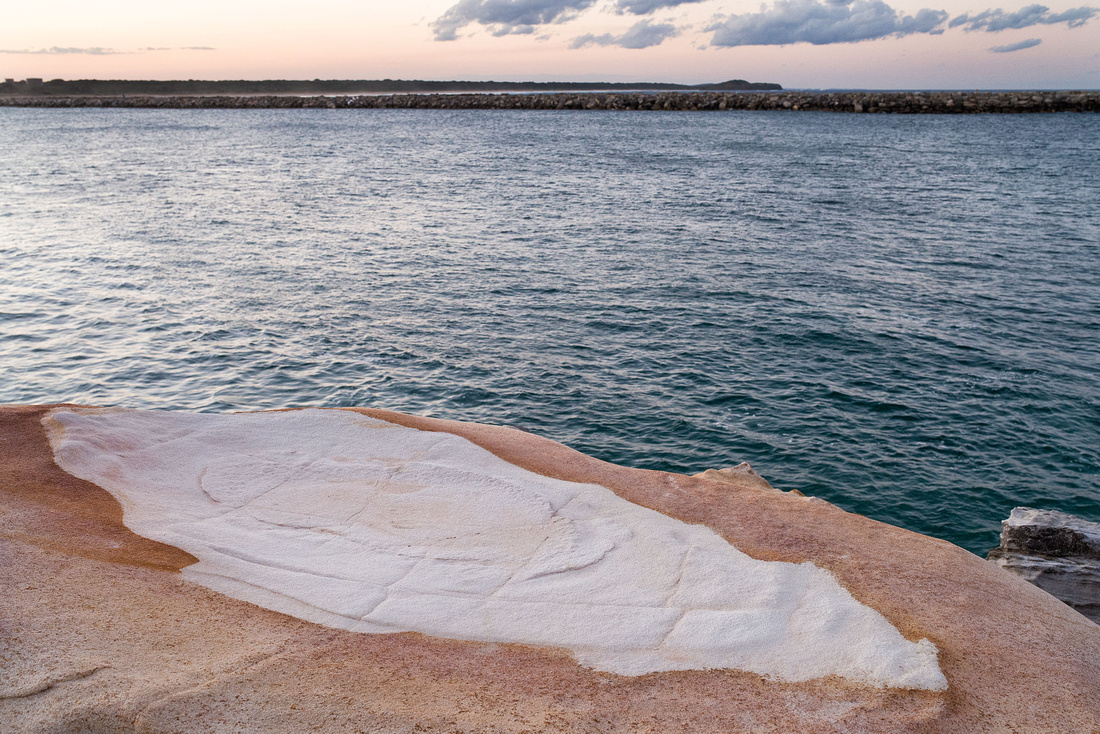
The sandstone boulders on the breakwater have interesting colours and patterns.
The sun had set by the time we arrived back at the campsite.
The full gallery is at http://alanwigginton.zenfolio.com/p259356686. Note that this is a work in progress.
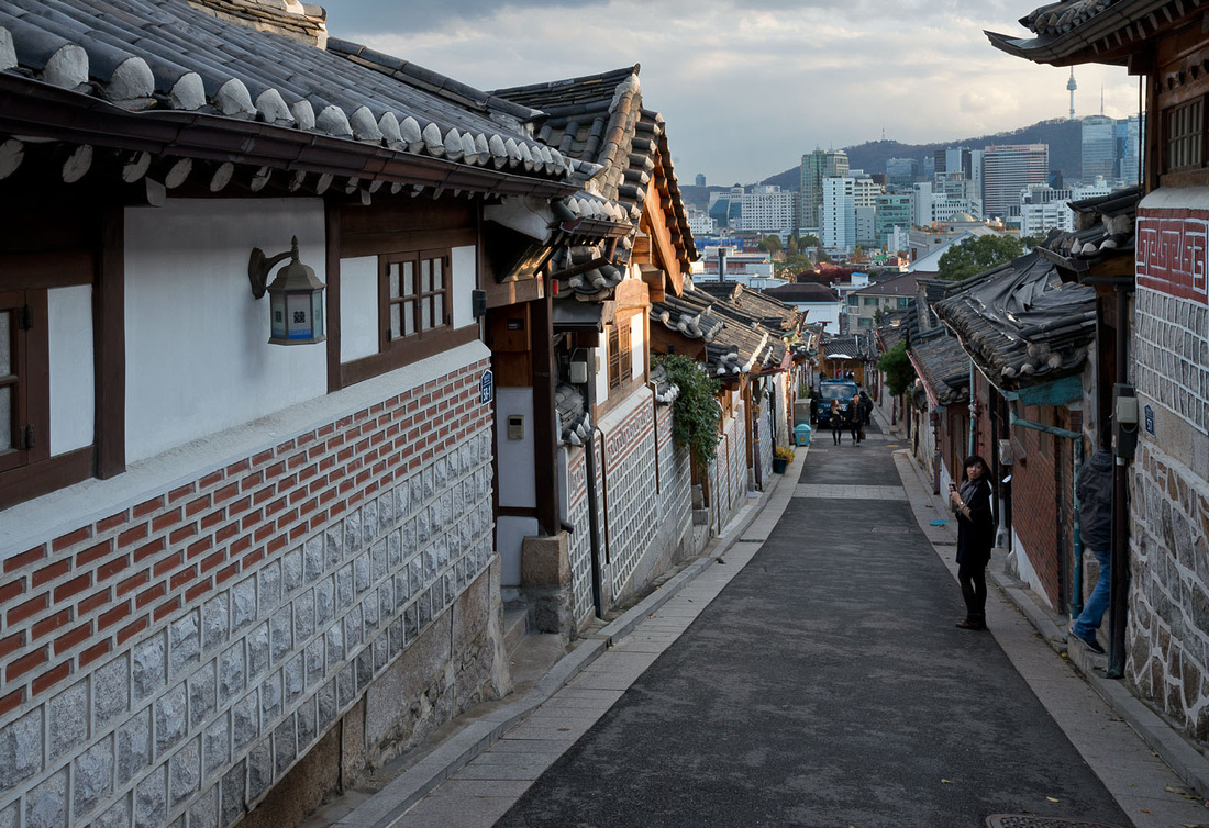
]]>I went for a walk around Gangnam this morning taking photos of anything that looked interesting.
|
Narrow street |
Carving on a door 
|

Just pipes on a brick wall.

|
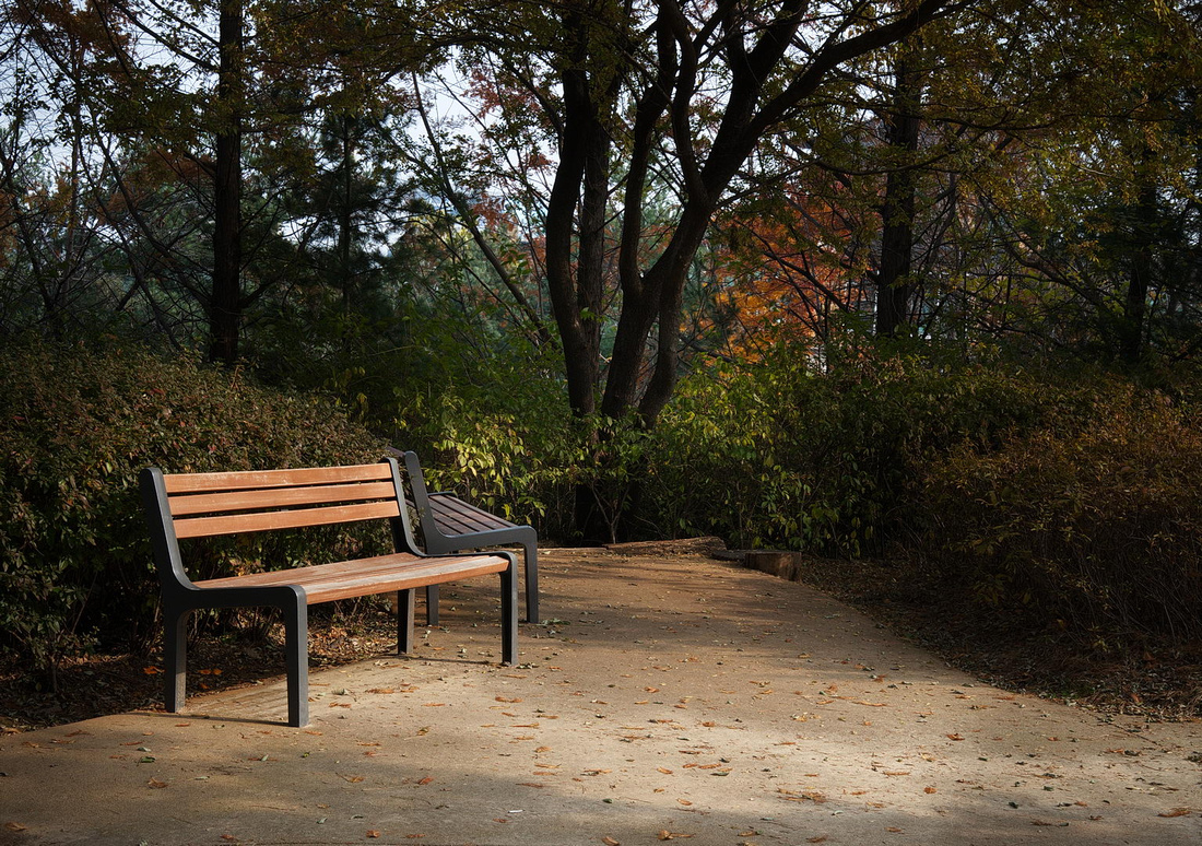
Seats in a park |
Stairway in a park |
A corner of the park with a couple of seats.
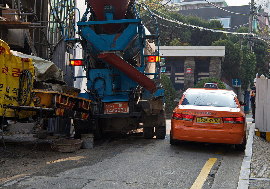
A tight squeeze for a taxi past a truck delivering concrete to a building site in one of he narrow streets.
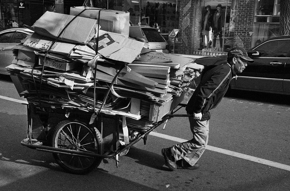
A man with a hand barrow of scrap in one of the more trendy streets in Gangnam.
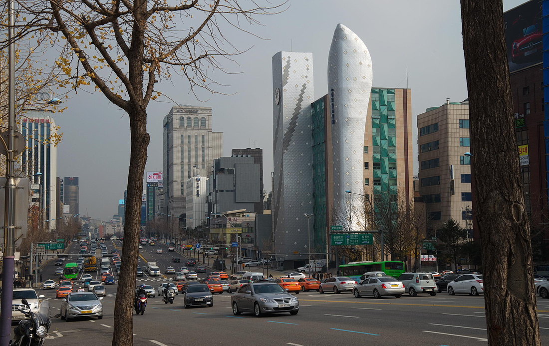
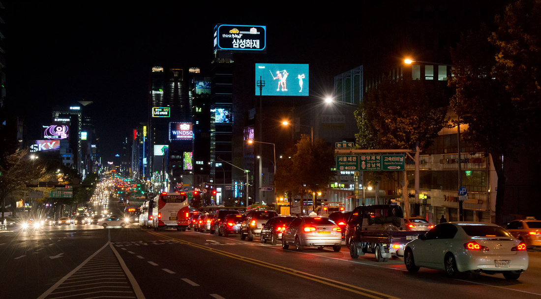
One of the wide main roads in Gangnam.
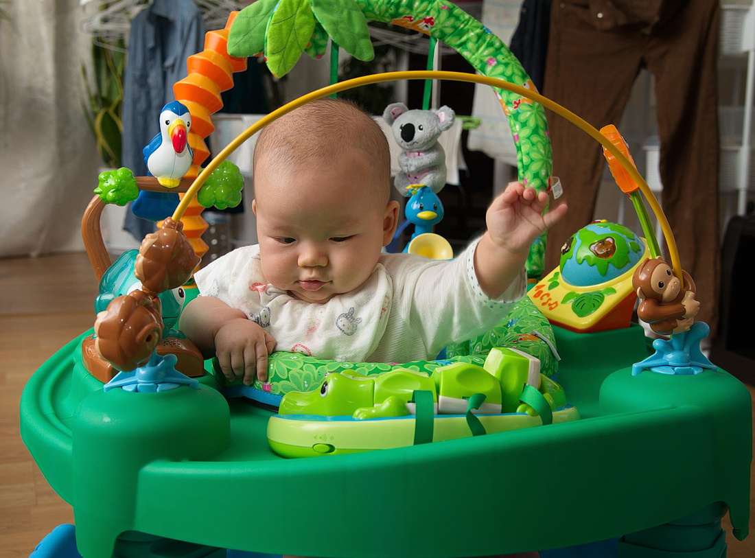
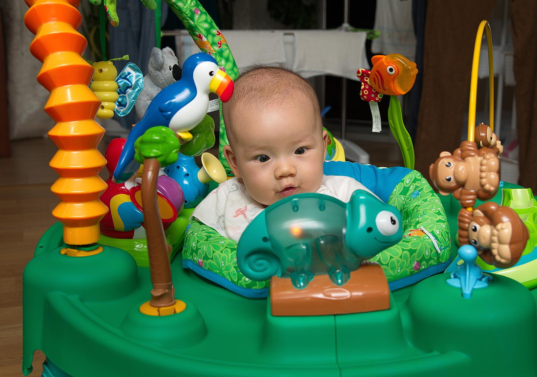
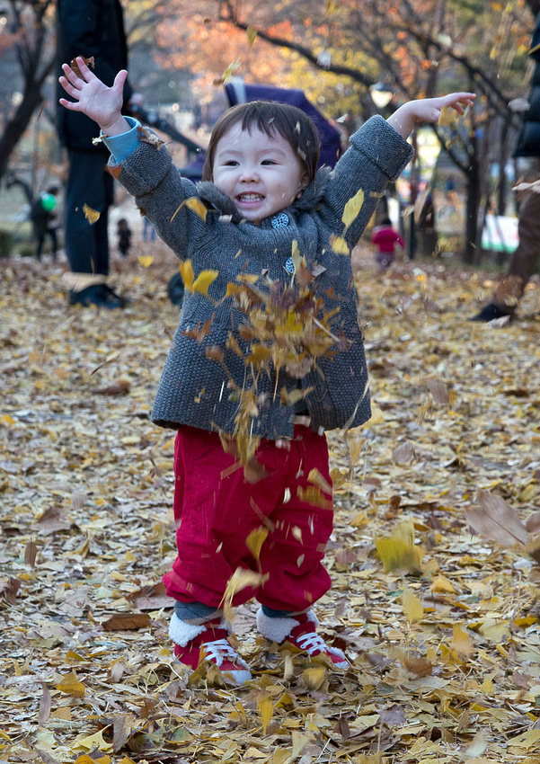
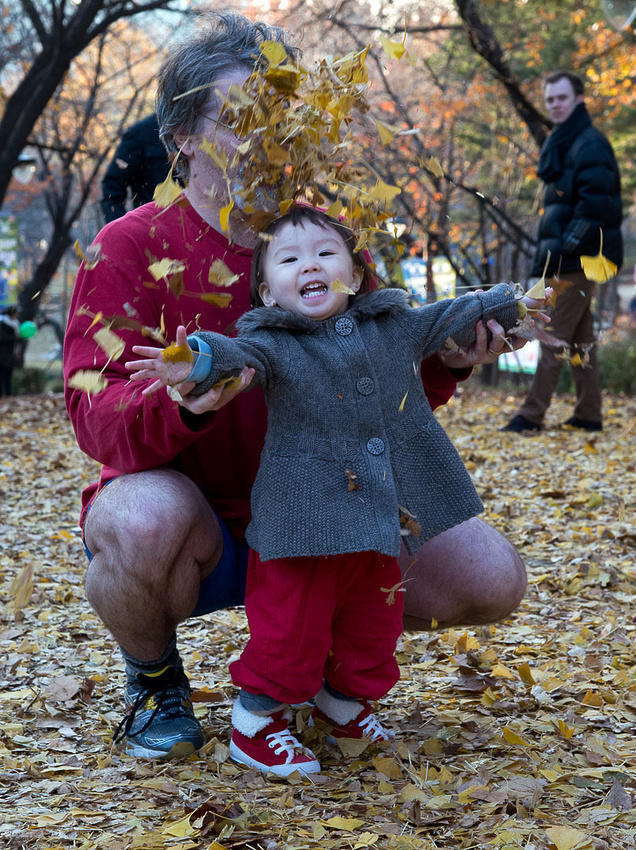
Christine has bought Drew a new toy (it's actually a whole collection of toys) and he loves it.
Saturday
We did some shopping in the morning then left from Incheon airport at 7:30 pm for our return to Australia, sad to be leaving friends and family in Korea, but looking forward to getting back to those in Australia.
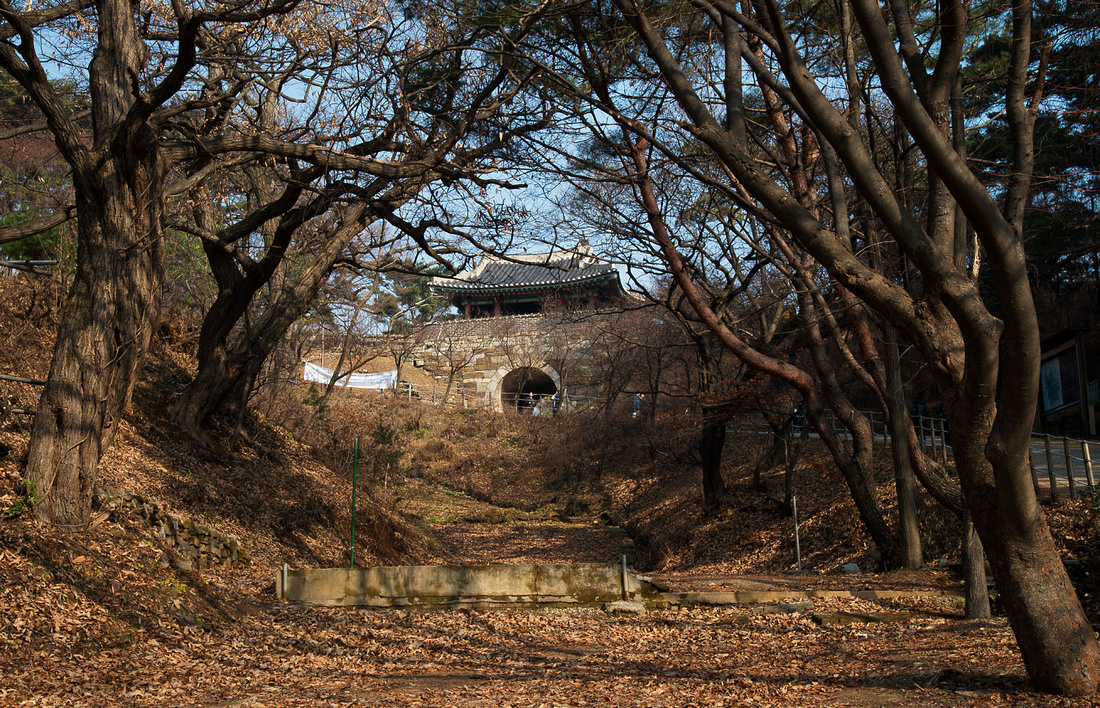
]]>We're all back on deck today (more or less) and went for a drive to Namhansanseong (South Mountain Fortress). Here is a map.
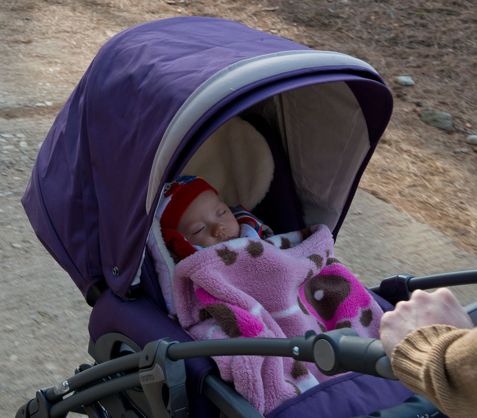
Christine's father took us (including Drew) for a walk beside the fortress wall.
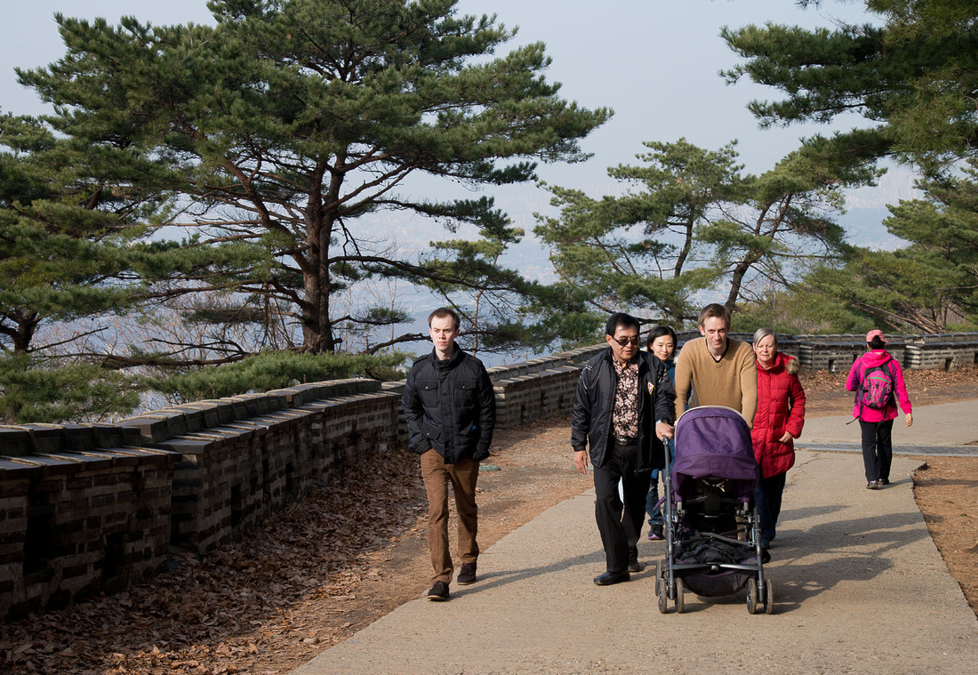
The Korean ladies we met were a bit shocked to see such a young baby out and about but he was quite snug and slept almost the whole time.
There would have been great views of Seoul except for the smog. What appears to be thousands of apartment blocks are just visible in this photo (click the image for a larger version).

Here are some views of the fortress wall.

We started the walk from this restaurant, where we had a duck lunch on our return.
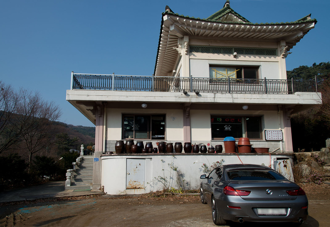
No chairs here. The table looks a bit bare here as this was before they brought out all the side dishes.

This is the narrow road, with some traditional buildings, near the restaurant.

]]>
No photos for yesterday and probably none for today. Bev, Rowan and I have had vomiting and diarrhoea - suspected to be due to a norovirus. Rowan ended up in hospital on a drip for a couple of hours. Mine was relatively mild. Christine and Drew are fine so far.
The health system is inexpensive compared to Australia. Christine was saying the cost would be higher for us, but it cost only about 13.00 each for Bev and I and less than 20.00 for Rowan, including the drip. Sam and Christine pay only about three dollars for a visit to a doctor.
We are all a lot better today but are taking it easy. Sam had booked a Demilitarised Zone tour for today and we had to skip that, which was a shame.
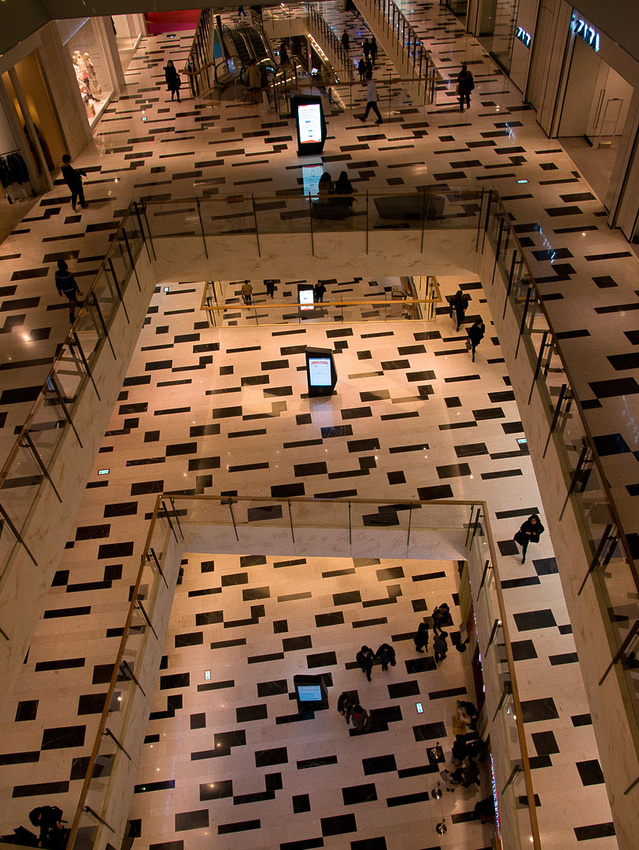
]]>We went off this morning to visit a park with old royal burial mounds, only to find that it was closed on Mondays. The rest of the morning was spent shopping at the COEX Mall in Gangnam.
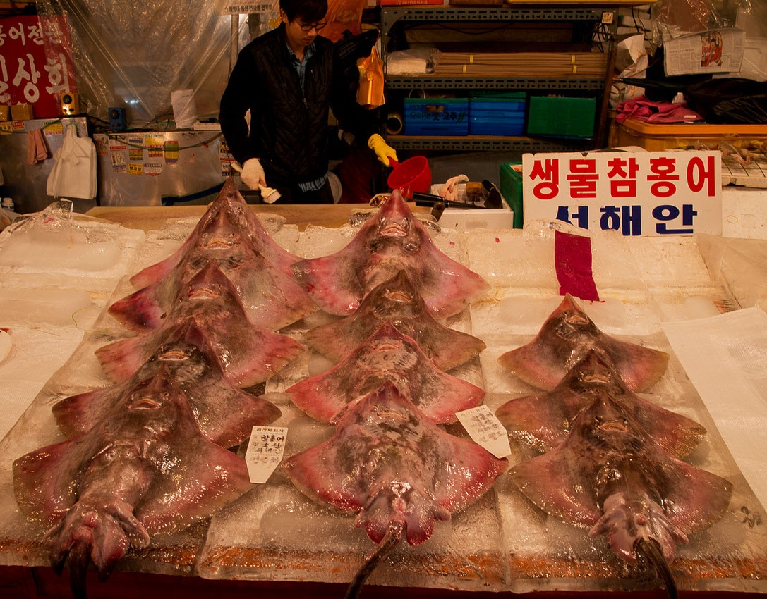
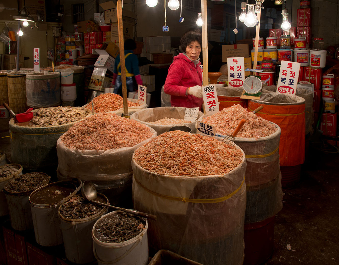
Late this afternoon Sam took us to the Noryangjin Fish Market where you can buy seafood then have it cooked for you. On the way to the fish market we passed these market stalls. (Click the images for a larger version).

The fish market has a huge number of individual stall holders selling almost anything you can find in the sea - much of it alive. Koreans like their seafood fresh. Here are some rays.
These are sea cucumbers and, yes they are to eat.
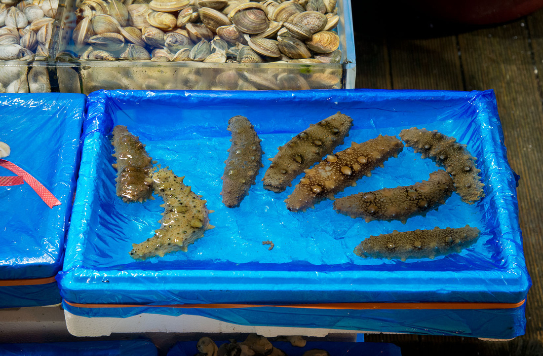
In the image below, the large barrels contain small dried shrimp. The small drums in front contain a disgusting looking slush that is probably a local delicacy.
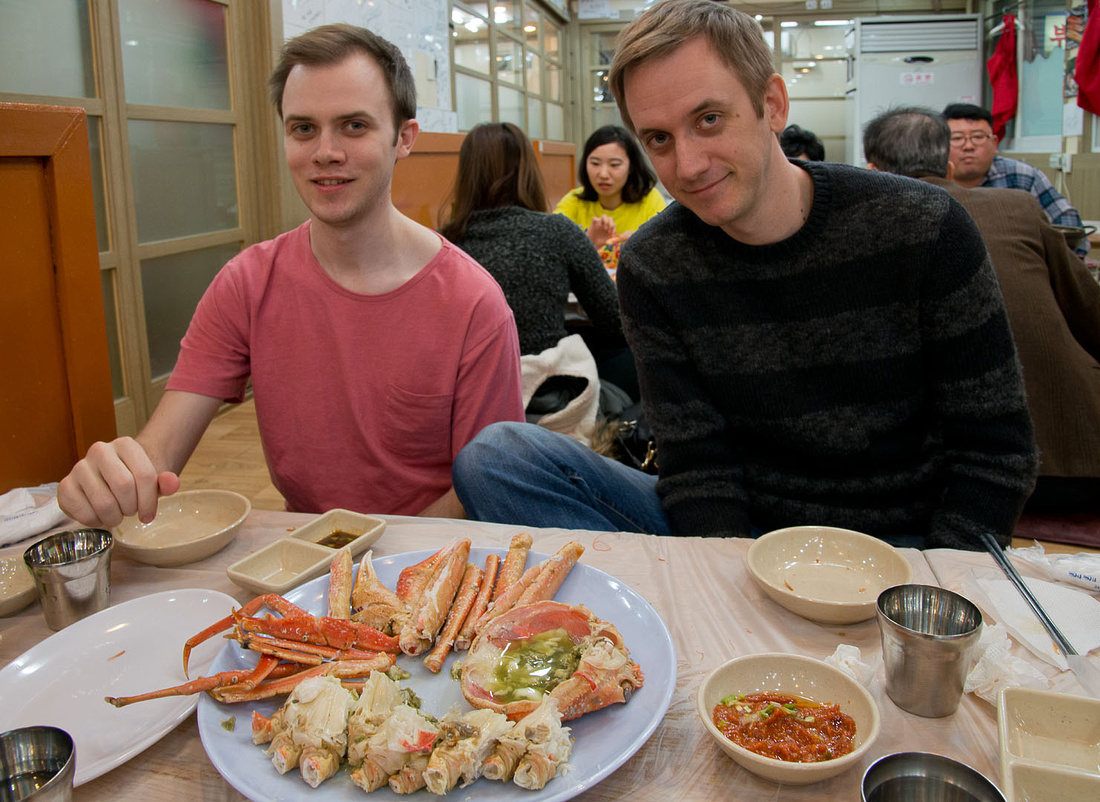
We decided on some King Crab and prawns that we bought from this stall holder. Yes the crab is alive.

And here is the crab after it has been cooked and broken up. We're sitting on the floor at low tables. We find this very difficult and uncomfortable.
After our meal we had a look at the new IFC mall shopping centre. You can see all three levels in this image.

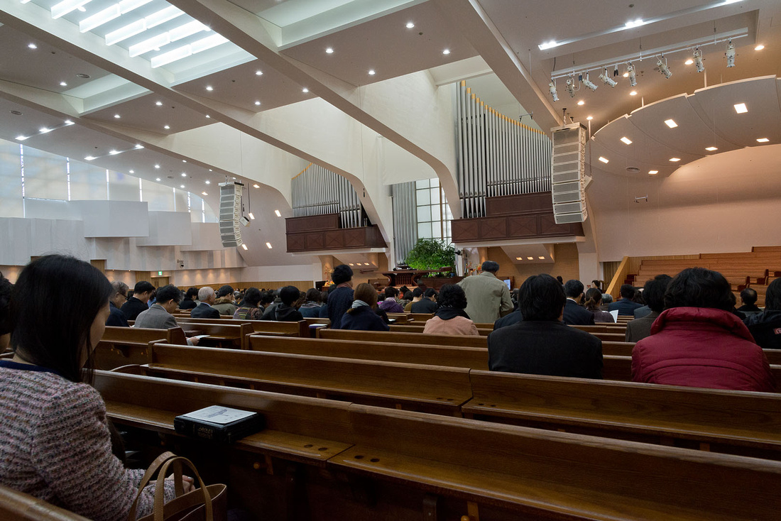
We started the day by attending the Somang Presbyterian Church, a very large Korean church in Gangnam. This photo was before it filled.
We followed this with a late lunch at Dan and HJ's (Christine's sister) place. Drew's cousin Eun-Song loves him but we got the impression that Drew wasn't so sure.
Children's Grand Park has many attractions including a zoo, botanical garden, stages, playgrounds and other attractions, and entry is free.

One road had been left covered in leaves and Dan and Eun-Song had some fun with them.
|
|
We all had dinner at the Intercontinental Hotel with Christine's parents. It was an all-you-can-eat buffet with a huge variety of food, so most of us ate too much.

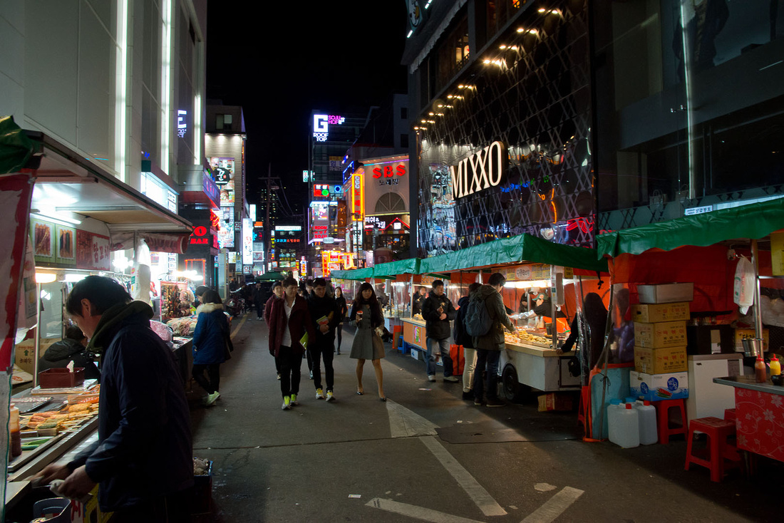
To finish the day, Sam took us on a walk around Gangnam.
I didn't take a single photo today. We went to a photographers studio for photos for family photos for Sam and Christine. This took over two hours and was fun and boring at the same time. Some friends of Sam's dropped in during the afternoon.
Here are a few more photos from earlier in the week.
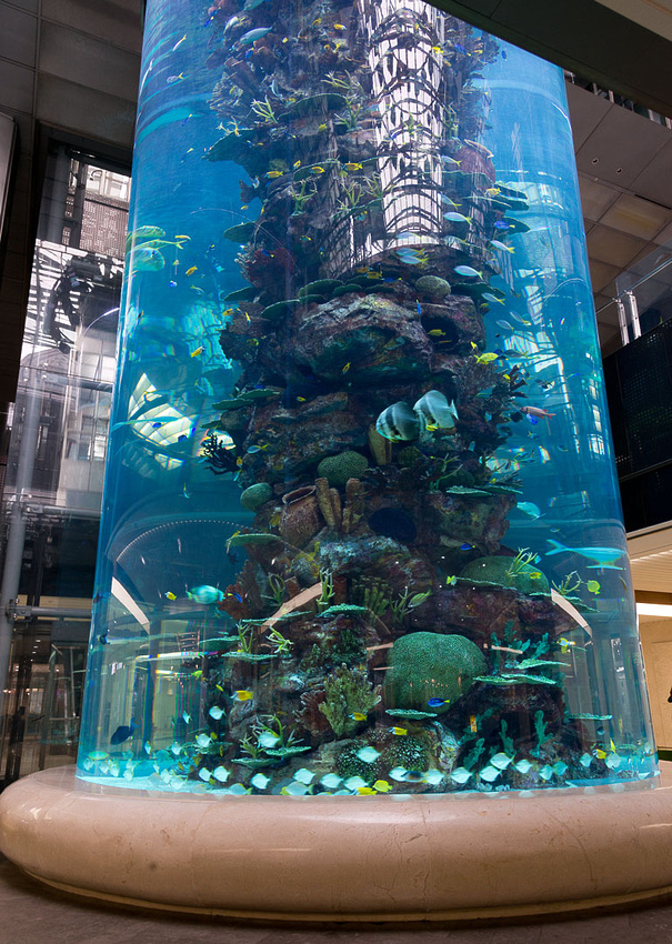
This two level cylindrical aquarium in a building lobby was impressive. This is the upper level. There are quite large fish in there

One from the lower level.
And of course some more photos of Drew.


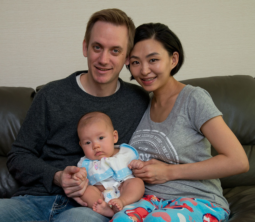
Sam, Christine and Drew.
]]>
Today was a rest day to recover from yesterday's hike. Christine, Bev and Rowan had a manicure and pedicure in preparation for a family photo to be taken tomorrow.

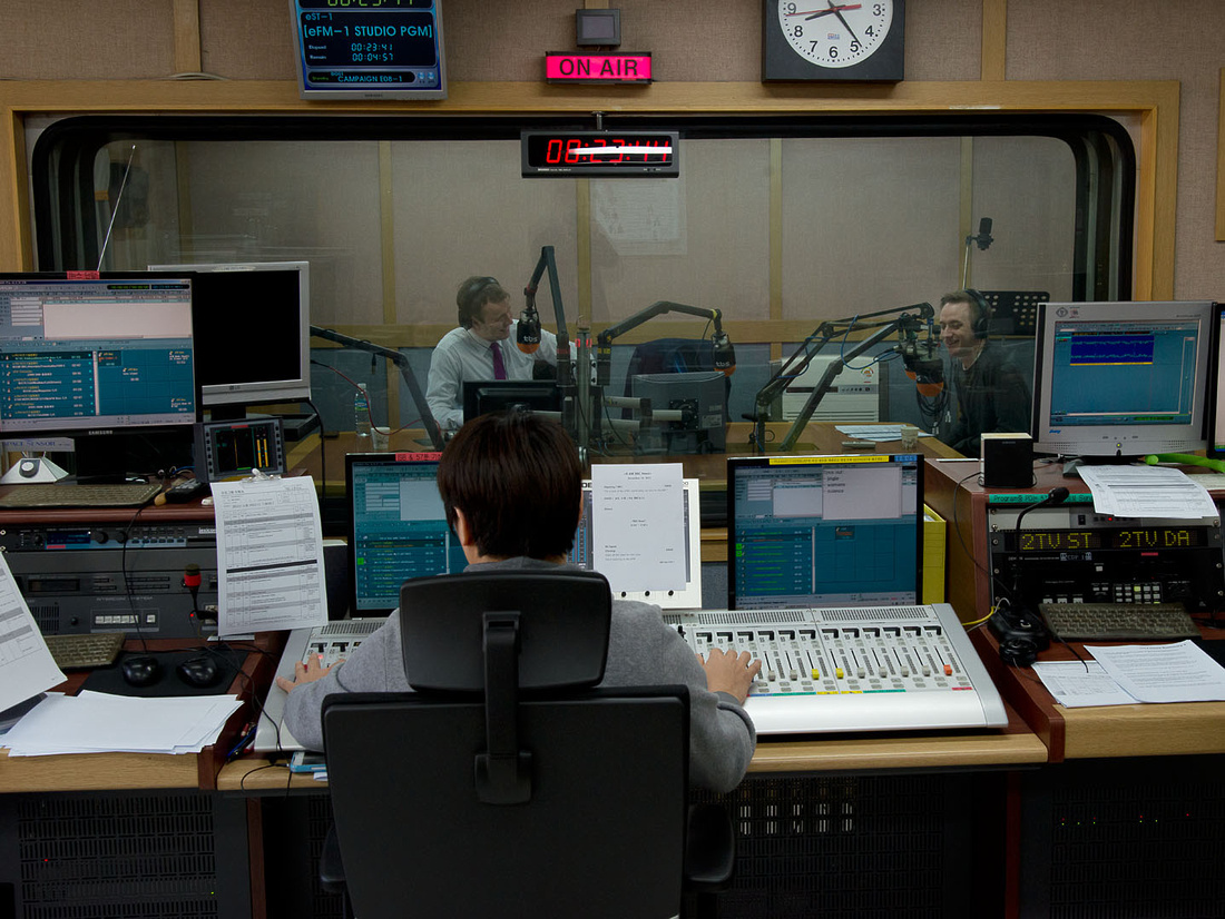
Late in the afternoon we went to see Christine taking part in Korea's most popular radio program on MBC. Christine takes part in a weekly half hour segment on the show "Now Radio" hosted by Jo Young Nam (a famous singer) and and Choi Yu-Ra (a famous actress).


Below are Bev, Kim Woo-Tae (Christine's Dad) and me, watching the show live.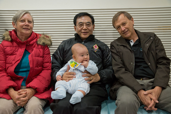 At the end of the show, to our surprise, we were all, including Drew, invited into the studio and introduced to the national audience of Korea's most popular radio show (according to Sam and Christine). We then had a group photo taken.
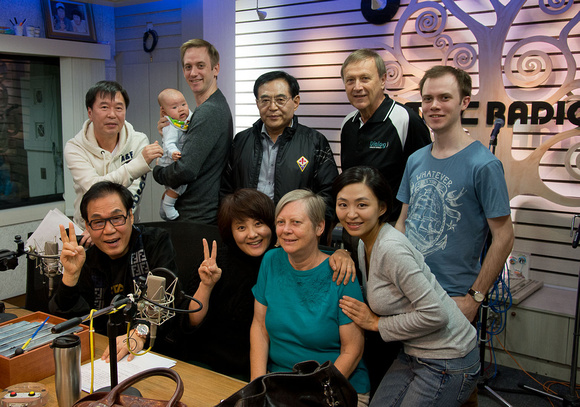
Finally, famous radio host bites baby.

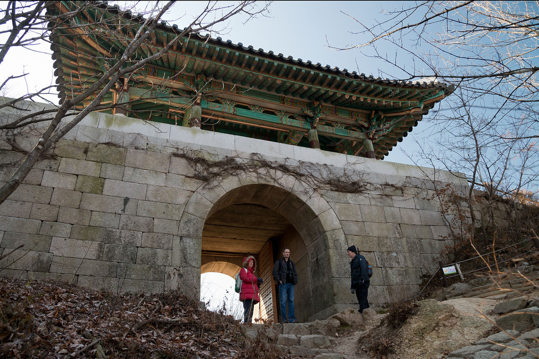
At 6:30 am and with the temperature at -2, we left the apartment to meet Sam's friend Mike for a hike in Bukhansan National Park. This national park is completely surrounded by urban areas. Despite the cold it was a beautiful sunny day. Here we are at the start .
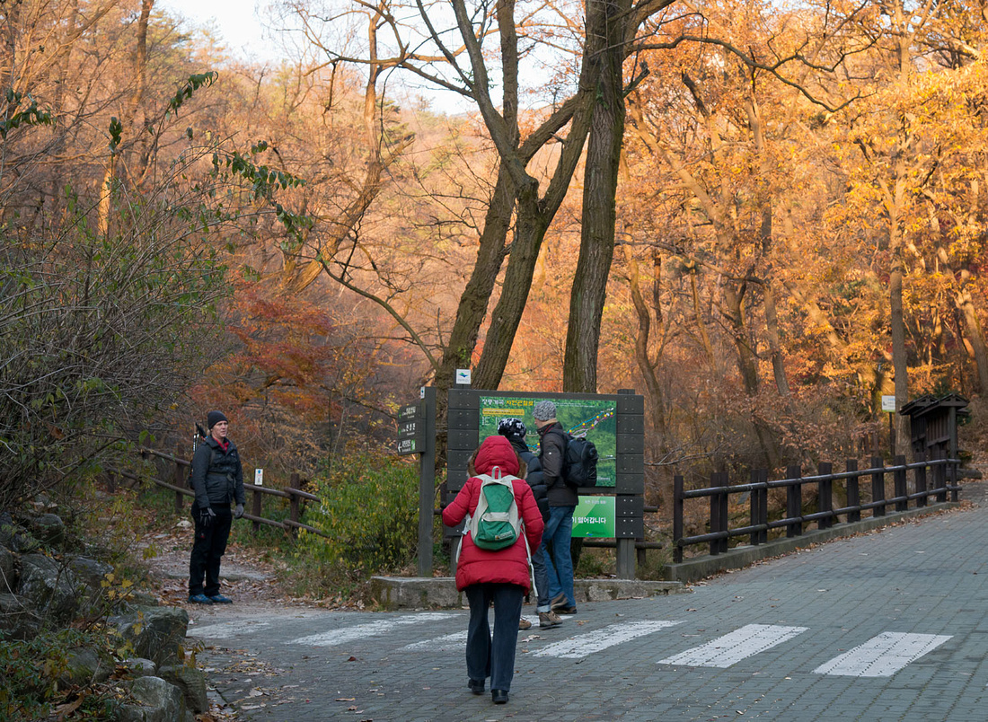
I think we spent more time taking photos than we did walking. Sam is taking a photo with Mike and Rowan waiting patiently.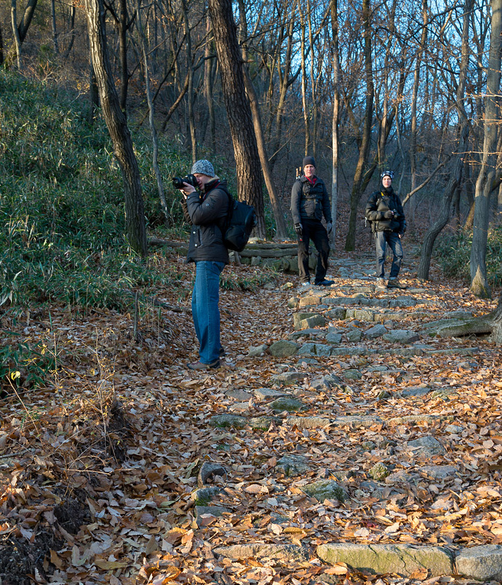
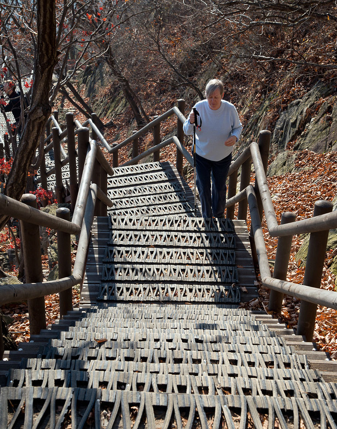
Bev found the going a bit difficult at times.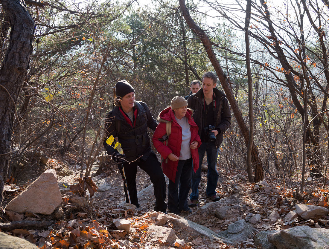 There were plenty of stairs to climb and we were glad to reach the top.
 The track leads to an old defensive wall with a number of gates. Surprisingly there was very little wind making it very pleasant in the sun but rather cold on the shady side of the mountain.
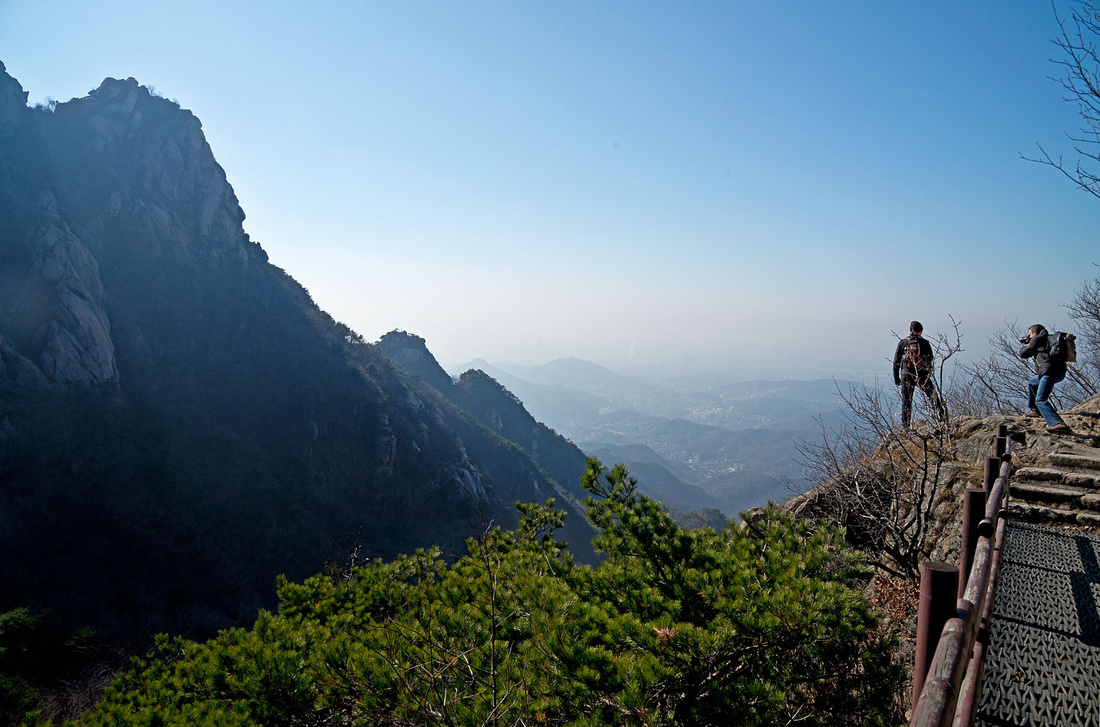
 The track gives some great views. This is on the way to a Buddhist temple, not far from the gate. You can see part of Seoul through the smog, and Sam is taking yet another photo. This is MIke's favourite place in Korea.
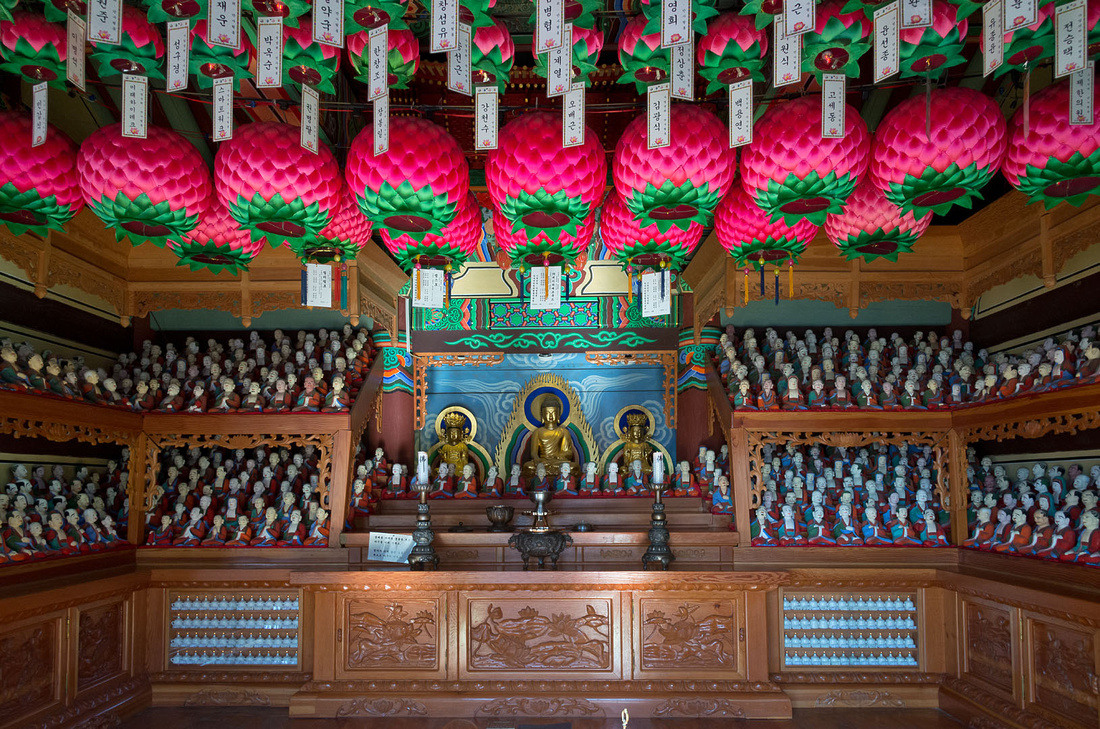
The Buddhist temple has several buildings. This one is built into a cave.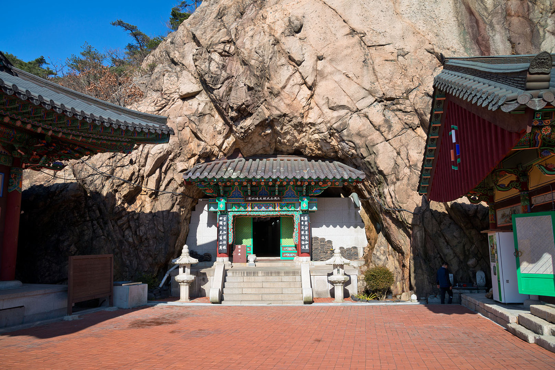 Inside another of the buildings.
 There were small patches of ice on the trail and some attractive icicles along the stream on the way down.
 The further down we went the more water there was in the stream with some nice waterfalls.
 We finished up with lunch at a restaurant near the end of the trail. It was great to sit down after seven hours on the trail.
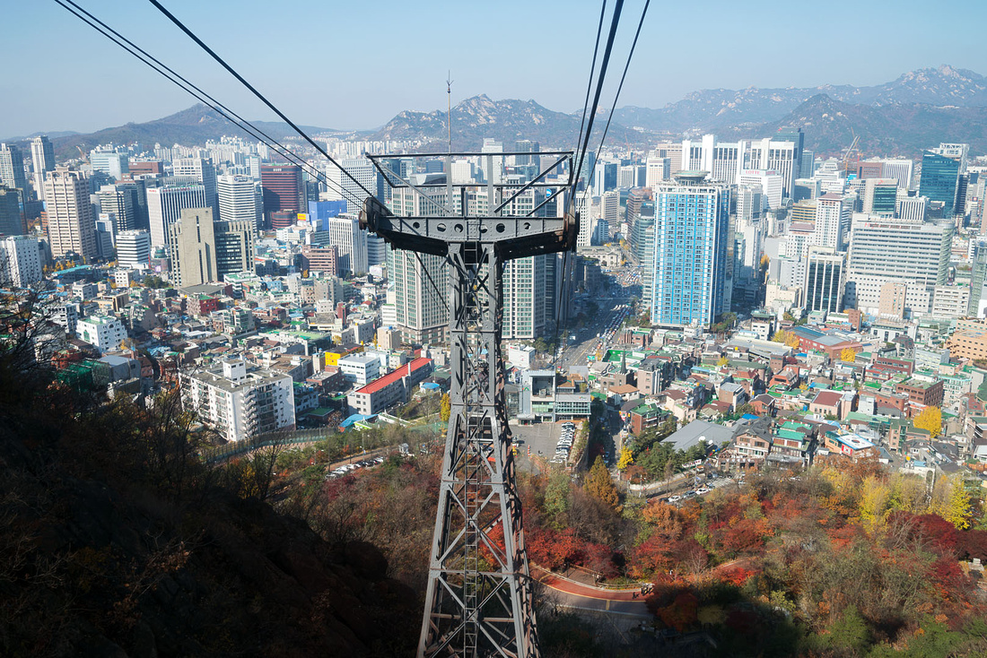
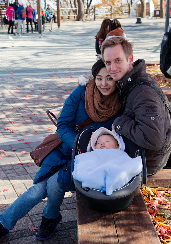
 We were going to have a quiet day but the sun was shining and it was such a nice day that Sam suggested we go to Namsan (South Mountain) for great views over Seoul. We all (including Drew) braved the cold wind and took the cable car to the top of the mountain.
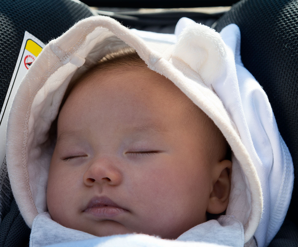
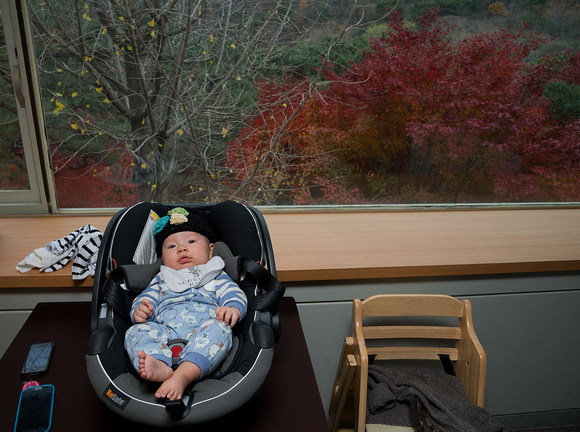
 Drew travelled in his car capsule and missed the views because he slept the whole time.
 Looking North-West from Namsan. The office blocks and apartments seem to go on forever. You see a similar view in all directions.

It was then off to Charlie's Hot Dog Grill for lunch. This is owned by Mike, a friend of Sam's who is going to take us hiking tomorrow (Thursday).
 And of course Drew is getting lots of attention.
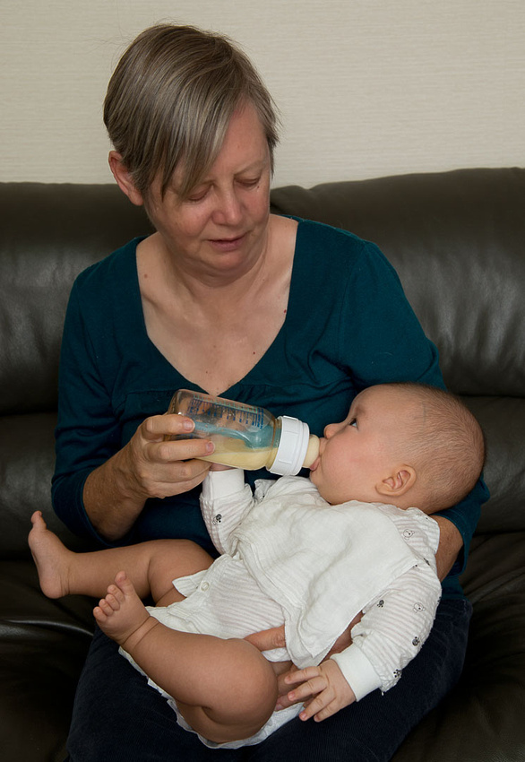 No that's not formula. Christine is so well organised she has set up her own milk bank.
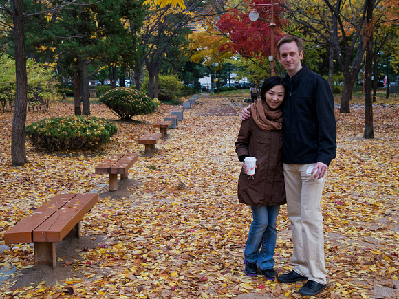
 Lunch was with Christine's family at Samcheong-gak - a restaurant with great views and great food. Drew went along but didn't get to eat any of the food.
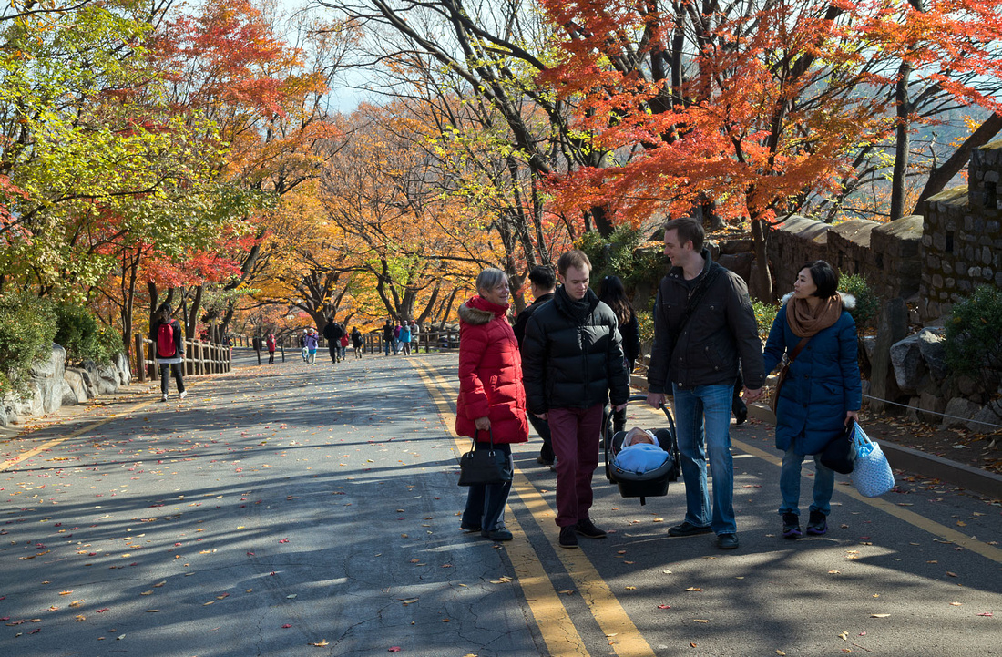
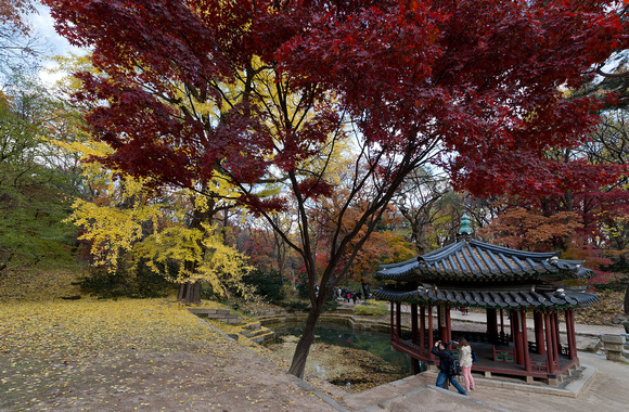
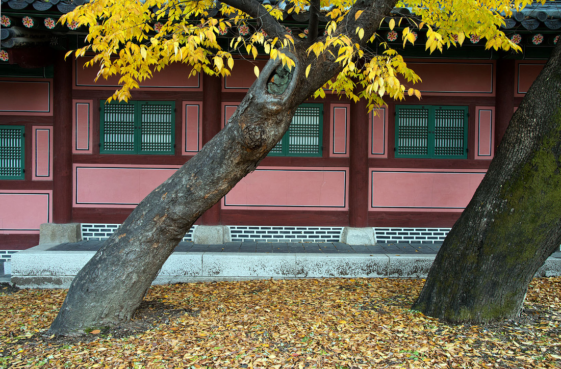
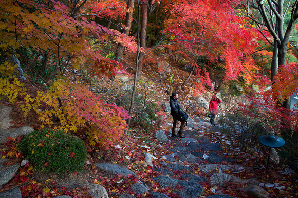
As we finished lunch, a few flakes of snow fell. I'm told this is extremely rare for November. After lunch we wandered around the grounds and enjoyed the autumn colours.
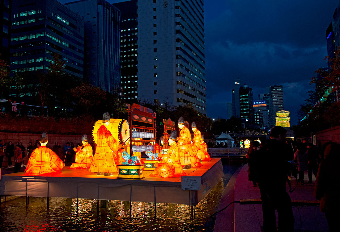
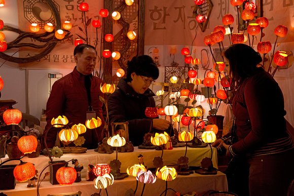
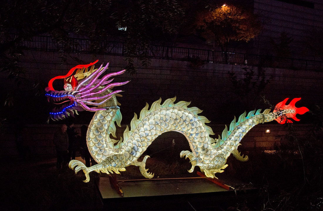
 Continuing a long day, we stopped off to look at the Lantern Festival, held on the Cheonggyecheon Stream in downtown Seoul.
 This stall is selling small lanterns. People can float lanterns on the stream for luck.
 This depicts the most popular children's show in Korea and there was a small crowd in front of it. Christine does the voice of the small bird at front centre.
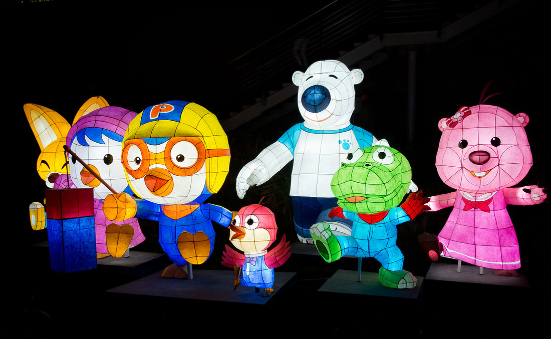 There were many of these - here are just a couple of others.

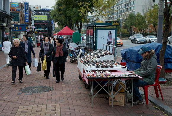
Here is a street scene in Gangnam.
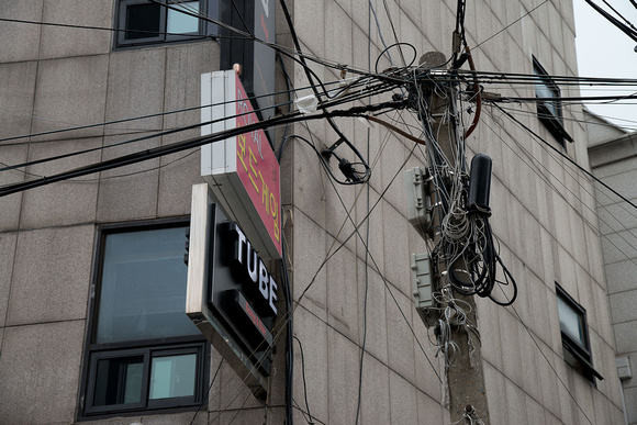
 I find the cabling in the older areas interesting.
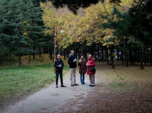
We then visited a park to see some of the Autumn colours,
 We brought a couple of Teddy Bears for Christines neice Eun-song. She seemed to like them.

We spent the rest of the evening getting to know Drew.